List of U.S. Highways in Colorado
| U.S. Highways in Colorado | |
|---|---|
   | |
| Highway names | |
| US Highways | U.S. Highway X (US X) |
| System links | |
Colorado State Highways
| |
List
| Number | Length (mi) | Length (km) | Southern or western terminus | Northern or eastern terminus | Formed | Removed | Notes | |
|---|---|---|---|---|---|---|---|---|
| 467.284 | 752.021 | I-70/US 6/US 50 near Mack | US 6 near Holyoke | — | — | |||
| 277.668 | 446.863 | I-70 near Minturn | US 24 near Burlington | — | — | |||
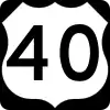
| 259.529 | 417.671 | US 40 in Granby | US 34 near Wray | — | — | |||
| 213.458 | 343.527 | US 34 at Deer Ridge in Rocky Mountain National Park | US 36 near Idalia | — | — | |||
| — | — | — | — | — | — | Now US 34 from Greeley to Wiggins, I-70 Bus. from Fort Morgan to Sterling, and US 6 east of Sterling[1] | ||
| 496.385 | 798.854 | US 40 west of Dinosaur | US 40 east of Arapahoe | — | — | |||
| — | — | — | — | — | c. 1936[2] | Now US 24 east of Limon[2] | ||
| — | — | — | — | — | c. 1936[2] | Now US 24 west of Limon and US 40 east of Limon[2] | ||
| 467.583 | 752.502 | I-70/US 6/US 50 near Grand Junction | US 50/US 400 near Holly | — | — | |||
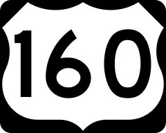
| 28 | 45 | US 160 near Pagosa Springs | US 84 near Chromo | — | — | |||
| 310 | 499 | I-25/US 85/US 87 near Trinidad | US 85 near Eaton | — | — | |||
| 305.040 | 490.914 | I-25/US 85/US 87 near Trinidad | I-25/US 87 | — | — | Concurrent with I-25 for whole route. | ||
| 59.823[3] | 96.276 | US 6 near Sterling | US 138 near Julesburg | — | — | |||
| 497.223[4] | 800.203 | US 160 near Teec Nos Pos, Arizona | US 160 near Walsh | c. 1930[5] | current | Original western terminus was Trinidad. Extended via US 85 and US 450 to near Dove Creek in 1934. Rerouted west of Cortez via US 164 in 1970 toward Four Corners Monument.[5][6] | ||
| — | — | — | — | 1966[6] | 1970[6] | Now US 160 west of Cortez | ||
| 263.947[7] | 424.782 | US 285 near Antonito | I-25 in Denver | 1936[8] | current | Originally terminated on Alameda Ave. at US 85/US 87. In 1969, rerouted to terminate at US 40 (Colfax Ave.) in Aurora. Truncated at I-25 in Denver in 1979.[8] | ||
| 385.22 | 619.95 | US 287/US 385 near Campo | US 287 near Virginia Dale | — | — | |||
| 72.718[9] | 117.028 | US 160 near Walsenburg | US 50 in La Junta | c. 1927[10] | current | |||
| 263.734 | 424.439 | US 287/US 385 near Campo | I-76 near Julesburg | — | — | |||
| 14.814[11] | 23.841 | US 50/US 385 in Granada | US 50/US 400 near Coolidge, Kansas | 1996[12] | current | |||
| — | — | — | — | c. 1927[13] | 1939[13] | Now US 491 north of Cortez and US 160 from Cortez to Walsenburg[13] | ||
| 69.602[14] | 112.014 | US 491 north of Shiprock, New Mexico | US 491 north of Dove Creek | 2003[15][16] | current | Formerly US 666 | ||
| 103.066 | 165.869 | US 550 near Durango | US 50 in Montrose | — | — | |||
| — | — | — | — | c. 1927[17] | 1936[17] | Now SH 291 through Salida and US 285 south of Buena Vista[17] | ||
| — | — | — | — | c. 1927[18] | 2003[15][16][18] | Now US 491 | ||
| — | — | New Mexico state line | Wyoming state line | — | — | Proposed, but never commissioned; would have followed (south to north): US 666, US 160, US 550, US 6/US 24, SH 13 | ||
| ||||||||
See also
 Colorado portal
 U.S. Roads portal
References
- "End of US Highway 38". US Ends.com. Retrieved September 29, 2017.
- "End of US Highway 40". US Ends.com. Retrieved September 29, 2017.
- "Highway Data Explorer". CDOT OTIS - Online Transportation Information System. Colorado DOT. Archived from the original on September 10, 2012. Retrieved September 29, 2017.
- "Highway Explorer". CDOT OTIS - Online Transportation Information System. Colorado DOT. Archived from the original on September 10, 2012. Retrieved September 29, 2017.
- "End of US Highway 160". US Ends.com. Retrieved September 29, 2017.
- "End of Historic Highway 164". US Ends.com. Retrieved September 29, 2017.
- "Highway Explorer". CDOT OTIS - Online Transportation Information System. Colorado DOT. Archived from the original on September 10, 2012. Retrieved September 29, 2017.
- "End of US Highway 285". US Ends.com. Retrieved September 29, 2017.
- "Highway Explorer". CDOT OTIS - Online Transportation Information System. Colorado DOT. Archived from the original on September 10, 2012. Retrieved September 29, 2017.
- "End of US Highway 350". US Ends.com. Retrieved September 29, 2017.
- "Highway Explorer". CDOT OTIS - Online Transportation Information System. Colorado DOT. Archived from the original on September 10, 2012. Retrieved September 29, 2017.
- "End of US Highway 400". US Ends.com. Retrieved September 29, 2017.
- "Ends of US Highway 450". US Ends.com. Retrieved September 29, 2017.
- "Highway Explorer". CDOT OTIS - Online Transportation Information System. Colorado DOT. Archived from the original on September 10, 2012. Retrieved September 29, 2017.
- "Ends of US Highway 491". US Ends.com. Retrieved September 29, 2017.
- Linthicum, Leslie. "It's Now U.S. 491, Not U.S. 666". ABQ Journal Online. Albuquerque Journal. Retrieved September 29, 2017.
- "Ends of US Highway 650". US Ends.com. Retrieved September 29, 2017.
- "Ends of US Highway 666". US Ends.com. Retrieved September 29, 2017.
External links
This article is issued from Wikipedia. The text is licensed under Creative Commons - Attribution - Sharealike. Additional terms may apply for the media files.