Colorado State Highway 347
State Highway 347 (SH 347) is a 5.2 mi (8.4 km) long state highway in western Colorado. SH 347's southern terminus is at U.S. Route 50 (US 50) east of Montrose, and the northern terminus is at Black Canyon of the Gunnison National Park.
| ||||
|---|---|---|---|---|
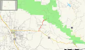 Map of Montrose County in western Colorado with SH 347 highlighted in red | ||||
| Route information | ||||
| Maintained by CDOT | ||||
| Length | 5.2 mi[1] (8.4 km) | |||
| Major junctions | ||||
| South end | ||||
| North end | ||||
| Location | ||||
| Counties | Montrose | |||
| Highway system | ||||
Colorado State Highways
| ||||

Route description
The route begins in the south at US 50 approximately ten miles east of Montrose and travels north to provide access to Black Canyon of the Gunnison National Park's south rim facilities.
History
The route was established in 1939 with its current routing. The entire route from US 50 to Black Canyon of the Gunnison National Park was paved by 1960. The national park was upgraded from a national monument in October 1999.[2]
Major intersections
The entire route is in Montrose County.
| Location | mi | km | Destinations | Notes | |
|---|---|---|---|---|---|
| | 0.0 | 0.0 | Southern terminus | ||
| | 5.2 | 8.4 | Northern terminus | ||
| 1.000 mi = 1.609 km; 1.000 km = 0.621 mi | |||||
References
- "Segment Descriptions for Highway 347". Colorado Department of Transportation. Retrieved 2008-03-25.
- Salek, Matthew E. "Colorado Routes 334-366". Retrieved 2010-05-29.
External links
This article is issued from Wikipedia. The text is licensed under Creative Commons - Attribution - Sharealike. Additional terms may apply for the media files.