Columbia, New York
Columbia is a town in Herkimer County, New York, United States. As of the 2010 census, the town population was 1,580.[3] The town is at the south border of the county and is southeast of Utica.
- There is also a Columbia County, New York, United States.
- For the place formerly called Columbia in Tompkins County, New York, see Etna, New York.
Columbia, New York | |
|---|---|
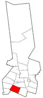 Location within Herkimer County | |
 Columbia Location within Herkimer County  Columbia Columbia (the United States) | |
| Coordinates: 42°55′40″N 75°2′51″W | |
| Country | United States |
| State | New York |
| County | Herkimer |
| Government | |
| • Type | Town Council |
| • Town Supervisor | George W. Weiss (R) |
| • Town Council | Members' List
|
| Area | |
| • Total | 35.10 sq mi (90.92 km2) |
| • Land | 35.07 sq mi (90.84 km2) |
| • Water | 0.03 sq mi (0.08 km2) |
| Elevation | 1,476 ft (450 m) |
| Population (2010) | |
| • Total | 1,580 |
| • Estimate (2016)[2] | 1,543 |
| • Density | 43.99/sq mi (16.99/km2) |
| Time zone | UTC-5 (Eastern (EST)) |
| • Summer (DST) | UTC-4 (EDT) |
| ZIP code | 13357 |
| Area code(s) | 315 |
| FIPS code | 36-043-17431 |
| GNIS feature ID | 0978855 |
History
The area was called "Coonradstown" during the early settlement period. The original settlers, mainly of German extraction, abandoned their holdings during the American Revolution, and the next settlement period took place around 1791. The first school, opened in 1795, was taught in the German language.
The town was organized in 1812 from part of the town of Warren, which was itself made by a partition of the town of German Flatts.
The population of Columbia in 1865 was 1,732.
Geography
According to the United States Census Bureau, the town has a total area of 35.1 square miles (90.9 km2), of which 35.1 square miles (90.8 km2) are land and 0.03 square miles (0.08 km2), or 0.06%, are water.[3]
The south town line is the border of Otsego County.
The Unadilla River, a tributary of the Susquehanna River, rises in the center of the town and flows westward. The northern part of the town drains northward towards the Mohawk River.
New York State Route 28 is a major north-south highway through Columbia.
Demographics
| Historical population | |||
|---|---|---|---|
| Census | Pop. | %± | |
| 1820 | 2,051 | — | |
| 1830 | 2,181 | 6.3% | |
| 1840 | 2,129 | −2.4% | |
| 1850 | 2,000 | −6.1% | |
| 1860 | 1,893 | −5.3% | |
| 1870 | 1,637 | −13.5% | |
| 1880 | 1,616 | −1.3% | |
| 1890 | 1,380 | −14.6% | |
| 1900 | 1,268 | −8.1% | |
| 1910 | 1,071 | −15.5% | |
| 1920 | 911 | −14.9% | |
| 1930 | 915 | 0.4% | |
| 1940 | 931 | 1.7% | |
| 1950 | 1,132 | 21.6% | |
| 1960 | 1,327 | 17.2% | |
| 1970 | 1,387 | 4.5% | |
| 1980 | 1,537 | 10.8% | |
| 1990 | 1,587 | 3.3% | |
| 2000 | 1,638 | 3.2% | |
| 2010 | 1,580 | −3.5% | |
| 2016 (est.) | 1,543 | [2] | −2.3% |
| U.S. Decennial Census[4] | |||
As of the census[5] of 2000, there were 1,630 people, 581 households, and 457 families residing in the town. The population density was 46.6 people per square mile (18.0/km2). There were 631 housing units at an average density of 18.0 per square mile (7.0/km2). The racial makeup of the town was 98.53% White, 0.06% African American, 0.49% Native American, 0.12% Asian, 0.06% Pacific Islander, and 0.74% from two or more races. Hispanic or Latino of any race were 0.37% of the population.
There were 581 households, out of which 39.2% had children under the age of 18 living with them, 64.7% were married couples living together, 7.7% had a female householder with no husband present, and 21.3% were non-families. 17.7% of all households were made up of individuals, and 7.6% had someone living alone who was 65 years of age or older. The average household size was 2.81 and the average family size was 3.12.
In the town, the population was spread out, with 28.1% under the age of 18, 7.9% from 18 to 24, 29.9% from 25 to 44, 23.5% from 45 to 64, and 10.6% who were 65 years of age or older. The median age was 36 years. For every 100 females, there were 110.6 males. For every 100 females age 18 and over, there were 104.5 males.
The median income for a household in the town was $36,758, and the median income for a family was $43,864. Males had a median income of $30,605 versus $22,031 for females. The per capita income for the town was $15,591. About 10.9% of families and 14.5% of the population were below the poverty line, including 23.1% of those under age 18 and 12.4% of those age 65 or over.
Communities and locations in Columbia, NY
- Cedarville – A hamlet at the west town line on County Road 18.
- Columbia Center – A hamlet near the middle of the town at the junction of County Roads 18 and 101.
- Dennison Corners – A hamlet on NY-28 at the north town line.
- Elizabethtown – A hamlet in the north part of the town, south of North Columbia at the junction of County Roads 43 and 123.
- Getman Corners – A hamlet on NY-28 south of Dennison Corners.
- Jones Hill – An elevation located east of Cedarville.
- Kingdom – A hamlet at the east town line, southeast of Getman Corners.
- Millers Mills – A location north of Millers Mills Crossing, located west of Unadilla Lake.
- Millers Mills Crossing – A hamlet in the southwest corner of the town.
- Monkey Mountain – An elevation located southwest of Columbia Center.
- North Columbia – A hamlet in the northwest part of the town.
- Orendorf Corners – A location north of South Columbia on NY-28 at County Road 18.
- Richfield Hill – An elevation located south of Millers Mills. Partially in the Town of Richfield.
- Schuyler Corners – A location north of South Columbia, located on NY-28.
- South Columbia – A hamlet in the southeast part of the town on NY-28.
- Spinnerville – A hamlet east of North Columbia and west of Dennison Corners, located near the north town line.
- Spoon Hill – An elevation located north-northwest of Columbia Center.
- Unadilla Lake – A small lake formed by the widening of the Unadilla River in the southwest part of the town.
- Youngs Crossing – A hamlet near the south town line, west of McCoon Crossing.
References
- "2016 U.S. Gazetteer Files". United States Census Bureau. Retrieved Jul 5, 2017.
- "Population and Housing Unit Estimates". Retrieved June 9, 2017.
- "Geographic Identifiers: 2010 Census Summary File 1 (G001): Columbia town, Herkimer County, New York". American Factfinder. U.S. Census Bureau. Archived from the original on February 13, 2020. Retrieved November 28, 2017.
- "Census of Population and Housing". Census.gov. Retrieved June 4, 2015.
- "U.S. Census website". United States Census Bureau. Retrieved 2008-01-31.
External links
- Historical information: Town of Columbia
- Early history of Columbia, New York
- Herkimer County Historical Society website
Municipalities and communities of Herkimer County, New York, United States | ||
|---|---|---|
| City | 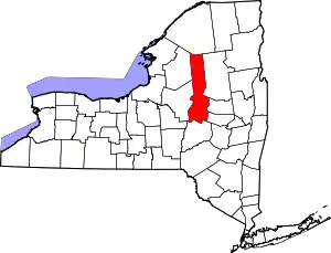 | |
| Towns | ||
| Villages | ||
| CDPs | ||
| Other hamlets |
| |
| Footnotes | ‡This populated place also has portions in an adjacent county or counties | |
| ||
| Authority control |
|---|
