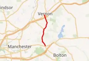
Connecticut Route 533
State Road 533 (SR 533; also known as Cindermill Road, Lake Street, and Tunnel Road) is a 4.03-mile-long (6.49 km) unsigned state road in northern Connecticut. It runs from U.S. Route 6 (US 6), US 44, and Route 85 in the town of Bolton to Route 30 in the town of Vernon.
| State Road 533 | |
|---|---|

| |
| Route information | |
| Maintained by ConnDOT | |
| Length | 4.03 mi[1] (6.49 km) |
| Existed | 1963–present |
| Major junctions | |
| South end | |
| North end | |
| Location | |
| Counties | Tolland, Hartford |
| Highway system | |
| |
Route description
SR 533 begins at US 6/US 44/Route 85 in the northwestern portion of the town of Bolton. In Bolton it is known as Cindermill Road. It then runs north for about 0.6 miles (0.97 km) before intersecting with Lake Street and briefly entering the town of Manchester. At the Lake Street intersection, the road becomes Lake Street. It runs north for about 0.7 miles (1.1 km) before entering the town of Vernon, passing the Risley Reservoir to the east. For almost a mile the road runs north before coming to a fork in the road. Route 533 heads northeast, while Lake Street heads northwest. At this fork, the road becomes Tunnel Road. The road runs northeast for 0.9 miles (1.4 km) before entering a short tunnel to go under the Hop River State Park Trail. The road then heads north again, passing over the Tankerhoosen River and passing under Interstate 84 (I-84). I-84 is accessible from SR 533 via a pair of frontage roads– SR 541 provides access to I-84 west and SR 542 provides access to I-84 east. About 0.3 miles (0.48 km) after passing under I-84, the road intersects Route 30 and ends.[2]
History
In 1963, Cider Mill Road, Lake Street and Tunnel Road were given the highway designation of SR 533. Part of SR 533 was part of SR 481 before being transferred to Route 533.
Junction List
| County | Location | mi[1] | km | Destinations | Notes | |||
|---|---|---|---|---|---|---|---|---|
| Tolland | Bolton | 0.00 | 0.00 | Southern terminus; northern terminus of Route 85 | ||||
| Hartford |
No major junctions | |||||||
| Tolland | Vernon | 3.61 | 5.81 | Western terminus of SR 541 | ||||
| 3.82 | 6.15 | Western terminus of SR 542 | ||||||
| 4.03 | 6.49 | Northern terminus | ||||||
| 1.000 mi = 1.609 km; 1.000 km = 0.621 mi | ||||||||
References
- Connecticut Department of Transportation (December 31, 2014). "Highway Log" (PDF). Connecticut Department of Transportation. Archived from the original (PDF) on July 26, 2015.
- Google (January 4, 2020). "Connecticut Route 533" (Map). Google Maps. Google. Retrieved January 4, 2020.