Contentnea Creek
Contentnea Creek is a major tributary of the Neuse River in North Carolina, USA. It is part of the Neuse River Basin, and flows for 91 miles between the Buckhorn Reservoir (confluence of Moccasin and Turkey Creeks), where it begins, and Grifton, North Carolina, where it flows into the Neuse River.
| Contentnea Creek Tributary to Neuse River | |
|---|---|
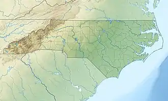
 Location of Contentnea Creek mouth | |
| Location | |
| Country | United States |
| State | North Carolina |
| Counties | Pitt Lenoir Greene Wilson |
| Cities | Hookerton Snow Hill Stantonsburg Wilson |
| Physical characteristics | |
| Source | Confluence of Moccasin and Turkey Creeks |
| • location | about 1 miles east of Stilleys Crossroads |
| • coordinates | 35°41′29″N 078°07′12″W[1] |
| • elevation | 136 ft (41 m) |
| Mouth | Neuse River |
• location | Grifton, North Carolina |
• coordinates | 35°20′26″N 077°23′20″W[2] |
• elevation | 3 ft (0.91 m) |
| Length | 91.0 mi (146.5 km)[3] |
| Basin size | 1,017.58 square miles (2,635.5 km2) |
| Discharge | |
| • location | Grifton, North Carolina |
| • average | 1,094.14 cu ft/s (30.983 m3/s) at mouth with Neuse River[4] |
| Basin features | |
| Progression | east and southeast |
| River system | Neuse River |
| Tributaries | |
| • left | Turkey Branch Mill Branch Marsh Swamp Little Swamp Mill Branch Shepard Branch Bloomery Swamp Toisnot Swamp Water Branch Beaman Run Mill Run Panther Swamp Beaverdam Run Mullet Run Polecat Run Little Contentnea Creek Grinnot Slough |
| • right | Moccssin Branch Little Creek Buckhorn Branch Marsh Swamp Little Swamp Black Creek Nahunta Swamp Fort Branch Tyson Marsh Shepherd Run Rainbow Creek Wheat Swamp Eagle Swamp |
| Waterbodies | Buckhorn Reservoir Wiggins Mill Reservoir |
Contentnea Creek begins as the outflow of Buckhorn Reservoir 12 miles west of Wilson, North Carolina. from there it flows through the Wiggins Mill Reservoir on the southwest side of Wilson, past the towns of Stantonsburg and Snow Hill, and finally emptying into the Neuse River 3 miles southeast of Grifton.[5]
References
- "GNIS Detail - Contentnea Creek". geonames.usgs.gov. US Geological Survey. Retrieved 22 July 2019.
- "GNIS Detail - Contentnea Creek". geonames.usgs.gov. US Geological Survey. Retrieved 22 July 2019.
- "ArcGIS Web Application". epa.maps.arcgis.com. US EPA. Retrieved 22 July 2019.
- "Contentnea Creek Watershed Report". Waters Geoviewer. US EPA. Retrieved 22 July 2019.
- "GNIS Detail - Contentnea Creek". geonames.usgs.gov. US Geological Survey. Retrieved 22 July 2019.
This article is issued from Wikipedia. The text is licensed under Creative Commons - Attribution - Sharealike. Additional terms may apply for the media files.