Cosby, Missouri
Cosby is a village in Andrew County, Missouri, United States. The population was 124 at the 2010 census. It is part of the St. Joseph, MO–KS Metropolitan Statistical Area.
Cosby, Missouri | |
|---|---|
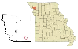 Location of Cosby, Missouri | |
| Coordinates: 39°51′49″N 94°40′47″W | |
| Country | United States |
| State | Missouri |
| County | Andrew |
| Area | |
| • Total | 0.09 sq mi (0.24 km2) |
| • Land | 0.09 sq mi (0.24 km2) |
| • Water | 0.00 sq mi (0.00 km2) |
| Elevation | 938 ft (286 m) |
| Population | |
| • Total | 124 |
| • Estimate (2019)[3] | 125 |
| • Density | 1,329.79/sq mi (513.19/km2) |
| Time zone | UTC-6 (Central (CST)) |
| • Summer (DST) | UTC-5 (CDT) |
| ZIP code | 64436 |
| Area code(s) | 816 |
| FIPS code | 29-16588[4] |
| GNIS feature ID | 0716334[5] |
History
Cosby was founded in the late 1870s, and moved about one mile to a new town site in 1885 when the railroad was extended to that point.[6] The village was named after Cosby Miller, the child of a first settler.[6] A post office called Cosby has been in operation since 1879.[7]
Geography
Cosby is located at 39°51′49″N 94°40′47″W (39.863522, -94.679738).[8]
According to the United States Census Bureau, the village has a total area of 0.09 square miles (0.23 km2), all land.[9]
Demographics
| Historical population | |||
|---|---|---|---|
| Census | Pop. | %± | |
| 1910 | 170 | — | |
| 1920 | 163 | −4.1% | |
| 1930 | 161 | −1.2% | |
| 1940 | 162 | 0.6% | |
| 1950 | 142 | −12.3% | |
| 1960 | 119 | −16.2% | |
| 1970 | 130 | 9.2% | |
| 1980 | 148 | 13.8% | |
| 1990 | 121 | −18.2% | |
| 2000 | 143 | 18.2% | |
| 2010 | 124 | −13.3% | |
| 2019 (est.) | 125 | [3] | 0.8% |
| U.S. Decennial Census[10] | |||
2010 census
As of the census[2] of 2010, there were 124 people, 45 households, and 34 families living in the village. The population density was 1,377.8 inhabitants per square mile (532.0/km2). There were 52 housing units at an average density of 577.8 per square mile (223.1/km2). The racial makeup of the village was 99.2% White and 0.8% from other races. Hispanic or Latino of any race were 0.8% of the population.
There were 45 households, of which 44.4% had children under the age of 18 living with them, 64.4% were married couples living together, 6.7% had a female householder with no husband present, 4.4% had a male householder with no wife present, and 24.4% were non-families. 17.8% of all households were made up of individuals, and 13.4% had someone living alone who was 65 years of age or older. The average household size was 2.76 and the average family size was 3.12.
The median age in the village was 35 years. 29% of residents were under the age of 18; 8.1% were between the ages of 18 and 24; 26.6% were from 25 to 44; 24.2% were from 45 to 64; and 12.1% were 65 years of age or older. The gender makeup of the village was 51.6% male and 48.4% female.
2000 census
As of the census[4] of 2000, there were 143 people, 55 households, and 37 families living in the village. The population density was 1,525.5 people per square mile (613.5/km2). There were 57 housing units at an average density of 608.1 per square mile (244.5/km2). The racial makeup of the village was 99.30% White and 0.70% Native American. Hispanic or Latino of any race were 2.10% of the population.
There were 55 households, out of which 36.4% had children under the age of 18 living with them, 60.0% were married couples living together, 1.8% had a female householder with no husband present, and 32.7% were non-families. 25.5% of all households were made up of individuals, and 7.3% had someone living alone who was 65 years of age or older. The average household size was 2.60 and the average family size was 3.22.
In the village, the population was spread out, with 28.7% under the age of 18, 5.6% from 18 to 24, 35.7% from 25 to 44, 18.9% from 45 to 64, and 11.2% who were 65 years of age or older. The median age was 35 years. For every 100 females, there were 95.9 males. For every 100 females age 18 and over, there were 92.5 males.
The median income for a household in the village was $35,938, and the median income for a family was $37,292. Males had a median income of $25,750 versus $22,500 for females. The per capita income for the village was $19,121. There were none of the families and 4.5% of the population living below the poverty line, including no under eighteens and none of those over 64.
Education
- Avenue City Elementary School
Notable people
- Dan Hegeman, state senator
- Ivan Schottel, American football coach
References
- "2019 U.S. Gazetteer Files". United States Census Bureau. Retrieved July 26, 2020.
- "U.S. Census website". United States Census Bureau. Retrieved 2012-07-08.
- "Population and Housing Unit Estimates". United States Census Bureau. May 24, 2020. Retrieved May 27, 2020.
- "U.S. Census website". United States Census Bureau. Retrieved 2008-01-31.
- "US Board on Geographic Names". United States Geological Survey. 2007-10-25. Retrieved 2008-01-31.
- "Andrew County Place Names, 1928-1945 (archived)". The State Historical Society of Missouri. Archived from the original on 24 June 2016. Retrieved 30 August 2016.CS1 maint: bot: original URL status unknown (link)
- "Post Offices". Jim Forte Postal History. Archived from the original on 6 March 2016. Retrieved 30 August 2016.
- "US Gazetteer files: 2010, 2000, and 1990". United States Census Bureau. 2011-02-12. Retrieved 2011-04-23.
- "US Gazetteer files 2010". United States Census Bureau. Archived from the original on 2012-07-02. Retrieved 2012-07-08.
- "Census of Population and Housing". Census.gov. Retrieved June 4, 2015.
External links
Municipalities and communities of Andrew County, Missouri, United States | ||
|---|---|---|
| Cities |  Map of Missouri highlighting Andrew County | |
| Villages | ||
| Townships | ||
| Unincorporated communities | ||
| Ghost towns | ||
| ||