Cottekill, New York
Cottekill is a small hamlet in the northwest part of the Town of Rosendale, Ulster county, New York in the United States. Located in the Rondout Valley, it is approximately 2.25 miles east of the hamlet of Stone Ridge, 2.5 miles northwest of Rosendale Village, 8.75 miles south of the city of Kingston and 10.9 miles north of the village of New Paltz. As of 2014, the population was listed at 451.
Cottekill, New York | |
|---|---|
hamlet | |
 | |
 Cottekill, New York Location within the state of New York | |
| Coordinates: 41°51′05″N 74°06′08″W | |
| Country | United States |
| State | New York |
| County | Ulster |
| Area | |
| • Total | 2.416 sq mi (6.26 km2) |
| • Land | 2.395 sq mi (6.20 km2) |
| • Water | 0.021 sq mi (0.05 km2) |
| Elevation | 295 ft (90 m) |
| Population (2014) | |
| • Total | 451 |
| • Density | 188/sq mi (73/km2) |
| Time zone | UTC-5 (Eastern (EST)) |
| • Summer (DST) | UTC-4 (EDT) |
| ZIP code | 12419 |
| Area code(s) | 845 |
Institutions and points of interest
Cottekill features a Post Office (12419) and has its own fire department, Cottekill Volunteer Fire Company. The Brookside School, a private school for children with developmental disabilities is located here as well as the Sustainable Living Resource Center, a project of Sustainable Hudson Valley. SUNY Ulster, a community college, is nearby in Stone Ridge.
There is also the Marbletown-Rosendale Rail Trail, curving along the old New York, Ontario and Western Railway (O&W) tracks, paralleling Lucas Avenue. It starts at Leggett Road, crosses the Cottekill Creek on a wooden footbridge and travels north to Cottekill Road, past the Cottekill Fire House. It continues north from the firehouse, along the O&W path, crosses Marcott Road and comes out on Route 209.
Demographics
- Median Age: 44.9 years
- Average Income: $49,737
Climate
- January Avg Temp: 22 °F
- July Avg Temp: 72 °F
- Rainfall Avg (inches): 45
- Snowfall Avg (inches): 42
Notable people
- Steve Hamilton (author) - Detective novelist
- Marja Vallila (sculptor)
Relevant links
Municipalities and communities of Ulster County, New York, United States | ||
|---|---|---|
| City | 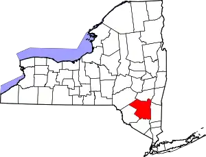 | |
| Towns | ||
| Villages | ||
| CDPs |
| |
| Other hamlets |
| |
| Footnotes | ‡This populated place also has portions in an adjacent county or counties | |
| ||