County of Heytesbury
The County of Heytesbury is one of the 37 counties of Victoria which are part of the cadastral divisions of Australia, used for land titles. The county is in the Western District of Victoria bounded by the Gellibrand River in the east and the Hopkins River in the west. In the north, the county was bounded approximately by the existing road, now the Princes Highway. Larger towns include Camperdown and Cobden. The county was proclaimed in 1849.
| Heytesbury Victoria | |||||||||||||||
|---|---|---|---|---|---|---|---|---|---|---|---|---|---|---|---|
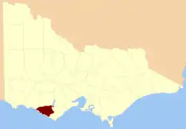 Location in Victoria | |||||||||||||||
| |||||||||||||||
Parishes
Parishes within the county:
- Brucknell
- Carpendeit
- Cooirejong
- Coradjil
- Ecklin
- Elingamite
- Jancourt
- Laang
- La Trobe (part in the County of Polwarth)
- Mepunga
- Narrawaturk
- Nirranda
- Nullwarre
- Paaratte
- Panmure (part in the County of Hampden)
- Pomborneit
- Purrumbete South
- Tallangatta
- Tandarook
- Timboon
- Waarre
- Wiridjil
- [1]
References
- Rootsweb Genealogy, Victorian Counties, retrieved 20 September 2008
- Research aids, Victoria 1910
- Map of the counties of Follett, Dundas, Ripon, Normanby, Villiers, Hampden, Heytesbury / John Sands
This article is issued from Wikipedia. The text is licensed under Creative Commons - Attribution - Sharealike. Additional terms may apply for the media files.