County of Merivale
The County of Merivale is a county located on the southern boundary of the state of Queensland, Australia.[1] Like all counties in Queensland, it is a non-functional administrative unit, that is used mainly for the purpose of registering land titles. The county was named in honour of Herman Merivale, the British permanent Under-Secretary of State for the Colonies. Its boundaries were declared and made subject to the Land Act 1897 on 7 March 1901.[1] Population centres within the County of Merivale include the towns of Warwick, Allora and Killarney.[2]
| Merivale Queensland | |||||||||||||||
|---|---|---|---|---|---|---|---|---|---|---|---|---|---|---|---|
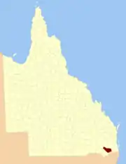 Location within Queensland | |||||||||||||||
| |||||||||||||||
Parishes
| Parish | LGA | Coordinates | Towns |
|---|---|---|---|
| Allora | Southern Downs | 28°02′S 151°59′E | Allora |
| Canal Creek | Southern Downs | 28°11′S 151°32′E | Karara |
| Canning | Southern Downs | 28°11′S 152°07′E | |
| Cunningham | Southern Downs | 28°18′S 152°13′E | Tannymorel |
| Dalrymple | Southern Downs | 28°01′S 151°52′E | |
| Deuchar | Southern Downs | 28°07′S 152°12′E | |
| Ellangowan | Toowoomba | 27°55′S 151°37′E | Ellangowan |
| Emu Vale | Southern Downs | 28°14′S 152°22′E | |
| Gilbert | Southern Downs | 28°07′S 152°20′E | |
| Gladfield | Southern Downs | 28°02′S 152°18′E | |
| Glengallan | Southern Downs | 28°07′S 152°04′E | |
| Goomburra | Southern Downs | 28°01′S 152°08′E | Goomburra |
| Gore | Toowoomba | 27°57′S 151°22′E | |
| Hanmer | Southern Downs | 28°07′S 151°39′E | |
| Killarney | Southern Downs | 28°22′S 152°18′E | Killarney |
| Kings Creek | Toowoomba | 27°59′S 151°47′E | |
| Leslie | Southern Downs | 28°07′S 151°59′E | |
| Leyburn | Southern Downs | 28°03′S 151°35′E | Leyburn |
| North Toolburra | Southern Downs | 28°06′S 151°53′E | |
| Palgrave | Southern Downs | 28°18′S 151°44′E | |
| Pratten | Southern Downs | 28°08′S 151°45′E | Pratten |
| Robinson | Southern Downs | 28°11′S 152°13′E | Yangan |
| Rosenthal | Southern Downs | 28°22′S 151°56′E | Dalveen |
| South Toolburra | Southern Downs | 28°13′S 151°48′E | |
| Talgai | Southern Downs | 28°01′S 151°42′E | |
| Tummaville | Toowoomba | 27°59′S 151°29′E | |
| Warwick | Southern Downs | 28°12′S 152°00′E | Warwick |
| Wildash | Southern Downs | 28°21′S 152°05′E |
References
- "Merivale (entry 21641)". Queensland Place Names. Queensland Government. Retrieved 1 September 2015.
- Darling Downs District, County of Merivale Maps - C1 Series at Queensland Archives.
External links
This article is issued from Wikipedia. The text is licensed under Creative Commons - Attribution - Sharealike. Additional terms may apply for the media files.