County of Aubigny

The County of Aubigny is a county (a cadastral division) in Queensland, Australia.[1] Like all counties in Queensland, it is a non-functional administrative unit, that is used mainly for the purpose of registering land titles. The county lies between 151°E and 152°E longitude, and it covers the Toowoomba Region and the Dalby part of the Western Downs Region,[2] The county was named by the Surveyor-General of New South Wales in 1850, possibly to honour the Earl of Arundel who had a long association with the name Aubigny. The area was officially named and bounded by the Governor in Council on 7 March 1901 under the Land Act 1897.[1]

Aubigny
Queensland
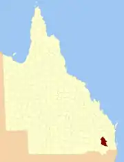
Location within Queensland
Lands administrative divisions around Aubigny:
Lytton Boondooma Fitzroy
Derby Aubigny Cavendish
Derby Merivale Churchill

Parishes

Aubigny is divided into parishes, listed as follows:

ParishLGACoordinatesTowns
BeauarabaToowoomba27°41′S 151°35′EPittsworth
BowenvilleToowoomba27°19′S 151°28′EBowenville
CambooyaToowoomba27°42′S 151°51′ECambooya
Cecil PlainsToowoomba27°38′S 151°22′EBrookstead, Cecil Plains
CliftonToowoomba27°55′S 152°00′EClifton
CumkillenbarWestern Downs27°02′S 151°23′EKaimkillenbun
DalbyWestern Downs27°09′S 151°18′EDalby
DouglasToowoomba27°19′S 151°59′E
DraytonToowoomba27°35′S 151°56′EToowoomba, Drayton
East PrairieToowoomba27°34′S 151°27′E
ElphinstoneToowoomba27°57′S 151°52′E
Eton ValeToowoomba27°39′S 151°53′E
FeltonToowoomba27°51′S 151°40′E
GehamToowoomba27°24′S 152°00′EGeham, Hampton
GoombungeeToowoomba27°17′S 151°53′EGoombungee
GowrieToowoomba27°32′S 151°53′E
HaldonToowoomba27°49′S 152°02′E
HodgsonToowoomba27°48′S 151°50′E
IrvingdaleWestern Downs27°09′S 151°27′E
IsaacToowoomba27°30′S 151°48′EKingsthorpe
JimbourWestern Downs27°00′S 151°16′EJimbour
JondaryanToowoomba27°23′S 151°28′EJondaryan
KingToowoomba27°21′S 151°48′E
MacalisterWestern Downs27°04′S 151°08′EMacalister
Maida HillWestern Downs26°54′S 151°30′EBell
MeringandanToowoomba27°26′S 151°50′EMeringandan
MiltonToowoomba27°10′S 151°46′E
MoolaWestern Downs27°03′S 151°32′E
MotleyToowoomba27°35′S 151°37′E
MyallWestern Downs27°09′S 151°10′E
North BranchToowoomba27°48′S 151°33′E
PiltonToowoomba27°54′S 152°07′EPilton
RamsayToowoomba27°44′S 151°58′E
RollestonToowoomba27°43′S 151°42′EPittsworth, Southbrook
RosalieToowoomba27°09′S 151°37′E
St RuthWestern Downs27°24′S 151°17′ESt Ruth
StephensToowoomba27°56′S 151°46′E
TabletopToowoomba27°57′S 152°00′E
ToothToowoomba27°53′S 151°49′ENobby
ToowoombaToowoomba27°29′S 151°56′ECharlton, Gowrie Jn, Highfields
WattsToowoomba27°22′S 151°40′EOakey
West PrairieToowoomba27°28′S 151°22′E
WestbrookToowoomba27°35′S 151°45′EWestbrook, Biddeston
WienholtWestern Downs27°13′S 151°26′E
YandillaToowoomba27°43′S 151°20′E
YoungToowoomba27°17′S 151°23′E

References

  1. "Aubigny (county) (entry 980)". Queensland Place Names. Queensland Government. Retrieved 31 August 2015.
  2. Darling Downs District, County of Aubigny Maps - A4 Series at Queensland Archives.


This article is issued from Wikipedia. The text is licensed under Creative Commons - Attribution - Sharealike. Additional terms may apply for the media files.