Southern Downs Region
The Southern Downs Region is a local government area in the Darling Downs region of Queensland, Australia, along the state's boundary with New South Wales. It was created in 2008 from a merger of the Shire of Warwick and the Shire of Stanthorpe.
| Southern Downs Region Queensland | |||||||||||||||
|---|---|---|---|---|---|---|---|---|---|---|---|---|---|---|---|
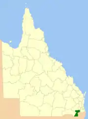 Location within Queensland | |||||||||||||||
| Population | 35,601 (2018)[1] | ||||||||||||||
| • Density | 5.0086/km2 (12.9722/sq mi) | ||||||||||||||
| Established | 2008 | ||||||||||||||
| Area | 7,108 km2 (2,744.4 sq mi)[1] | ||||||||||||||
| Mayor | Vic Pennisi | ||||||||||||||
| Council seat | Warwick | ||||||||||||||
| Region | Darling Downs | ||||||||||||||
| State electorate(s) | Southern Downs | ||||||||||||||
| Federal Division(s) | Maranoa | ||||||||||||||
| Website | Southern Downs Region | ||||||||||||||
| |||||||||||||||
It has an estimated operating budget of A$22.8 million.
History
The majority of the former Warwick Shire is home to the Githabul people who have lived around this area for tens of thousands of years before arrival by Europeans in the early 1840s.[2]
The current area of the Southern Downs Region existed as two distinct local government areas:
- the Shire of Warwick; which in turn consisted of four previous local government areas:
- the City of Warwick;
- the Shire of Allora;
- the Shire of Glengallan;
- the Shire of Rosenthal;
- and the Shire of Stanthorpe.
The City of Warwick came into being as the Warwick Municipality on 25 May 1861 under the Municipalities Act 1858, a piece of New South Wales legislation inherited by Queensland at its separation two years earlier. On 21 July 1869, the Municipality of Allora was established under the Municipal Institutions Act 1864.
On 11 November 1879, the Clifton, Glengallan and Stanthorpe Divisions were created as three of 74 divisions within Queensland under the Divisional Boards Act 1879. In 1886, Rosenthal was created out of parts of Glengallan.
With the passage of the Local Authorities Act 1902, Warwick and Allora became Towns and the four Divisions became Shires. On 23 January 1915 the Town of Allora was abolished and a new Shire of Allora was created from the southern part of the Shire of Clifton.
On 4 April 1936, Warwick was proclaimed a city.
On 21 November 1991, the Electoral and Administrative Review Commission, created two years earlier, produced its second report, and recommended that local government boundaries in the Warwick area be rationalised. The Local Government (Allora, Glengallan, Rosenthal and Warwick) Regulation 1994 was gazetted on 20 May 1994. On 25 June, an election was held for the new Shire of Warwick, and on 1 July 1994, the original entities passed out of existence. Stanthorpe was unaffected by these changes.
In July 2007, the Local Government Reform Commission released its report and recommended that Warwick and Stanthorpe amalgamate. It noted that Warwick was the regional centre for the region, with the maximum travelling time between Warwick and any other town being one hour. Both councils opposed the amalgamation citing cultural differences and different river catchment areas and economic drivers.[3] On 15 March 2008, the two Shires formally ceased to exist, and elections were held on the same day to elect eight councillors and a mayor to the Regional Council.
Wards
The council remains undivided and its elected body consists of eight councillors and a mayor, elected for a four-year term.
Mayors
Towns and localities
The Southern Downs Region includes the following settlements:
Warwick region
|
Warwick area:
|
Allora area:
|
Glengallan area:
|
Rosenthal area:
|
* - not to be confused with Willow Vale, Queensland
Stanthorpe region
- Stanthorpe
- Amiens
- Applethorpe
- Ballandean
- Broadwater
- Cottonvale**
- Dalcouth
- Diamondvale
- Eukey
- Glen Aplin
- Greenlands
- Kyoomba
- Lyra
- Messines
- Mingoola
- Nundubbermere
- Passchendaele
- Pikedale
- Pikes Creek
- Pozieres
- Severnlea
- Somme
- The Summit
- Thorndale
- Wallangarra
- Wyberba
** - acquired its name from one Private E Cotton a local who enlisted in the Australian Air Force
Libraries
The Southern Downs Regional Council operates public libraries at Allora, Stanthorpe, and Warwick.[8] It also operates a mobile library servicing Dalveen, Karara, Killarney, Leyburn, Maryvale, Pratten, Wheatvale and Yangan.[8]
Population
The populations given relate to the component entities prior to 2008. The next census, due in 2011, will be the first for the new Region.
| Year | Population (Region total) |
Population (Stanthorpe) |
Population (Warwick) |
Population (Allora) |
Population (Glengallan) |
Population (Rosenthal) |
|---|---|---|---|---|---|---|
| 1933 | 25,016 | 6,934 | 6,664 | 2,624 | 6,334 | 2,460 |
| 1947 | 24,009 | 7,419 | 7,129 | 2,217 | 5,269 | 1,975 |
| 1954 | 25,862 | 8,335 | 9,151 | 2,106 | 4,639 | 1,631 |
| 1961 | 26,288 | 8,514 | 9,843 | 1,961 | 4,388 | 1,582 |
| 1966 | 25,917 | 8,503 | 10,065 | 1,890 | 3,906 | 1,553 |
| 1971 | 24,115 | 8,189 | 9,303 | 1,719 | 3,410 | 1,494 |
| 1976 | 24,583 | 8,709 | 9,169 | 1,666 | 3,491 | 1,548 |
| 1981 | 24,300 | 8,576 | 8,853 | 1,679 | 3,611 | 1,581 |
| 1986 | 26,270 | 9,143 | 9,435 | 2,041 | 3,688 | 1,963 |
| 1991 | 28,288 | 9,556 | 10,393 | 2,132 | 3,966 | 2,241 |
| 1996 | 29,563 | 9,596 | 10,896 | 2,234 | 3,990 | 2,742 |
| 2001 | 30,554 | 9,860 | 10,956 | 2,439 | 4,088 | 3,129 |
| 2006 | 31,385 | 9,968 | 11,143 | 2,437 | 4,169 | 3,558 |
References
- "3218.0 – Regional Population Growth, Australia, 2017-18: Population Estimates by Local Government Area (ASGS 2018), 2017 to 2018". Australian Bureau of Statistics. Australian Bureau of Statistics. 27 March 2019. Retrieved 25 October 2019. Estimated resident population, 30 June 2018.
- "Githabul people show their pride". Warwick Daily News. 13 August 2012. Retrieved 13 March 2014.
- Queensland Local Government Reform Commission (July 2007). Report of the Local Government Reform Commission (PDF). 2. pp. 297–301. ISBN 1-921057-11-4. Retrieved 3 June 2010.
- "2008 Southern Downs Regional Council - Mayoral Election - Election Summary". results.ecq.qld.gov.au. Retrieved 4 December 2017.
- "2012 Southern Downs Regional Council - Mayoral Election - Election Summary". results.ecq.qld.gov.au. Retrieved 4 December 2017.
- "2016 Southern Downs Regional Council - Mayoral Election - Election Summary". results.ecq.qld.gov.au. Retrieved 4 December 2017.
- "2020 Local Government Elections: Saturday, 28 March 2020". Electoral Commission of Queensland. 2020. Retrieved 16 June 2020.
- "Library details". Southern Downs Regional Council. Archived from the original on 31 January 2018. Retrieved 31 January 2018.