Coyote Flats, Texas
Coyote Flats is a city in Johnson County in the U.S. state of Texas.[3] As of the 2010 census, before the community was incorporated, the population was 312.[4]
Coyote Flats, Texas | |
|---|---|
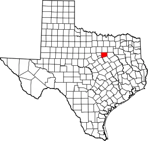
 Location in Johnson County and the U.S. state of Texas | |
| Coordinates: 32°21′20″N 97°17′32″W | |
| Country | United States |
| State | Texas |
| County | Johnson |
| Area | |
| • Total | 3.36 sq mi (8.71 km2) |
| • Land | 3.33 sq mi (8.62 km2) |
| • Water | 0.04 sq mi (0.09 km2) |
| Elevation | 860 ft (260 m) |
| Population (2010) | |
| • Total | 312 |
| • Estimate (2019)[2] | 363 |
| • Density | 109.04/sq mi (42.10/km2) |
| Time zone | UTC-6 (Central (CST)) |
| • Summer (DST) | UTC-5 (CDT) |
| ZIP code | 76031 (Cleburne) |
| FIPS code | 48-17429 |
| GNIS feature ID | 2663677 |
History
In 2009, the city of Keene wanted to annex seven parcels of land to its south, but was met with strong opposition from the parcels' residents. Judge John Neill of the 18th District Court subsequently blocked the annexation of three of the seven parcels on the grounds that they were outside of Keene's extraterritorial jurisdiction.[5] On March 10, 2010, 25 residents petitioned a specially called meeting of the Johnson County Commissioners Court to become incorporated as a municipality. The name "Coyote Flats" was submitted at the meeting.[6]
An election to incorporate the City of Coyote Flats was held on May 8, 2010. The measure was approved by a vote of 76 to 11.[7] John Barnett was sworn in as mayor on August 11.[8]
Geography
Coyote Flats is located at 32°21′20″N 97°17′32″W (32.355614, -97.292037).[3] It is 6 miles (10 km) east of Cleburne, 4 miles (6 km) south of Keene, and 7 miles (11 km) southwest of Alvarado. Downtown Fort Worth is 30 miles (48 km) to the north.
According to the United States Census Bureau, Coyote Flats has a total land area of 3.329 square miles (8.618 km2) and a total water area of 0.035 square miles (0.091 km2).[3]
Demographics
| Historical population | |||
|---|---|---|---|
| Census | Pop. | %± | |
| 2010 | 312 | — | |
| 2019 (est.) | 363 | [2] | 16.3% |
| U.S. Decennial Census[9] | |||
References
- "2019 U.S. Gazetteer Files". United States Census Bureau. Retrieved August 7, 2020.
- "Population and Housing Unit Estimates". United States Census Bureau. May 24, 2020. Retrieved May 27, 2020.
- "US Gazetteer files: 2010, 2000, and 1990". United States Census Bureau. 2011-02-12. Retrieved 2011-04-23.
- "Geographic Identifiers: 2010 Census Summary File 1 (G001): Coyote Flats CDP, Texas". American Factfinder. U.S. Census Bureau. Archived from the original on February 13, 2020. Retrieved December 21, 2018.
- Source: Welcome to Coyote Flats, Texas
- Source: Residents seek to establish area as municipality
- Source: ESD tax increase OK'ed, Senate race goes to runoff
- Source: A new town with a new leader
- "Census of Population and Housing". Census.gov. Retrieved June 4, 2015.
