Crittenden, Kentucky
Crittenden is a home rule-class city[3] in Grant and Kenton counties, Kentucky, in the United States. The population was 3,815 as of the 2010 census,[4] up from 2,401 at the 2000 census.
Crittenden, Kentucky | |
|---|---|
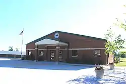 Crittenden City Hall | |
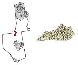 Location of Crittenden in Grant and Kenton counties. | |
| Coordinates: 38°46′56″N 84°36′21″W | |
| Country | United States |
| State | Kentucky |
| County | Grant |
| Area | |
| • Total | 3.43 sq mi (8.89 km2) |
| • Land | 3.40 sq mi (8.82 km2) |
| • Water | 0.03 sq mi (0.07 km2) |
| Elevation | 932 ft (284 m) |
| Population (2010) | |
| • Total | 3,815 |
| • Estimate (2019)[2] | 3,876 |
| • Density | 1,138.33/sq mi (439.51/km2) |
| Time zone | UTC-5 (Eastern (EST)) |
| • Summer (DST) | UTC-4 (EDT) |
| ZIP code | 41030 |
| Area code(s) | 859 |
| FIPS code | 21-18568 |
| GNIS feature ID | 0490355 |
| Website | crittenden |
Geography
Crittenden is located in northern Grant County at 38°46′56″N 84°36′21″W (38.782248, -84.605794).[5] A small portion of the northern border of the city touches the Boone County line, and another part of the city extends north into Kenton County.
Interstate 75 passes through Crittenden, with access from Exit 166; I-75 leads north 27 miles (43 km) to Cincinnati and south 56 miles (90 km) to Lexington. U.S. Route 25 (Dixie Highway) is a local road running parallel to I-75 that passes through the center of Crittenden; US 25 leads north 7 miles (11 km) to Walton and south 11 miles (18 km) to Williamstown, the Grant County seat.
According to the United States Census Bureau, Crittenden has a total area of 3.4 square miles (8.9 km2), of which 0.03 square miles (0.07 km2), or 0.80%, is water.[4]
History
The area of what is now Crittenden may have been settled as early as 1812. The community was called "Pin Hook" until 1834, when it was renamed for Kentucky statesman and later governor John J. Crittenden.[6][7][8]
Demographics
| Historical population | |||
|---|---|---|---|
| Census | Pop. | %± | |
| 1850 | 250 | — | |
| 1860 | 290 | 16.0% | |
| 1870 | 295 | 1.7% | |
| 1880 | 323 | 9.5% | |
| 1890 | 440 | 36.2% | |
| 1900 | 199 | −54.8% | |
| 1910 | 189 | −5.0% | |
| 1920 | 185 | −2.1% | |
| 1930 | 265 | 43.2% | |
| 1940 | 232 | −12.5% | |
| 1950 | 287 | 23.7% | |
| 1960 | 287 | 0.0% | |
| 1970 | 359 | 25.1% | |
| 1980 | 597 | 66.3% | |
| 1990 | 731 | 22.4% | |
| 2000 | 2,401 | 228.5% | |
| 2010 | 3,815 | 58.9% | |
| 2019 (est.) | 3,876 | [2] | 1.6% |
| U.S. Decennial Census[9] | |||
As of the census[10] of 2000, there were 2,401 people, 870 households, and 634 families residing in the city. The population density was 1,055.8 people per square mile (408.4/km2). There were 990 housing units at an average density of 435.3 per square mile (168.4/km2). The racial makeup of the city was 98.21% White, 0.42% African American, 0.25% Native American, 0.17% Asian, 0.08% Pacific Islander, 0.33% from other races, and 0.54% from two or more races. Hispanic or Latino of any race were 1.25% of the population.
There were 870 households, out of which 46.7% had children under the age of 18 living with them, 55.5% were married couples living together, 12.4% had a female householder with no husband present, and 27.1% were non-families. 19.7% of all households were made up of individuals, and 3.8% had someone living alone who was 65 years of age or older. The average household size was 2.76 and the average family size was 3.19.
In the city, the population was spread out, with 32.5% under the age of 18, 12.0% from 18 to 24, 36.1% from 25 to 44, 15.0% from 45 to 64, and 4.4% who were 65 years of age or older. The median age was 28 years. For every 100 females, there were 95.5 males. For every 100 females age 18 and over, there were 91.4 males.
The median income for a household in the city was $40,944, and the median income for a family was $44,038. Males had a median income of $31,399 versus $24,556 for females. The per capita income for the city was $16,573. About 6.2% of families and 8.4% of the population were below the poverty line, including 10.1% of those under age 18 and 6.0% of those age 65 or over.
Notable people
Crittenden is the home of Survivor contestant Rodger Bingham. It is also the home of country music artist and songwriter Lisa Shaffer. Her band is named after a ridge in Crittenden, Heathen Ridge.
References
- "2019 U.S. Gazetteer Files". United States Census Bureau. Retrieved July 24, 2020.
- "Population and Housing Unit Estimates". United States Census Bureau. May 24, 2020. Retrieved May 27, 2020.
- "Summary and Reference Guide to House Bill 331 City Classification Reform" (PDF). Kentucky League of Cities. Retrieved December 30, 2014.
- "Geographic Identifiers: 2010 Demographic Profile Data (G001): Crittenden city, Kentucky". American Factfinder. U.S. Census Bureau. Retrieved December 8, 2016.
- "US Gazetteer files: 2010, 2000, and 1990". United States Census Bureau. 2011-02-12. Retrieved 2011-04-23.
- http://www.kyhometown.com/crittenden/
- Rennick, Robert M. (1987). Kentucky Place Names. University Press of Kentucky. p. 72. ISBN 0813126312. Retrieved 2013-04-28.
- Gannett, Henry (1905). The Origin of Certain Place Names in the United States. Govt. Print. Off. pp. 96.
- "Census of Population and Housing". Census.gov. Retrieved June 4, 2015.
- "U.S. Census website". United States Census Bureau. Retrieved 2008-01-31.
External links
Municipalities and communities of Grant County, Kentucky, United States | ||
|---|---|---|
| Cities | 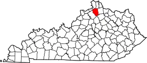 Location of Grant County, Kentucky | |
| Unincorporated communities | ||
| Footnotes | ‡This populated place also has portions in an adjacent county or counties | |
| ||
| Authority control |
|---|