Crossings of the Yarra River
The Yarra River is a river in southern Victoria, Australia; which flows through the city of Melbourne. Over the river's 242-kilometre (150 mi) length there are many structures that bridge the river.
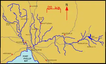
A map of the Yarra River and its tributaries.
Crossings
The following is a partial list of structures that fully span the Yarra River in order of closest to the mouth of the river in Hobsons Bay.[1][2][3][4]
| Name | Image | Type | Height | Year Built | Location | Details |
|---|---|---|---|---|---|---|
| - | Transmission Line | Spotswood/Port Melbourne | Transmits from Newport Power Station. | |||
| Spotswood sewer tunnel | Sewer | 1895 | Flooded in 1895 during construction, six deaths | |||
| West Gate Bridge | 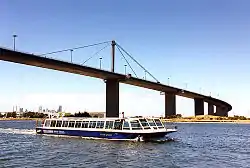 | Freeway | 53 m (174 ft) | 1978 | Second longest bridge in Australia. | |
| - | Transmission Line | 56 m (184 ft) | - | Docklands/Port Melbourne | Connects to Fishermans Bend Terminal | |
| Bolte Bridge | 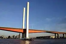 | Tollway | 25 m (82 ft) | 1999 | Tower height 140 m (460 ft) | |
| Webb Bridges | Pedestrian | - | 1986 | Docklands | Originally built as part of the Webb Dock rail link, had rails removed in the late 1990s, and reconstructed at the south end in 2004 as a pedestrian bridge as part of Docklands precinct. | |
| Charles Grimes Bridge | Primary Arterial Road | 3–4 m (9.8–13.1 ft) | 1975 | First bridge built in 1975, reconstructed in 2001. | ||
| Seafarers Bridge | Shared - pedestrians and cyclists | - | 2009 | Melbourne Convention Centre/World Trade Centre | ||
| Spencer Street Bridge | 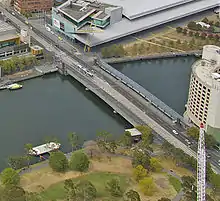 | Primary Arterial Road/Tram/Pedestrian | 2–3 m (6 ft 7 in–9 ft 10 in) | 1930 | Melbourne/Southbank | |
| King Street Bridge | 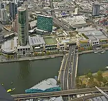 | Primary Arterial Road/Pedestrian | 2–3 m (6 ft 7 in–9 ft 10 in) | 1961 | Southern end offramps altered 1997 for the development of Crown Casino. | |
| Queens Bridge |  | Major Road/Tram | 2–3 m (6 ft 7 in–9 ft 10 in) | 1889 | Originally the site of a timber footbridge built in 1860. | |
| Sandridge Bridge | .jpg.webp) | Railway (Disused) | - | 1888 | First bridge built 1853, second bridge built 1858, current bridge built 1888. Former rail bridge for the Port Melbourne and St Kilda railway lines, first rail crossing of the Yarra, converted to pedestrian use in 2006. | |
| Evan Walker Bridge | 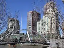 | Pedestrian | - | 1992 | Renamed in 2015 in honour of Evan Walker[5] | |
| Princes Bridge | 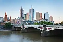 | Major Road/Tram | - | 1888 | First bridge built 1844, second bridge built 1850, current bridge built 1888. | |
| Swan Street Bridge | Primary Arterial Road | - | 1952 | Melbourne | ||
| Burnley Tunnel | 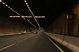 | Tollway | N/A | 1997 | Eastbound CityLink tunnel from Southbank to Burnley. | |
| Domain Tunnel | 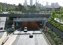 | Westbound CityLink tunnel from Southbank to Richmond. | ||||
| Morell Bridge | Pedestrian | - | 1899 | Former roadway closed when CityLink built, now pedestrian bridge. | ||
| Hoddle Bridge | Primary Arterial Road | - | 1938 | Cremorne | Former punt river crossing site, now carries Hoddle Highway. | |
| Cremorne Railway Bridge | Railway | - | 1946 | South Yarra/Cremorne | Carries Sandringham, Frankston, Pakenham and Cranbourne railway lines. First bridge built in 1860, current bridge built 1946 | |
| Church Street Bridge | 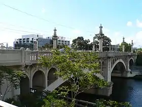 | Road/Tram | - | 1923 | South Yarra/Richmond | First bridge built in 1857, current bridge built 1923 |
| - | Transmission Line | - | - | 1st of 5 crossings of the same line. | ||
| - | Transmission Line | - | - | Toorak/Burnley | 2nd of 5 crossings of the same line. | |
| - | Transmission Line | - | - | 3rd of 5 crossings of the same line. | ||
| MacRobertson Bridge | Primary Arterial Road | - | 1934 | First crossing was a punt opened in 1880, current bridge built 1934 | ||
| - | Transmission Line | - | - | 4th of 5 crossings of the same line. | ||
| Heyington Bridge | Railway/Pedestrian | - | - | Glen Waverley railway line. | ||
| - | Transmission Line | - | - | 5th of 5 crossings of the same line. | ||
| Gardiners Creek Bridge | Pedestrian | - | - | |||
| Monash Freeway | Road | - | 1960s | Forced relocation of the Yarra River | ||
| Swan Street | Road, trams | - | - | Burnley/Hawthorn | ||
| Hawthorn Railway Bridge | Rail | - | 1861 | Alamein, Belgrave & Lilydale Lines | ||
| Hawthorn Bridge | 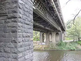 | Road, trams | - | 1861 | Richmond/Hawthorn | Originally built in 1861, widened in 1890, renovated in 1931 |
| Victoria Bridge | Road, trams | - | 1884 | Richmond/Kew | Originally built in 1884, widened in 1890, strengthened and widened in 1915, reconditioned and further widened in 1933 | |
| Walmer Street Footbridge | Footbridge | - | 1892 | Abbotsford/Kew | First bridge built in 1891; was washed away one month after construction. Current bridge: Whipple truss design. | |
| Collins Bridge | Footbridge | - | - | |||
| Johnston Street Bridge | Road | - | 1858 | Burnley/Hawthorn | ||
| Kanes Bridge, Studley Park | Footbridge | - | - | Fairfield/Kew | Original bridge opened in 1928 and destroyed in 1934 flood. Rebuilt in 1935. | |
| Eastern Freeway | Road | - | 1977 | Forced relocation of the Yarra River | ||
| Fairfield Pipe Bridge | 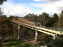 | Pipeline/Footbridge | - | - | ||
| Chandler Bridge | Road | - | 1891 | Alphington/Kew | Once part of the Outer Circle railway, now carries part of the Chandler Highway. | |
| Footbridge | Main Yarra Trail | - | - | Ivanhoe/Kew East | ||
| Burke Road | Road | - | - | |||
| - | Transmission Line | - | - | Bulleen | 1st of 8 crossings in Bulleen of the same line. | |
| Banksia Street | 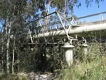 | Road | - | - | Heidelberg/Bulleen | |
| - | Transmission Line | - | - | Lower Plenty/Templestowe Lower | 7th of 8 crossings of the same line. | |
| Odyssey House / Finns Reserve | Footbridge | - | - | |||
| - | Transmission Line | - | - | 8th of 8 crossings of the same line. | ||
| Westerfolds Park | Footbridge, Main Yarra Trail | - | - | |||
| Fitzsimons Lane | Road | - | - | Eltham/Templestowe | ||
| - | Transmission Line | - | - | Separate line joining the above-mentioned line. | ||
| - | Footbridge | - | - | |||
| - | Transmission Line | - | - | |||
| Warrandyte Bridge | 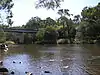 | Road | - | 1952 | Warrandyte/North Warrandyte | First bridge built 1861, current bridge built in 1952. |
| The Heritage Golf Club | Road | - | - | Christmas Hills/Chirnside Park | ||
| - | Transmission Line | - | - | |||
| - | Private road | - | - | |||
| Healesville railway | Rail | - | - | Yering | ||
| Melba Highway | Road | - | - | |||
| Proposed Melba Highway bypass | Road | - | - | |||
| Maxwells Road | Road | - | - | Coldstream/Healesville | ||
| Maroondah Highway | Road | - | - | |||
| Healesville - Koo Wee Rup Road | Road | - | - | Launching Place | ||
| Former Healesville - Koo Wee Rup Road | Road | - | - | |||
| Don Road | Road | - | - | |||
| - | Private road | - | - | |||
| Station Road | Road | - | - | Wesburn | ||
| Dee Road | Road | - | - | Millgrove | ||
| McKenzie-King Drive | Road | - | - | |||
| Mayer Bridge | Road | - | 1993 | Warburton | Connects Warburton Highway to Dammans Road. Officially re-opened 30 May 1993 by Councillor Pat Hunter, Shire President. | |
| Swing Bridge | Footbridge | - | - | Connects Story Reserve to Dammans Road. | ||
| Brisbane Bridge | Road | - | - | Connects Warburton Highway to Dammans Road | ||
| Bramich Footbridge | Footbridge | - | 1993 | Officially re-opened 30 May 1993 by Councillor Pat Hunter, Shire President. | ||
| Redwood Bridge | Footbridge | - | 2000 | Completed March 2000. Constructed by 22 Construction Regiment, 4 Combat Engineer Regiment and members of the Warburton Advancement League | ||
| Signs Bridge | Road | - | - | Where the Warburton Highway crosses the Yarra River in Warburton | ||
| Woods Point Road | Road | - | - | East Warburton | ||
| Hazelwood Road | Road | - | - | |||
| Cement Creek Road | Road | - | - | |||
| O'Shannassy Reservoir | Access road | - | - | |||
| Peninsula Road | Road | - | - | McMahons Creek | Culvert crossing dry river bed drained by Big Peninsula Tunnel | |
| Big Peninsula Tunnel walking track | walking track | - | - | Concrete stepping stones | ||
| Woods Point Road | 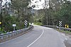 | Road | - | - | Reefton | |
| Upper Yarra Dam | Dam | - | 1957 |
- There are also a number of ferries that cross the Yarra at various points such as the West Gate Ferry and Herring Island Punt.
References
- Melways, Edition 35, 2008
- "Boroondara info on Chandler Bridge". Archived from the original on 1 May 2009. Retrieved 4 January 2009.
- "Darebin info on the Chandler Bridge". Archived from the original on 6 September 2006.
- Anderson, J. T. Noble (October 1934). "Metropolitan Roads and Bridges" (PDF). Journal of Institution of Engineers Australia. 6: 359–360.
- "Bridge honours Evan Walker". Southbank Local News. 13 August 2015. Retrieved 15 September 2017.
External links
This article is issued from Wikipedia. The text is licensed under Creative Commons - Attribution - Sharealike. Additional terms may apply for the media files.