Cuba, Illinois
Cuba is a city in Fulton County, Illinois, United States. The population was 1,294 at the 2010 census,[3] down from 1,418 at the 2000 census.
Cuba, Illinois
Centerville Middletown | |
|---|---|
| Nicknames: Cube, Cubie-town | |
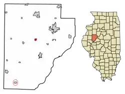 Location of Cuba in Fulton County, Illinois. | |
 Cuba, Illinois Location within Fulton County  Cuba, Illinois Cuba, Illinois (Illinois) | |
| Coordinates: 40°29′36″N 90°11′36″W | |
| Country | United States |
| State | Illinois |
| County | Fulton |
| Township | Putman |
| Founded | 1818 |
| Area | |
| • Total | 0.54 sq mi (1.41 km2) |
| • Land | 0.54 sq mi (1.41 km2) |
| • Water | 0.00 sq mi (0.00 km2) |
| Elevation | 682 ft (208 m) |
| Population (2010) | |
| • Total | 1,294 |
| • Estimate (2019)[2] | 1,170 |
| • Density | 2,154.70/sq mi (831.65/km2) |
| Time zone | UTC-6 (CST) |
| • Summer (DST) | UTC-5 (CDT) |
| Postal code | 61427 |
| Area code(s) | 309 |
| FIPS code | 17-17991 |
History
Cuba was founded in 1837 when the two rival towns of Centerville and Middleton merged.[4] The new town was named after the island of Cuba.[5] A post office has been in operation at Cuba since 1837.[6]
Geography
Cuba is located near the geographic center of Fulton County at 40°29′36″N 90°11′36″W (40.493422, -90.193307).[7] Illinois Route 97 passes through the city, leading north 40 miles (64 km) to Galesburg and south 20 miles (32 km) to Havana on the Illinois River.
According to the 2010 census, Cuba has a total area of 0.54 square miles (1.40 km2), all land.[8]
Demographics
| Historical population | |||
|---|---|---|---|
| Census | Pop. | %± | |
| 1860 | 348 | — | |
| 1870 | 568 | 63.2% | |
| 1880 | 656 | 15.5% | |
| 1890 | 1,114 | 69.8% | |
| 1900 | 1,198 | 7.5% | |
| 1910 | 2,019 | 68.5% | |
| 1920 | 1,484 | −26.5% | |
| 1930 | 1,479 | −0.3% | |
| 1940 | 1,620 | 9.5% | |
| 1950 | 1,482 | −8.5% | |
| 1960 | 1,380 | −6.9% | |
| 1970 | 1,581 | 14.6% | |
| 1980 | 1,648 | 4.2% | |
| 1990 | 1,440 | −12.6% | |
| 2000 | 1,418 | −1.5% | |
| 2010 | 1,294 | −8.7% | |
| 2019 (est.) | 1,170 | [2] | −9.6% |
| U.S. Decennial Census[9] | |||
As of the census[10] of 2000, there were 1,418 people, 552 households, and 384 families residing in the city. The population density was 2,616.7 people per square mile (1,013.9/km2). There were 594 housing units at an average density of 1,096.1 per square mile (424.7/km2). The racial makeup of the city was 98.45% White, 0.21% African American, 0.07% Native American, 0.14% Asian, 0.14% from other races, and 0.99% from two or more races. Hispanic or Latino of any race were 0.56% of the population.
There were 552 households, out of which 30.1% had children under the age of 18 living with them, 54.5% were married couples living together, 12.3% had a female householder with no husband present, and 30.4% were non-families. 27.0% of all households were made up of individuals, and 13.0% had someone living alone who was 65 years of age or older. The average household size was 2.48 and the average family size was 2.98.
In the city, the population was spread out, with 25.9% under the age of 18, 7.5% from 18 to 24, 26.2% from 25 to 44, 21.2% from 45 to 64, and 19.3% who were 65 years of age or older. The median age was 38 years. For every 100 females, there were 86.3 males. For every 100 females age 18 and over, there were 82.5 males.
The median income for a household in the city was $30,682, and the median income for a family was $35,952. Males had a median income of $31,522 versus $19,519 for females. The per capita income for the city was $16,608. About 8.4% of families and 9.8% of the population were below the poverty line, including 10.7% of those under age 18 and 6.9% of those age 65 or over.
Notable people
- Paul H. Landis, sociologist born in Cuba in 1901[11]
- Harry K. Newburn, educator born in Cuba[12]
References
- "2019 U.S. Gazetteer Files". United States Census Bureau. Retrieved July 14, 2020.
- "Population and Housing Unit Estimates". United States Census Bureau. May 24, 2020. Retrieved May 27, 2020.
- "Geographic Identifiers: 2010 Census Summary File 1 (G001), Cuba city, Illinois". American FactFinder. U.S. Census Bureau. Archived from the original on February 13, 2020. Retrieved May 12, 2016.
- Callary, Edward (29 September 2008). Place Names of Illinois. University of Illinois Press. p. 84. ISBN 978-0-252-09070-7.
- Gannett, Henry (1905). The Origin of Certain Place Names in the United States. Govt. Print. Off. p. 96.
- "Fulton County". Jim Forte Postal History. Retrieved 2 November 2015.
- "US Gazetteer files: 2010, 2000, and 1990". United States Census Bureau. 2011-02-12. Retrieved 2011-04-23.
- "G001 - Geographic Identifiers - 2010 Census Summary File 1". United States Census Bureau. Archived from the original on 2020-02-13. Retrieved 2015-12-27.
- "Census of Population and Housing". Census.gov. Retrieved June 4, 2015.
- "U.S. Census website". United States Census Bureau. Retrieved 2008-01-31.
- http://www.asanet.org/footnotes/1985/ASA.07.1985.pdf
- Papers of Harry K. Newburn
External links
| Wikimedia Commons has media related to Cuba, Illinois. |
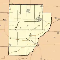
Municipalities and communities of Fulton County, Illinois, United States | ||
|---|---|---|
| Cities | Map of Illinois highlighting Fulton County | |
| Town | ||
| Villages | ||
| Townships | ||
| Unincorporated communities | ||
| Ghost towns | ||
| Footnotes | ‡This populated place also has portions in an adjacent county or counties | |
| ||