Banner Township, Fulton County, Illinois
Banner Township is one of twenty-six townships in Fulton County, Illinois, USA. As of the 2010 census, its population was 373 and it contained 177 housing units.[2] The township was known as Utica Township, then Monterey Township, before becoming Banner Township.
Banner Township | |
|---|---|
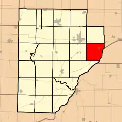 Location in Fulton County | |
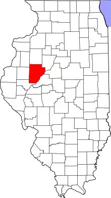 Fulton County's location in Illinois | |
| Coordinates: 40°29′50″N 89°56′04″W | |
| Country | United States |
| State | Illinois |
| County | Fulton |
| Established | November 6, 1849 |
| Area | |
| • Total | 34.1 sq mi (88 km2) |
| • Land | 28.5 sq mi (74 km2) |
| • Water | 5.6 sq mi (15 km2) 16.42% |
| Elevation | 495 ft (151 m) |
| Population (2010) | |
| • Estimate (2016)[1] | 361 |
| • Density | 13.1/sq mi (5.1/km2) |
| Time zone | UTC-6 (CST) |
| • Summer (DST) | UTC-5 (CDT) |
| ZIP codes | 61520 |
| FIPS code | 17-057-03584 |
Geography
According to the 2010 census, the township has a total area of 34.1 square miles (88 km2), of which 28.5 square miles (74 km2) (or 83.58%) is land and 5.6 square miles (15 km2) (or 16.42%) is water.[2]
Cities, towns, villages
Unincorporated towns
(This list is based on USGS data and may include former settlements.)
- Kings Hill (Settlement with school & burying ground)
- Mills point
- Copperas Creek landing
- Commerce Was an early village on the mouth of the copperas creek where it empties into the Illinois River. Just like Mills Point it never materialized & ceased to exist. It was platted in 1843 by Lyman B. Suydam.
Cemeteries
The township contains these four cemeteries: Bybee, Kings Hill, Utica and Walnut.
Major highways
 US Route 24
 Illinois Route 9
Lakes
- Pond Lily Lake
- Slim Lake
School districts
- Canton Union School District 66
- Illini Bluffs Community Unit School District 327
Political districts
- Illinois' 17th congressional district
- State House District 91
- State Senate District 46
References
- "Banner Township, Fulton County, Illinois". Geographic Names Information System. United States Geological Survey. Retrieved 2010-01-16.
- United States Census Bureau 2007 TIGER/Line Shapefiles
- United States National Atlas
- "Population and Housing Unit Estimates". Retrieved June 9, 2017.
- "Population, Housing Units, Area, and Density: 2010 - County -- County Subdivision and Place -- 2010 Census Summary File 1". United States Census. Archived from the original on 2020-02-12. Retrieved 2013-05-28.
- "Census of Population and Housing". Census.gov. Retrieved June 4, 2016.
External links
Places adjacent to Banner Township, Fulton County, Illinois | |
|---|---|
Municipalities and communities of Fulton County, Illinois, United States | ||
|---|---|---|
| Cities | Map of Illinois highlighting Fulton County | |
| Town | ||
| Villages | ||
| Townships | ||
| Unincorporated communities | ||
| Ghost towns | ||
| Footnotes | ‡This populated place also has portions in an adjacent county or counties | |
| ||
This article is issued from Wikipedia. The text is licensed under Creative Commons - Attribution - Sharealike. Additional terms may apply for the media files.
