Cuchilla Grande
Cuchilla Grande is a hill range that crosses the east part of Uruguay from north to south. It extends from the south part of Cerro Largo Department, through the departments of Treinta y Tres and Lavalleja and ends in Maldonado Department where it forms its highest peaks.
| Cuchilla Grande | |
|---|---|
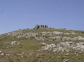 Cerro Catedral, the highest point in Uruguay. | |
| Highest point | |
| Peak | Cerro Catedral (Cathedral Hill) |
| Elevation | 513.66 m (1,685.2 ft) |
| Coordinates | 34°22′0″S 54°40′0″W |
| Geography | |
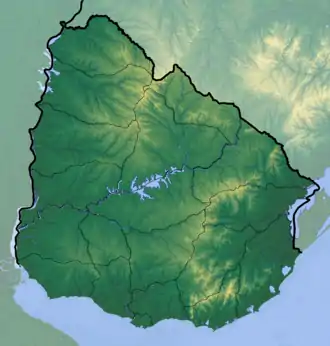 Cuchilla Grande Location in Uruguay | |
| Country | Uruguay |
| Geology | |
| Age of rock | Precambrian |
| Type of rock | Granite, gneiss |
Noted features
In the southern part of this range, there is the Cerro Catedral, the highest point of the country. This hill is situated in the Maldonado Department.
Also found in this range is the Cerro Pan de Azúcar, likewise situated in the Maldonado Department, near Piriápolis.
Secondary ranges
- Cuchilla de Mansavillagra
- Sierra Carapé
- Sierra Aceguá
- Sierra de las Ánimas
- Cuchilla Grande Inferior
- Cuchilla de Cerro Largo
See also
This article is issued from Wikipedia. The text is licensed under Creative Commons - Attribution - Sharealike. Additional terms may apply for the media files.
