Curtis Park, Sacramento, California
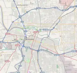
Curtis Park is a neighborhood located within the city of Sacramento, California. Curtis Park is defined as north of Sutterville Road, south of Broadway Ave., east of Freeport Boulevard, and west of Highway 99. Curtis Park is a largely residential neighborhood. It is known for its charming vintage homes including Victorian, Bungalow, and 1920s revival style subdivisions. Information about the neighborhood can be obtained from the Sierra Curtis Neighborhood Association.
Curtis Park | |
|---|---|
Neighborhood of Sacramento | |
 Curtis Park Location within Sacramento | |
| Coordinates: 38.54548°N 121.47922°W | |
| Country | United States |
| State | California |
| County | Sacramento |
| City | Sacramento |
| ZIP Code | 95818 |
Utility providers
Notable residents
Traditionally one of the more well-to-do neighborhoods in the city proper, Curtis Park has been home to many of Sacramento's best known citizens.
- Kevin Johnson- Mayor of Sacramento, former NBA star
- Roger Dickinson—Assemblyman
- Dave Jones - California Insurance Commissioner, former State Assemblyman & Sacramento City Councilmember
- Gloria McLeod - California State Senator from Chino keeps a home in Curtis Park
- Raphael Saadiq musician
- Joe Serna the late mayor of Sacramento, lived here until his death
- Ray Eames - Childhood home of the designer
References
- Utilities Department. City of Sacramento. Retrieved 2011-02-26.
- Sacramento Municipal Utility District Archived 2010-03-14 at the Wayback Machine. Retrieved 2011-02-26.
External links
This article is issued from Wikipedia. The text is licensed under Creative Commons - Attribution - Sharealike. Additional terms may apply for the media files.
