Dafoe, Saskatchewan
Dafoe (2016 population: 15) is a special service area in the Canadian province of Saskatchewan within the Rural Municipality of Big Quill No. 308 and Census Division No. 10. It was a village prior to August 2018. Dafoe is located east of the intersection of Highway 6 and the Yellowhead Highway southwest of Big Quill Lake, the Dafoe Brook[6] flows to the east of the community. Dafoe marks the far west end of the area known to Icelandic settlers in Saskatchewan as the Lakes Settlement (Icelandic: Vatnabyggð).[7]
Dafoe | |
|---|---|
Special service area | |
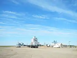
 Industrial area in Dafoe | |
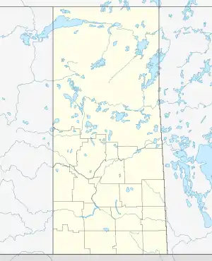
 Location of Dafoe in Saskatchewan  Dafoe, Saskatchewan (Canada) | |
| Coordinates: 51°45′16″N 104°31′39″W | |
| Country | |
| Province | |
| Region | Saskatchewan |
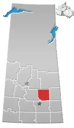
| Census division | 10 |
| Rural Municipality | Big Quill No. 308 |
| Post office founded | July 1, 1911 |
| Incorporated (village)[1] | May 28, 1920 |
| Dissolved (Special service area)[2] | July 31, 2018 |
| Government | |
| • Type | Municipal |
| • Governing body | Dafoe Village Council |
| • Mayor | Bob Pilkey |
| • Administrator | Santana Dawson |
| Area | |
| • Total | 0.80 km2 (0.31 sq mi) |
| Population (2016) | |
| • Total | 15 |
| • Density | 18.7/km2 (48/sq mi) |
| Time zone | UTC-6 (CST) |
| Postal code | S0K 1C0 |
| Area code(s) | 306 |
| Highways | |
| [3][4][5] | |
History
Dafoe incorporated as a village on May 28, 1920.[8] It restructured on July 31, 2018, relinquishing its village status in favour of becoming a special service area under the jurisdiction of the Rural Municipality of Big Quill No. 308.[2]
Demographics
In the 2016 Census of Population conducted by Statistics Canada, the Village of Dafoe recorded a population of 15 living in 7 of its 10 total private dwellings, a 0% change from its 2011 population of 15. With a land area of 0.8 km2 (0.31 sq mi), it had a population density of 18.8/km2 (48.6/sq mi) in 2016.[9]
In the 2011 Census of Population, the Village of Dafoe recorded a population of 15, a 50% change from its 2006 population of 10. With a land area of 0.8 km2 (0.31 sq mi), it had a population density of 18.8/km2 (48.6/sq mi) in 2011.[10]
See also
- RCAF Station Dafoe
- List of communities in Saskatchewan
- List of special service areas in Saskatchewan
References
- "Urban Municipality Incorporations". Saskatchewan Ministry of Government Relations. p. 3. Archived from the original on October 15, 2014. Retrieved May 9, 2020.
- "The Saskatchewan Gazette: Restructuring of the Village of Dafoe". Saskatchewan Queen's Printer. July 13, 2018. pp. 1581–1583. Retrieved May 9, 2020.
- National Archives, Archivia Net, Post Offices and Postmasters, archived from the original on 2006-10-06
- Canadian Textiles Institute. (2005), CTI Determine your provincial constituency, archived from the original on 2007-09-11
- Commissioner of Canada Elections, Chief Electoral Officer of Canada (2005), Elections Canada On-line, archived from the original on 2007-04-21
- Google Maps - Dafoe Brook
- Lindal, W. J. (1946). The Saskatchewan Icelanders: A Strand of the Canadian Fabric. Winnipeg: Columbia Press. p. 167.
- "Urban Municipality Incorporations". Saskatchewan Ministry of Government Relations. Archived from the original on October 15, 2014. Retrieved June 1, 2020.
- "Population and dwelling counts, for Canada, provinces and territories, and census subdivisions (municipalities), 2016 and 2011 censuses – 100% data (Saskatchewan)". Statistics Canada. February 8, 2017. Retrieved May 30, 2020.
- "Population and dwelling counts, for Canada, provinces and territories, and census subdivisions (municipalities), 2011 and 2006 censuses (Saskatchewan)". Statistics Canada. June 3, 2019. Retrieved May 30, 2020.
