Dalbandin
Dalbandin (Balochi: دالبندین) is a city and the Headquarter of District Chaghi, Balochistan, near the Iran and Afghanistan border. It has a population of 16,319, and the remainder of the entire Dalbandin Tehsil has a population of 110,503.[1] It is located at an altitude of 843 m (2769 ft). Dalbandin is famous for fruit orchards and more. Dalbandin Airport is a small domestic airport located at the city's centre.
Dalbandin
دالبندین | |
|---|---|
 Dalbandin 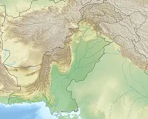 Dalbandin | |
| Coordinates: 28°53′39.26″N 64°23′54.94″E | |
| Country | |
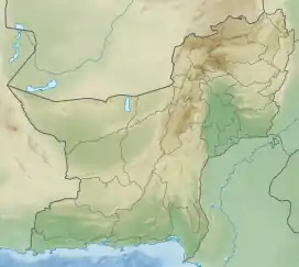
| Province | Balochistan |
| District | Chagai |
| Government | |
| Elevation | 843 m (2,766 ft) |
| Population | |
| • Total | 16,319 |
| Demonym(s) | Dalbandinis |
| Time zone | UTC+5 (PST) |
| Calling code | 0825 |
| Highways | |
Etymology
The name of city has a little story. Before the advent of the British into the Sub-Continent, the territory was known as Naalbandin. The people in this area were expert farriers, that were regionally known Naalbandin. But the English people could not properly pronounce the word Naalbandin and modified it into Dalbandin.
Climate
Dalbandin has a hot desert climate (Köppen climate classification BWh) with extremely hot summers and cool winters. The climate is dry whole the year but some rain does fall in the winter.
| Climate data for Dalbandin | |||||||||||||
|---|---|---|---|---|---|---|---|---|---|---|---|---|---|
| Month | Jan | Feb | Mar | Apr | May | Jun | Jul | Aug | Sep | Oct | Nov | Dec | Year |
| Record high °C (°F) | 29.1 (84.4) |
36.0 (96.8) |
37.6 (99.7) |
40.8 (105.4) |
45.6 (114.1) |
48.8 (119.8) |
51.4 (124.5) |
46.7 (116.1) |
44.6 (112.3) |
42.2 (108.0) |
34.2 (93.6) |
29.4 (84.9) |
51.4 (124.5) |
| Average high °C (°F) | 17.4 (63.3) |
20.0 (68.0) |
26.2 (79.2) |
32.5 (90.5) |
38.1 (100.6) |
42.2 (108.0) |
42.5 (108.5) |
41.2 (106.2) |
37.7 (99.9) |
32.1 (89.8) |
25.4 (77.7) |
19.5 (67.1) |
31.2 (88.2) |
| Daily mean °C (°F) | 9.3 (48.7) |
12.3 (54.1) |
18.1 (64.6) |
24.1 (75.4) |
29.2 (84.6) |
33.1 (91.6) |
34.2 (93.6) |
32.5 (90.5) |
27.7 (81.9) |
21.8 (71.2) |
15.6 (60.1) |
10.9 (51.6) |
22.4 (72.3) |
| Average low °C (°F) | 1.3 (34.3) |
4.6 (40.3) |
9.9 (49.8) |
15.8 (60.4) |
20.3 (68.5) |
23.9 (75.0) |
25.9 (78.6) |
23.7 (74.7) |
17.7 (63.9) |
11.5 (52.7) |
5.7 (42.3) |
2.3 (36.1) |
13.6 (56.4) |
| Record low °C (°F) | −11.1 (12.0) |
−8.5 (16.7) |
−2.8 (27.0) |
2.2 (36.0) |
7.0 (44.6) |
12.8 (55.0) |
17.8 (64.0) |
8.3 (46.9) |
7.0 (44.6) |
−1.0 (30.2) |
−8.0 (17.6) |
−12.2 (10.0) |
−12.2 (10.0) |
| Average precipitation mm (inches) | 16.1 (0.63) |
18.1 (0.71) |
18.6 (0.73) |
7.8 (0.31) |
2.2 (0.09) |
0.8 (0.03) |
3.9 (0.15) |
0.9 (0.04) |
0.4 (0.02) |
1.5 (0.06) |
2.5 (0.10) |
7.9 (0.31) |
80.7 (3.18) |
| Mean monthly sunshine hours | 244.5 | 238.8 | 254.4 | 282.4 | 325.6 | 331.2 | 317.9 | 315.8 | 309.6 | 317.9 | 291.5 | 256.5 | 3,486.1 |
| Source: NOAA (1961-1990)[2] | |||||||||||||
2011 Earthquake
The 7.2 Mw Dalbandin earthquake shook a remote region of Balochistan on 19 January 2011. The dip-slip shock had a maximum Mercalli intensity of VI (Strong), caused moderate damage, and left three dead and several injured.
2016 US drone strike
Taliban leader Mullah Akhtar Mansour was killed in a convoy next to the town by a U.S. drone strike on 21 May 2016.[3]
References
- "Archived copy" (PDF). Archived from the original (PDF) on 9 March 2018. Retrieved 8 March 2018.CS1 maint: archived copy as title (link)
- "Dalbandin Climate Normals 1961-1990". National Oceanic and Atmospheric Administration. Retrieved 17 January 2013.
- Crawford, Jamie. "Taliban leader Mullah Mansour likely killed in airstrike, U.S. officials say". CNN. Retrieved 22 May 2016.
