Chagai District
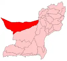
Chagai District (Balochi: چاگے; Urdu: ضلع چاغی), also known as Chaghi District, is the largest district of Pakistan and is located in the north west corner of Balochistan, Pakistan.[2]
ضِلع چاغى | |
|---|---|
| Chagai District | |
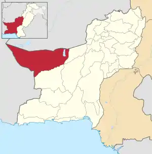 Map of Balochistan with Chagai District higlighted | |
| Country | |
| Province | |
| Division | Rakhshan Division |
| Established | 1896 |
| Headquarters | Chagai |
| Government | |
| • MPA | Mir Muhammad Arif Muhammad Hassni |
| Area | |
| • Total | 44,748 km2 (17,277 sq mi) |
| Population (2017)[1] | |
| • Total | 226,008 |
| • Density | 5.1/km2 (13/sq mi) |
| Time zone | UTC+5 (PST) |
| Website | http://chaghionline.com |
According to the 1998 census, the total population in the Dalbandin and Taftan subdivisions was 93,000, the majority of which (96%) had Balochi as a first language.[3]
Administration
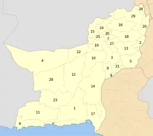
Chagai District is administratively subdivided into the following tehsils and union councils:[2]
Education
According to Pakistan District Education Rankings, a report by Alif Ailaan, district Chaghi is ranked at number 91 nationally, with an education score of 52.06. The learning score is 55.58 and gender parity is at 60.11.
The national rank according to readiness is 91, with a readiness score of 55.58 and gender parity of 60.11. The school infrastructure rank of District Chaghi is 114 nationally, with a severe shortage of electricity with a score of 4.55 and building condition score of 12.27.
Lack of girls schools is the main issue of the region.[4] App by the residents of the place and lack of facilities in the existing ones.
See also
References
- "DISTRICT WISE CENSUS RESULTS CENSUS 2017" (PDF). www.pbscensus.gov.pk. Archived from the original (PDF) on 2017-08-29. Retrieved 2017-11-06.
- Tehsils & Unions in the District of Chaghi - Government of Pakistan
- 1998 Census report, pp. 84–85.
- https://web.archive.org/web/20180803074507/https://elections.alifailaan.pk/taleemdo-app/
Bibliography
- 1998 District census report of Chagai. Census publication. 38. Islamabad: Population Census Organization, Statistics Division, Government of Pakistan. 1999.
External links
| Wikimedia Commons has media related to Chagai District. |