Daska
Daska (Urdu: ڈسکہ), is a city in the Punjab province of Pakistan. The city is the capital of Daska Tehsil, one of four tehsils of Sialkot District.[2] It is the 50th largest city of Pakistan by population.
Daska
ڈسکہ | |
|---|---|
City | |
 Daska  Daska | |
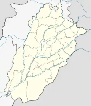
| Coordinates: 32°20′N 74°21′E | |
| Country | |
| Province | |
| Division | Gujranwala |
| District | Sialkot |
| Tehsil | Daska |
| Government | |
| • MNA | Iftikharul Hasan Shah |
| • MPA | Zeeshan Rafique |
| Elevation | 217 m (712 ft) |
| Population | |
| • City | 175,464 |
| • Rank | 50th, Pakistan |
| Time zone | UTC+5 (PST) |
| Calling code | 052 |
| Number of towns | 1 |
| Postal Code | 051010 |
17th-19th Centuries
Daska was founded during the reign of Shah Jahan, and was initially named Shah Jahanabad, according to Mughal revenue records.[3] It was later renamed Daska as it is das (“ten”) koh (Mughal unit of distance) from Sialkot, Pasrur, Gujranwala, and Wazirabad.[4] During the Afghan Durrani invasion of the 18th century, Daska was ruined and its inhabitants forced to seek shelter in the nearby mudfort of Kot Daska.[5] Daska was later repopulated during the Sikh era.[6] Daska was captured by Ranjit Singh in 1802 and made part of the Sikh Empire.[7]
20th Century
In 1929, Daska was the site of Hindu-Sikh riots when Akali Sikhs attempted to seize control of Gurdwara Sant Wayaram Singh. The local Hindu community claimed it was built to be a dharamsala.[8]
In August 1947, 5,000 refugees from surrounding areas gathered at Daska Camp for two weeks before being escorted to the Indian border by the Pakistani Military.[9]
Economy and Geography
Daska tehsil was once the biggest tehsil of Pakistan, containing almost 400 villages.
There are a number of farm machinery manufacturers based in Daska.[10] Being surrounded by big industrial cities such as Gujranwala and Sialkot, Daska has a very healthy employment rate. The urban area of Daska is no more than 3 kilometres (1.9 mi) in length but it still manages to hold the title of an industrial city which contributes a lot in national economy. Mughal, Kashmiri, Rajpoot, Arain and Malik tribes are prominent in the urban area and several Jatt tribes are in the majority in rural areas. The Bambawali-Ravi-Bedian Canal flows through its centre which makes the surrounded area fertile and rich for crops.
See also
References
- "PAKISTAN: Provinces and Major Cities". PAKISTAN: Provinces and Major Cities. citypopulation.de. Retrieved 4 May 2020.
- Tehsils & Unions in the District of Sialkot – Government of Pakistan Archived 9 February 2012 at the Wayback Machine
- Commissioner, Pakistan Office of the Census (1962). Population Census of Pakistan, 1961: Dacca. 2.Chittagong. 3.Sylhet. 4.Rajshahi. 5.Khulna. 6.Rangpur. 7.Mymensingh. 8.Comilla. 9.Bakerganj. 10.Noakhali. 11.Bogra. 12.Dinajpur. 13.Jessore. 14.Pabna. 15.Kushtia. 16.Faridpur. 17.Chittagong Hill tracts.
- Gazetteer of the Jhang District: 1883. 1883.
- Gazetteer of the Jhang District: 1883. 1883.
- Gazetteer of the Jhang District: 1883. 1883.
- bahādur.), Muḥammad Laṭīf (Saiyid, khān (1891). History of the Panjáb from the Remotest Antiquity to the Present Time. Calcutta Central Press Company, limited.
- Nijjar, Bakhshish Singh (1996). History of the United Panjab. Atlantic Publishers & Dist. ISBN 978-81-7156-534-4.
- Page, Co-Director Media South Asia Project Institute of Development Studies David; Page, David; Singh, Anita Inder; Moon, Penderel; Khosla, G. D. (2002). The Partition Omnibus. Oxford University Press. ISBN 978-0-19-565850-7.
- "Sialkot: Chinese to assist Daska machinery makers". Dawn. 14 May 2004. Retrieved 12 September 2020.
