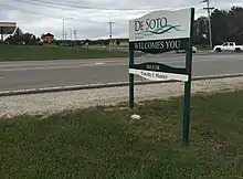
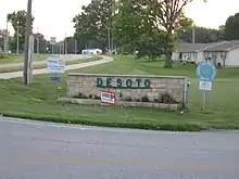
De Soto, Kansas
De Soto /dəˈsoʊtoʊ/ is a city in Johnson and Leavenworth counties in the U.S. state of Kansas,[1] and part of the Kansas City Metropolitan Area. As of the 2010 census, the city population was 5,720, and in 2018 the estimated population was 6,443.[7] De Soto was incorporated as a city on October 1, 1897.
De Soto, Kansas | |
|---|---|
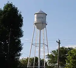 Water tower (2017) | |
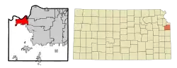 Location within Johnson County and Kansas | |
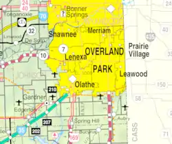 KDOT map of Johnson County (legend) | |
| Coordinates: 38°58′45″N 94°58′7″W[1] | |
| Country | United States |
| State | Kansas |
| Counties | Johnson, Leavenworth |
| Townships | Lexington, Sherman |
| Founded | 1828 |
| Platted | 1857 |
| Incorporated | October 1, 1897 |
| Named for | Hernando de Soto |
| Government | |
| • Type | Mayor–Council |
| • Mayor | Rick Walker |
| Area | |
| • Total | 11.28 sq mi (29.22 km2) |
| • Land | 11.15 sq mi (28.89 km2) |
| • Water | 0.13 sq mi (0.33 km2) |
| Elevation | 860 ft (260 m) |
| Population | |
| • Total | 5,720 |
| • Estimate (2019)[4] | 6,512 |
| • Density | 583.83/sq mi (225.43/km2) |
| Time zone | UTC-6 (CST) |
| • Summer (DST) | UTC-5 (CDT) |
| ZIP codes | 66018, 66019 |
| Area code | 913 |
| FIPS code | 20-17850 [1][5] |
| GNIS ID | 479178 [1][6] |
| Website | desotoks.us |
History
De Soto was part of a large territory extending to present-day St. Louis that was occupied by the Osage people, who were relocated from east of the Mississippi River in the upper Midwest. After the Treaty of St Louis in 1825, the Shawnee were forcibly relocated from Cape Girardeau to southeastern Kansas near the Neosho River.[8] Only the Black Bob band of Shawnee resisted removal, however by 1828 they too migrated west and settled in northeastern Kansas in and around De Soto along the Kansas River. Later in the 19th century, many cultures of Native Americans arrived in the area after being pushed west by European-American pressure following colonial expansion and later the discovery of Gold in 1849. Between 1829-1854 almost thirty tribes were assigned reservations in what would become Kansas Territory. The Shawnee Methodist Mission was built in the De Soto area to minister to the tribe.[8] A reserve was established in Kansas and soon other Shawnee from as far east as Ohio would join the reservation. The Agency of the Shawnee Indians, also known as Lexington, was located on the southern edge of the city.[8]
The city of De Soto was platted in the spring of 1857, named for sixteenth-century Spanish explorer Hernando de Soto.[9] In 1858, John Possum, a Shawnee man, and Hattie Possum sold 80 acres (32 ha) to John F. Legate, S. Todd and Stratton and Williams for $1,200. The next sale was 80 acres to the De Soto Town Company in July 1861 for $1,176. Major James B. Abbot is remembered as one of the town's pioneer landowners and the builder of Abbot Hall. Today, Abbot Hall is one of two town museums.[10]
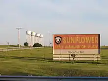
With the construction of the 9,080-acre (3,670 ha) Sunflower Army Ammunition Plant south of De Soto, the city's population boomed in the early 1940s during World War II. In May 1943, a Kansas City Star article reported "a town rapidly growing, with a population increase from 400 to 1,000 persons in under a year." This sudden overflow in population put a great strain on housing and other resources in the city; however, many original residents prospered during this time, buying property and starting new businesses. Production flowed steadily at the Sunflower Army Ammunition Plant until the plant went on standby in March 1948, with small-scale production following shortly after until its closure in 1993.[10]
Clearview
In 1943, nearby Sunflower Village was built to house workers for nearby Sunflower Ordnance Works. The west side "Old Village" had 853 dwellings in 1943, and the east side "New Village" had 580 pre-fab units that was completed by 1945. Housing, a school and traffic were filled and overflowing. Highway 10, the main street which is now currently 83rd Street. As people came in, it was getting harder to find room and places to room, bored and to dwell in, to a point that people were living in the chicken house and sleeping under quilts on the ground where the current Scout House is sitting on Wea Street. It was so unbearable that rooms that were rented out "by the shift" that other people were bring in trailers and tents. In 1955, the housing units transferred to Sunflower Ordnance Worker (SOW), then sold to private buyers. In 1961, Sunflower was sold to Quick Way Homes and renamed as Clearview City. In 1998, Clearview City was annexed by the city of De Soto, boosting the city's population by 339 people.[11]
1951 flood
In mid-July 1951, heavy rains led to a great rise of water in the Kansas River and other surrounding areas of the central United States, known as the Great Flood of 1951. De Soto, along the south side of the river, was severely damaged. The river crest at De Soto was 42.3 feet (12.9 m), the highest recorded on the Kansas River during the flood.[12] Most of the downtown area was completely flooded, with over 4 feet (1.2 m) of standing water in some places.
Recent growth
Since the 2008 recession came to an end, growth in De Soto has steadily picked up, with substantial commercial development in the K-10 Business District.
The number of single-family building permits approved each year has more than tripled in the past decade, with 61 homes constructed in 2019, the city's all-time record for housing starts.[13] In 2019, the Kansas City Star reported that De Soto was, and is expected to remain the fastest-growing city in the Kansas City metro area.[14]
Future growth
After the closure of the Sunflower Army Ammunition Plant in 1993, plans for potential development of the 15.5 square mile lot south of De Soto [15] began to make rounds around locals, plans for an Oz Entertainment amusement park consumed seven futile years, after which the land was transferred to the Sunflower Redevelopment Group in 2005.[16] At that time, about 3,700 acres were transferred clean, but much of that land was targeted for open space, buffer and parkland.[16] Another plan that was set to open in 2002 was the newly announced Kansas Speedway and Kansas City Wizards stadiums. Recently, a master use plan has been adopted by the cities of Olathe, De Soto, Johnson County, the State of Kansas and Sunflower Redevelopment Group.[16] The master plan calls for high density housing, major commercial zoning, a "downtown" area for offices, high density commercial and civic uses, and land promised to The University of Kansas, Kansas State University and the City of De Soto, as well as land being reserved for the army reserves, parks and other public spaces.[16] However, the cleanup is expected to be completed by 2038. Recently, The Kansas City Star reported that Kansas state lawmakers urged the acceleration of cleanup efforts of the lot and announced that the northeastern portion of the plant, closest to De Soto, would be ready for light commercial and industrial development by 2020.[16]
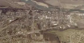
Geography
According to the United States Census Bureau, the city has a total area of 11.20 square miles (29.00 km2), of which 11.07 square miles (28.67 km2) are land and 0.13 square miles (0.33 km2), or 1.15%, are water.[17] While the majority of De Soto is located in northwestern Johnson County at 38°58′45″N 94°58′7″W (38.9791709, -94.9685783), the golf course north of the Kansas River is located in southern Leavenworth County.[1] The city also has two non-contiguous plots of land, one at Evening Star Road and 135th Street at roughly 0.08 square miles and the other near Linwood, at 0.04 square miles. Both are city-owned parks. De Soto mainly lies south of the Kansas River, the only city in Johnson County originally platted around the river. Four of the river's tributaries, Captain Creek, Kill Creek, Cedar Creek, Camp Creek end within the city limits.[18]
Considered by many locals to be an exurb, rather than a suburb, De Soto is part of the Kansas City metropolitan area, and it borders other communities on the eastern edges. These include Shawnee to the northeast, Lenexa to the east, and Olathe to the southeast.
De Soto currently has annexation agreements with Olathe and Gardner,[15] guaranteeing De Soto will be able to annex as far south as 143rd Street and as far east as meeting Olathe at its western boundary, or more than quadrupling the city's current size.[15]
Demographics
| Historical population | |||
|---|---|---|---|
| Census | Pop. | %± | |
| 1860 | 35 | — | |
| 1870 | 102 | 191.4% | |
| 1880 | 141 | 38.2% | |
| 1890 | 223 | 58.2% | |
| 1900 | 226 | 1.3% | |
| 1910 | 240 | 6.2% | |
| 1920 | 255 | 6.3% | |
| 1930 | 384 | 50.6% | |
| 1940 | 383 | −0.3% | |
| 1950 | 518 | 35.2% | |
| 1960 | 1,271 | 145.4% | |
| 1970 | 1,839 | 44.7% | |
| 1980 | 2,061 | 12.1% | |
| 1990 | 2,291 | 11.2% | |
| 2000 | 4,561 | 99.1% | |
| 2010 | 5,720 | 25.4% | |
| 2019 (est.) | 6,512 | [4] | 13.8% |
| U.S. Decennial Census | |||
2010 census
As of the census[3] of 2010, there were 5,720 people, 2,007 households, and 1,523 families residing in the city. The population density was 516.7 inhabitants per square mile (199.5/km2). There were 2,204 housing units at an average density of 199.1 per square mile (76.9/km2). The racial makeup of the city was 89.7% White, 0.8% African American, 0.8% Native American, 0.4% Asian, 5.9% from other races, and 2.3% from two or more races. Hispanic or Latino of any race were 14.6% of the population.
There were 2,007 households, of which 41.5% had children under the age of 18 living with them, 60.4% were married couples living together, 10.5% had a female householder with no husband present, 5.0% had a male householder with no wife present, and 24.1% were non-families. 19.0% of all households were made up of individuals, and 6.3% had someone living alone who was 65 years of age or older. The average household size was 2.83 and the average family size was 3.25.
The median age in the city was 35.4 years. 28.6% of residents were under the age of 18; 8.8% were between the ages of 18 and 24; 26.5% were from 25 to 44; 26.3% were from 45 to 64; and 9.9% were 65 years of age or older. The gender makeup of the city was 50.2% male and 49.8% female.
2000 census
As of the census[5] of 2000, here were 4,561 people, 1,642 households, and 1,246 families residing in the city. The population density was 403.0/mi2 (155.6/km2). There were 1,730 housing units at an average density of 152.9/mi2 (59.0/km2). The racial makeup of the city was 94.80% White, 0.20% African American, 0.94% Native American, 0.37% Asian, 0.07% Pacific Islander, 1.69% from other races, and 1.93% from two or more races. Hispanic or Latino of any race were 6.86% of the population.
There were 1,642 households, out of which 41.7% had children under the age of 18 living with them, 62.1% were married couples living together, 8.6% had a female householder with no husband present, and 24.1% were non-families. 21.3% of all households were made up of individuals, and 7.4% had someone living alone who was 65 years of age or older. The average household size was 2.78 and the average family size was 3.23.
In the city, the population was spread out, with 30.5% under the age of 18, 8.1% from 18 to 24, 32.5% from 25 to 44, 20.9% from 45 to 64, and 8.1% who were 65 years of age or older. The median age was 32 years. For every 100 females, there were 103.2 males. For every 100 females age 18 and over, there were 100.4 males.
The median income for a household in the city was $46,426, and the median income for a family was $52,219. Males had a median income of $36,203 versus $31,682 for females. The per capita income for the city was $23,141. About 3.2% of families and 5.2% of the population were below the poverty line, including 6.1% of those under age 18 and 13.1% of those age 65 or over.
Economy

Two local corporations, Great American Bank and Custom Foods, Inc., and one national corporation, Goodcents Deli Fresh Subs, are headquartered in De Soto. Huhtamaki Americas, Inc. and Engineered Air, two international enterprises, chose De Soto for their North American headquarters. In addition, Merck Animal Health, one of the world's leading manufacturers of animal health supplies, selected De Soto for one of its four U.S. manufacturing facilities. Rehrig Pacific, a plastics manufacturer, chose De Soto to house their Midwestern U.S. operations. In 2019, Biodesix, a lung cancer research company, opened a testing and research laboratory in De Soto.[19]
Largest employers
as of January 2020, the largest employers in the city are:
| # | Employer | # of Employees |
|---|---|---|
| 1 | De Soto School District | 1,655 |
| 2 | Engineered Air | 870 |
| 3 | Huhtamaki | 640 |
| 4 | Merck Animal Health | 180 |
| 5 | Rehrig Pacific | 110 |
| 6 | Custom Foods Inc | 110 |
| 7 | Goodcent's Deli Fresh Subs Headquarters | 95 |
| 8 | Hillside Village | 86 |
Arts and culture
Between 1999 and 2000, a barn that had originally been built in the 1880s was moved piece by piece from a farmstead and placed on the Zimmerman farm at the northwest corner of the Kill Creek Road and K-10 interchange.[20] The barn was historically called the White-Waitmann barn but after its erection in 2000, by contractors and community volunteers, it also became known as the Zimmerman barn. The barn was not only a piece of American history, but it became well known throughout the community because the owner, Darrel Zimmerman, allows the public to pay a fee and use the barn for events such as weddings, graduations, and other meetings. However, a fierce storm demolished the barn in May 2010. The barn was rebuilt in 2013, after it was determined that Zimmerman could not locate another historic-looking barn to move on the location.[21]
The Day After was filmed from Edgerton Road to the main De Soto exit K-285(Lexington Ave) on ![]() K-10 as Interstate 70.
K-10 as Interstate 70.
All Creatures Here Below is partially set in De Soto, but filmed in Kansas City.[22]
Regional attractions
De Soto Days Festival
The city has been the host of the annual De Soto Days Festival. The fair begins on the Thursday before Labor Day and runs until the holiday itself, making it the third longest Labor Day festival in the County.[23] The fair has booths and three stages, entertaining 10,000 patrons annually on the 3 operating days.[24]
Winesong at Riverfest
Winesong at Riverfest is a major cultural attraction for the Kansas City area. The event, which began in 2012, is a wine festival hosted by the De Soto Rotary Club annually in early June. The event features wineries from the Midwest, and includes samples, appetizers, music and art competitions.[25] Annual attendance is 1,000.
Government
The De Soto government consists of a mayor and five council members, with a council appointed president.
Mayor
- Rick Walker (term expires 2022)
City Council President
- Lori Murdock (term expires 2024)
City Council
- Danny Lane (term expires 2024)
- Kevin Ritter (term expires 2021)
- Kevin Honomichl (term expires 2022)
- Rob Daniels (term expires 2022)
The council meets the first and third Thursday of each month at 7:00 p.m and the planning commission meets on the fourth Tuesday of the month. The De Soto City Council is an At-Large Representation, meaning the council serve the entire city, at-large, versus a single designated portion per member. City Hall is located at 32905 West 84th Street.
De Soto is a Kansas city of the second-class.
De Soto's ZIP codes are 66018 and 66019. 66019 was activated to serve the Sunflower Army Ammunition Plant in 1942, and has been kept in service since. De Soto is the least populous city in the state of Kansas to have more than one ZIP code.
2016 mayoral recall
An effort to recall Mayor Tim Maniez and City Councilmember Bill McDaniel from their positions was launched in February 2016, and garnered national attention.[26] Recall supporters submitted their petition applications against Maniez and McDaniel to the Johnson County Elections Board on February 18, 2016. Judy Macy and other De Soto residents filed petitions against Maniez and McDaniel due to concerns about meeting decorum. The petition against Maniez noted his lack of control over meetings, while the McDaniel's petition cited argumentative and negative behavior. Recall organizers also expressed frustration with the firing of city administrator Cynthia Wagner in February 2016. As of June 2017, the Johnson County Elections Board has not taken any action. The matter was considered abandoned on November 7, 2017 when both parties were voted against additional terms.[26]
Education
The city of De Soto is served by the De Soto school district.
Library
The Johnson County Library System maintains the De Soto Downtown Library.
In a 2006 downtown revitalization plan, the city states that it plans to open a municipal-maintained library.[27]
Media
Newspapers
The De Soto Explorer was started in 1998 and served as De Soto's main news source for 14 years, until the closure of the printing facility and website in 2012. In the fall of 2015, Discovering De Soto magazine released its first preview edition.[28] In 2017, the De Soto City Council motioned to fund issues of Discovering De Soto in order to distribute the magazine by mail and around local businesses. In 2018, the De Soto City Council once again motioned to fund upcoming issues of Discovering De Soto for the year.[29]
The Kansas City Star and the Lawrence Journal-World both cover and deliver to De Soto.
Transportation
Road
De Soto is served by several highways:
 K-10 runs through most portions of southern De Soto. Two exits have a direct connection to De Soto.
- Exit – Edgerton Road
- Exit – Lexington Avenue, formerly
 K-285 (Decommissioned in 1999)
 - Exit – Kill Creek Road
 K-32 runs about 5 miles (8 km) north of De Soto. Two junctions have a direct connection to De Soto.
- Junction – 189th Street
 CR-26(Leavenworth County)
 - Junction – 158th Street
 CR-2(Leavenworth County)
- Junction – 189th Street
- S. Wyandotte Road / 158th Street CR-2(Leavenworth County)
 CR-3(Leavenworth County)
- CR-26(Leavenworth County)
 CR-32(Leavenworth County)
- West 103rd Street / Lexington Avenue / West 83rd Street runs through De Soto. East on 83rd Street is Lenexa and Overland Park, west is Lawrence. West 103rd Street comes in from Lawrence, runs south of the city, turns into a four-lane road near Sunflower Nature Park and travels north into the city as Lexington Avenue until an intersection with West 83rd Street, and then turns east towards Lenexa.
- Kill Creek Road runs through eastern portions De Soto. South on Kill Creek Road is a connector road to Olathe and Gardner. Kill Creek Road comes in from rural Johnson County, runs into the city, and end at an intersection with West 83rd Street.
Rail
De Soto was settled in 1828 as a city along the Kansas River. Several years later, in 1857, the Atchison, Topeka, Santa Fe Railway constructed track through northern portions of town, parallel to the river. De Soto's train depot was constructed along a siding around 1860.[30] In 1900, a railyard was constructed east of town to allow the switching of freight cars from Topeka to Kansas City. The yard consisted of seven rails along the main line and siding. Portions of the yard are still in use today to store unused freight cars.[30] However, only three lines remain, as the others were removed to save on maintenance.[30]
In 1942, during the construction of the Sunflower Army Ammunition Plant, the U.S. army constructed a spur through De Soto to connect the plant to a main rail line. To this day the spur is used for the industrial district shipments.[30]
Notable people
Notable individuals who were born in and/or have lived in De Soto include:
- Stanley Adams (1922-1999), U.S. Army Lieutenant Colonel, Medal of Honor Recipient[31]
- Howard Gloyd (1902-1978), herpetologist[32]
- Greyson Jenista (1996), Atlanta Braves minor league, right fielder
- Frank Lee (1873-1952), U.S. Representative from Missouri[33]
- John Outland (1871-1941), American Football Player and Coach
- Kenneth Spencer (1902-1960)
See also
- Highway 2 Bridge in De Soto
References
- Geographic Names Information System (GNIS) details for De Soto, Kansas; United States Geological Survey (USGS); October 13, 1978.
- "2019 U.S. Gazetteer Files". United States Census Bureau. Retrieved July 24, 2020.
- "U.S. Census website". United States Census Bureau. Retrieved 2012-07-06.
- "Population and Housing Unit Estimates". United States Census Bureau. May 24, 2020. Retrieved May 27, 2020.
- "U.S. Census website". United States Census Bureau. Retrieved 2008-01-31.
- "US Board on Geographic Names". United States Geological Survey. 2007-10-25. Retrieved 2008-01-31.
- "Population and Housing Unit Estimates". Retrieved September 14, 2019.
- http://desotoks.us/AgendaCenter/ViewFile/Agenda/_06252019-317
- Blackmar, Frank Wilson (1912). Kansas: A Cyclopedia of State History, Embracing Events, Institutions, Industries, Counties, Cities, Towns, Prominent Persons, Etc. Standard Publishing Company. pp. 516.
- "About Us, Our History". Archived from the original on 2016-04-24. Retrieved 2016-04-21.
- "World's Largest Ammunition Plant Comes to De Soto". Discovering De Soto. Vol. 2017 no. Fall. pp. 8, 10.
- https://water.weather.gov/ahps2/hydrograph.php?wfo=eax&gage=dsok1
- https://www.kansascity.com/news/business/development/article239030748.html.html
- https://www.kansascity.com/news/business/development/article239030748.html
- https://www.desotoks.us/DocumentCenter/View/1126/2019-Comprehensive-Plan-Final-with-Appendix-Sept-2019
- http://www.kansascity.com/news/politics-government/article210955679.html
- "Geographic Identifiers: 2010 Census Summary File 1 (G001): De Soto city, Kansas". American Factfinder. U.S. Census Bureau. Archived from the original on February 13, 2020. Retrieved May 22, 2018.
- "City of De Soto Official Zoning Map" (PDF). City of De Soto. May 30, 2013. Archived from the original (PDF) on September 22, 2015. Retrieved May 22, 2018.
- https://www.biodesix.com/contact
- "Archived copy". Archived from the original on 2010-04-11. Retrieved 2010-05-30.CS1 maint: archived copy as title (link)
- http://www.kansascity.com/2010/05/13/1943534/storm-destroys-historic-zimmerman.html
- https://www.thepitchkc.com/arts-entertainment/movies/article/21067709/david-dastmalchian-from-homeless-heroin-addict-to-antman-to-his-new-kansas-cityfilmed-all-creatures-here-below
- http://www.desotodays.com
- http://festivalnet.com/78501/De-Soto-Kansas/Festivals/De-Soto-Days-Festival
- http://www.winesongatriverfest.com
- https://ballotpedia.org/Tim_Maniez_and_Bill_McDaniel_recall,_De_Soto,_Kansas_(2016)
- "Archived copy" (PDF). Archived from the original (PDF) on 2016-05-09. Retrieved 2018-01-18.CS1 maint: archived copy as title (link)
- Discovering Desoto online magazine.
- https://drive.google.com/drive/folders/0B6Btc7LOS9CwcWhnaDB2c1RUUEE
- http://www.marc.org/Transportation/Plans-Studies/Transportation-Plans-and-Studies/Special-studies-and-projects/special-studies-pdfs/commuterrail_2002/Assessment5.aspx
- "Johnson County to remember a Kansas Congressional Medal of Honor recipient on Veterans Day". Johnson County, Kansas. Archived from the original on 2016-04-13. Retrieved 2016-04-01.
- "KHS Distinguished Life Members". Kansas Herpetological Society. Retrieved 2016-04-01.
- "Lee, Frank Hood (1873-1952)". Biographical Directory of the United States Congress. U.S. Congress. Retrieved 2016-04-01.
Further reading
External links
| Wikimedia Commons has media related to De Soto, Kansas. |
Municipalities and communities of Johnson County, Kansas, United States | ||
|---|---|---|
| Cities | 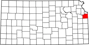 Map of Kansas highlighting Johnson County | |
| Unincorporated communities | ||
| Townships | ||
| Footnotes | ‡This populated place also has portions in an adjacent county or counties | |
| ||
Kansas City metropolitan area's cities and counties | ||
|---|---|---|
| Central city | 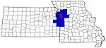 | |
| Largest cities (over 100,000 in 2000) | ||
| Medium-sized cities (10,000 to 100,000 in 2000) | ||
| Smaller Cities (between 5,000 and 9,900 in 2010) | ||
| Counties | ||
| Authority control |
|---|