Deer Isle Thorofare Light
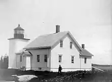
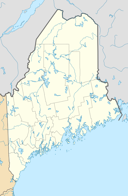
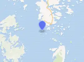
Deer Isle Thorofare Light, also known as Mark Island Light,[4] is a lighthouse on Penobscot Bay, Maine, about 1.8 nautical miles (3.3 km; 2.1 mi) west-southwest of Stonington. It was built in 1857.
 | |
 | |
| |
| Location | Penobscot Bay, Maine |
|---|---|
| Coordinates | 44°8′3.72″N 68°42′11.79″W |
| Year first constructed | 1857 |
| Automated | 1958 |
| Foundation | Masonry |
| Construction | Brick |
| Tower shape | Square tower |
| Markings / pattern | White with black lantern and trim |
| Tower height | 7.5 metre |
| Focal height | 52 feet (16 m) |
| Original lens | 4th order Fresnel Lens |
| Current lens | 9.8 inches (250 mm) |
| Range | 8 nautical miles (15 km; 9.2 mi) |
| Characteristic | Fl W 6s |
| Fog signal | Original: Bell Current: Horn: 1 every 15s, operates continuously |
| Admiralty number | J0073 |
| ARLHS number | USA-221 |
| USCG number | 1-3095 [3] |
History
The station was established in 1857 with the building of the current small square brick tower and a keeper's house. It was built at the time that the granite quarries on Deer Isle and Crotch Island, immediately to the east, were becoming important for the construction of public buildings throughout the eastern United States. It was automated in 1958. The keeper's house burned down in 1959 and the rest of the buildings were removed shortly thereafter. In 1998 control of the site was passed to the Island Heritage Trust, a local group which preserves historic sites in the area. They have promised to keep the island as a bird sanctuary.[3]
Location and Nomenclature
It sits on a small island at the west end of the Deer Island Thorofare and of Merchant Row, two east-west passages among the small islands which lie between Deer Isle and Isle au Haut. The island is called "Mark Island" on NOAA charts 13302 and 13313, but "Marks Island" on the larger scale chart 13315. The light is called "Mark Island Light" on an early 20th-century postcard and is still locally referred to by that name. Also confusing is that the large island to the north and the town on it are "Deer Isle", but the passage is "Deer Island Thorofare".
References
- "Historic Light Station Information and Photography: Maine". United States Coast Guard Historian's Office. 2009-08-06. Archived from the original on 2017-05-01.
- United States Coast Guard (2009). Light List, Volume I, Atlantic Coast, St. Croix River, Maine to Shrewsbury River, New Jersey. p. 29.
- Rowlett, Russ (2009-10-03). "Lighthouses of the United States: Eastern Maine". The Lighthouse Directory. University of North Carolina at Chapel Hill.
- Deer Isle Lighthouse Trail