Deir Shamil
Deir Shamil (Arabic: دير شميل, also spelled Deir el-Shemil) is a village in northwestern Syria, administratively part of the Hama Governorate, located west of Hama. Nearby localities include Nahr al-Bared to the north, Tell Salhab to the northeast, Jubb Ramlah to the east, al-Laqbah and Deir Mama to the south and Daliyah to the west. According to the Central Bureau of Statistics (CBS), Deir Shamil had a population of 4,537 in the 2004 census.[1] Its inhabitants are predominantly Alawites.[2]
Deir Shmaeil
دير شميَل Deir el-Shemil | |
|---|---|
Village | |
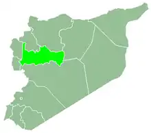
 Deir Shmaeil Location in Syria | |
| Coordinates: 35°12′38″N 36°20′35″E | |
| Country | |
| Governorate | Hama |
| District | Masyaf |
| Subdistrict | Jubb Ramlah |
| Population (2004) | |
| • Total | 4,537 |
In the early 1960s it was described as a large village of 600 inhabitants. It contained the remains of an Ottoman-era seraglio.[2]
References
- General Census of Population and Housing 2004. Syria Central Bureau of Statistics (CBS). Hama Governorate. (in Arabic)
- Boulanger, 1841, p. 178.
Bibliography
- Boulanger, Robert (1966). The Middle East, Lebanon, Syria, Jordan, Iraq, Iran. Hachette.
- Smith, Eli; Robinson, Edward (1841). Biblical Researches in Palestine, Mount Sinai and Arabia Petraea: A Journal of Travels in the Year 1838. 3. Crocker and Brewster.
This article is issued from Wikipedia. The text is licensed under Creative Commons - Attribution - Sharealike. Additional terms may apply for the media files.