Derrinturn
Derrinturn (Irish: Doire an tSoirn) is a village in County Kildare, Ireland. It is part of the parish of Carbury. It is located about 60 km (37 mi) from Dublin.
Derrinturn
Doire an tSoirn | |
|---|---|
Town | |
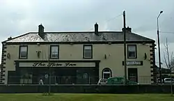 The Turn Inn, Derrinturn | |
 Derrinturn Location in Ireland | |
| Coordinates: 53°20′23″N 6°56′24″W | |
| Country | Ireland |
| Province | Leinster |
| County | County Kildare |
| Area | |
| • Total | 2 km2 (0.8 sq mi) |
| Elevation | 85 m (279 ft) |
| Population (2016)[1] | 1,602 |
| Time zone | UTC+0 (WET) |
| • Summer (DST) | UTC-1 (IST (WEST)) |
| Irish Grid Reference | N759266 |
The main road through Derrinturn is the R403 regional road.
The village had a population of 1,602 in 2016. From 1961 to 2016, the population increased from 183 to 1,602 (an increase of 875%). In the 20 years between 1996 and 2016, the population tripled (from 544 to 1,602 people).[2]
Derrinturn has one Roman Catholic church and a primary school St. Conleth's (Naomh Connlaodh).[3]
Derrinturn townland has an area of 132.40 hectares (327.2 acres).[4] It borders the townlands of Ballyhagan to the west, Ballyshannon to the east, Coonagh to the east, Dreenan to the south, Newbury Demesne to the north, and Rathmore to the south.[4]
See also
| Year | Pop. | ±% |
|---|---|---|
| 1961 | 183 | — |
| 1966 | 176 | −3.8% |
| 1981 | 395 | +124.4% |
| 1986 | 528 | +33.7% |
| 1991 | 553 | +4.7% |
| 1996 | 544 | −1.6% |
| 2002 | 799 | +46.9% |
| 2006 | 1,138 | +42.4% |
| 2011 | 1,541 | +35.4% |
| 2016 | 1,602 | +4.0% |
| [5][2][1] | ||
References
- "Sapmap Area - Settlements - Derrinturn". Census 2016. CSO. April 2016. Retrieved 6 January 2020.
- https://www.citypopulation.de/en/ireland/towns/kildare/0349__derrinturn/
- "St Conleth's National School". www.stconlethsns.ie. Retrieved 2019-03-27.
- "Derrinturn Townland, Co. Kildare". www.townlands.ie. Retrieved 2019-03-27.
- http://www.cso.ie/census
| Wikimedia Commons has media related to Derrinturn. |
Places in County Kildare | ||
|---|---|---|
| Towns | 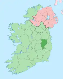 | |
| Villages and Townlands |
| |
| Landforms | ||
| Topics |
| |