Dimbokro
Dimbokro is a town in south-central Ivory Coast. It is the seat of both Lacs District and N'Zi Region. It is also the seat of and a sub-prefecture of Dimbokro Department. Dimbokro is also a commune.
Dimbokro | |
|---|---|
Town, sub-prefecture, and commune | |
 Railway bridge at Dimbokro | |
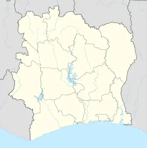 Dimbokro Location in Ivory Coast | |
| Coordinates: 6°39′N 4°42′W[1] | |
| Country | |
| District | Lacs |
| Region | N'Zi |
| Department | Dimbokro |
| Population (2014)[2] | |
| • Total | 64,957 |
| Time zone | UTC+0 (GMT) |
The town is located along the river N'Zi, approximately 50 km southeast of the official capital of Ivory Coast, Yamoussoukro. Dimbokro is connected by both road and railway from the country's commercial capital and de facto political capital Abidjan on the coast. Except for a textile factory, the town is of limited size and economic importance. Dimbokro is otherwise known as the birthplace of the country's current president, Alassane Ouattara and African reggae superstar Alpha Blondy.
Climate
| Climate data for Dimbokro | |||||||||||||
|---|---|---|---|---|---|---|---|---|---|---|---|---|---|
| Month | Jan | Feb | Mar | Apr | May | Jun | Jul | Aug | Sep | Oct | Nov | Dec | Year |
| Average high °C (°F) | 33.9 (93.0) |
35.5 (95.9) |
35.0 (95.0) |
34.4 (93.9) |
33.5 (92.3) |
31.7 (89.1) |
30.2 (86.4) |
29.9 (85.8) |
30.9 (87.6) |
31.8 (89.2) |
32.7 (90.9) |
32.2 (90.0) |
32.6 (90.7) |
| Daily mean °C (°F) | 27.2 (81.0) |
29.1 (84.4) |
29.1 (84.4) |
28.9 (84.0) |
28.2 (82.8) |
27.0 (80.6) |
25.9 (78.6) |
25.7 (78.3) |
26.6 (79.9) |
27.2 (81.0) |
27.6 (81.7) |
26.9 (80.4) |
27.4 (81.3) |
| Average low °C (°F) | 20.3 (68.5) |
22.6 (72.7) |
23.2 (73.8) |
23.3 (73.9) |
23.0 (73.4) |
22.5 (72.5) |
22.0 (71.6) |
21.9 (71.4) |
22.0 (71.6) |
22.3 (72.1) |
22.2 (72.0) |
20.9 (69.6) |
22.2 (72.0) |
| Average precipitation mm (inches) | 11.9 (0.47) |
48.0 (1.89) |
11.9 (0.47) |
139.4 (5.49) |
161.0 (6.34) |
205.6 (8.09) |
112.4 (4.43) |
74.8 (2.94) |
125.5 (4.94) |
119.9 (4.72) |
60.4 (2.38) |
22.6 (0.89) |
1,093.4 (43.05) |
| Mean monthly sunshine hours | 203.5 | 178.1 | 203.5 | 216.5 | 214.7 | 164.3 | 118.2 | 93.9 | 121.7 | 189.0 | 203.0 | 183.5 | 2,089.9 |
| Source: NOAA[3] | |||||||||||||
Transport
Dimbokro is served by Dimbokro Airport and by a station on the national railway system.[4]
A railway bridge over the Nzi River near Dimbokro collapsed on 6 September 2016.[5]
In 2014, the population of the sub-prefecture of Dimbokro was 64,957.[6]
Villages
The 24 villages of the sub-prefecture of Dimbokro and their population in 2014 are<:ref name="N'Zi"/>
- Ahouniassou (596)
- Ahua (2,218)
- Akessemossou (401)
- Alloko-Kouakoukro (78)
- Andianou (300)
- Bassa-Yobouébo (541)
- Dimbokro (48,860)
- Ebimolossou (2,022)
- Faiteassou (201)
- Kangrassou-Eluibo (945)
- Kangrassou-M'brizuénouan (104)
- Kangrassou-Yobouébo (230)
- Koffi-Ahoussouko (418)
- Koffi-Kouadiokro (36)
- Kolibo (268)
- Krokokro (560)
- Niamassou (544)
- Sokro (92)
- Soungassou (1,833)
- Tangoumanssou (1,486)
- Troumabo (1,486)
- Kadjabo (488)
- Soungassi (573)
- Wawérénou (677)
References
- "Ivory Coast Cities Longitude & Latitude". sphereinfo.com. Archived from the original on 13 September 2012. Retrieved 19 November 2010.
- "Côte d'Ivoire". geohive.com. Archived from the original on 24 November 2015. Retrieved 5 December 2015.
- "Dimbokro Climate Normals 1961–1990". National Oceanic and Atmospheric Administration. Retrieved December 21, 2015.
- Photo of station
- Railways Africa Nzi River bridge
- "RGPH 2014, Répertoire des localités, Région N'Zi" (PDF). ins.ci. Retrieved 5 August 2019.
Regional seat: Dimbokro | ||
| Bocanda Department |  | |
| Dimbokro Department | ||
| Kouassi-Kouassikro Department | ||
* also a commune | ||
