Dix River
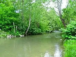
The Dix River is a 79.3-mile-long (127.6 km)[1] tributary of the Kentucky River in central Kentucky in the United States.
It begins in western Rockcastle County, about 5 miles (8 km) west of Mount Vernon. It flows generally northwest, in a tight meandering course, passing north of Stanford and east of Danville. Northeast of Danville it is impounded by the Dix Dam to form the Herrington Lake reservoir. The river then flows about 2 miles (3 km) before joining the Kentucky River near High Bridge, about 20 miles (32 km) southwest of Lexington, in the region of the Kentucky River Palisades.
At Danville the river has a mean annual discharge of 480 cubic feet per second.[2]
The watershed of the river is largely agricultural land, with undulating hills over a bed of limestone. The river is a popular destination for fly fishing, in particular for varieties of bass. Occasionally, recreational kayakers and canoeists can be found on tame day trips. Water levels are Class I+ with possible mild class II.
See also
References
- U.S. Geological Survey. National Hydrography Dataset high-resolution flowline data. The National Map Archived 2012-03-29 at the Wayback Machine, accessed June 13, 2011
- USGS Surface-Water Annual Statistics for Kentucky
External links
- University of Kentucky: lower Dix River watershed
- University of Kentucky: upper Dix River watershed
- U.S. Geological Survey Geographic Names Information System: Dix River
| Authority control |
|
|---|