Dolenja Vas, Zagorje ob Savi
Dolenja Vas (pronounced [dɔˈleːnja ˈʋaːs]; Slovene: Dolenja vas) is a settlement in the Municipality of Zagorje ob Savi in central Slovenia. It extends from the western outskirts of Zagorje ob Savi to the left bank of the Sava River. The area is part of the traditional region of Upper Carniola. It is now included with the rest of the municipality in the Central Sava Statistical Region.[2]
Dolenja Vas | |
|---|---|
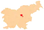
 Dolenja Vas Location in Slovenia | |
| Coordinates: 46°7′56.46″N 14°59′25.05″E | |
| Country | |
| Traditional region | Upper Carniola |
| Statistical region | Central Sava |
| Municipality | Zagorje ob Savi |
| Area | |
| • Total | 1.54 km2 (0.59 sq mi) |
| Elevation | 327.1 m (1,073.2 ft) |
| Population (2002) | |
| • Total | 436 |
| [1] | |
References
- Statistical Office of the Republic of Slovenia
- Zagorje ob Savi municipal site Archived March 6, 2012, at the Wayback Machine
External links
This article is issued from Wikipedia. The text is licensed under Creative Commons - Attribution - Sharealike. Additional terms may apply for the media files.