Dolenje Vrhpolje
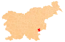
Dolenje Vrhpolje (pronounced [dɔˈleːnjɛ ˈʋəɾxpɔljɛ]; German: Unterfeld[2]) is a settlement south of Šentjernej at the foot of the Gorjanci Hills in southeastern Slovenia. The area is part of the traditional region of Lower Carniola. It is now included in the Southeast Slovenia Statistical Region.[3]
Dolenje Vrhpolje | |
|---|---|
 Dolenje Vrhpolje Location in Slovenia | |
| Coordinates: 45°49′18.77″N 15°20′6.86″E | |
| Country | |
| Traditional region | Lower Carniola |
| Statistical region | Southeast Slovenia |
| Municipality | Šentjernej |
| Area | |
| • Total | 1.05 km2 (0.41 sq mi) |
| Elevation | 231.5 m (759.5 ft) |
| Population (2002) | |
| • Total | 143 |
| [1] | |
References
- Statistical Office of the Republic of Slovenia
- Leksikon občin kraljestev in dežel zastopanih v državnem zboru, vol. 6: Kranjsko. 1906. Vienna: C. Kr. Dvorna in Državna Tiskarna, p. 74.
- Šentjernej municipal site
External links
| Settlements | Administrative centre: Šentjernej
|  |
|---|---|---|
| Landmarks |
| |
This article is issued from Wikipedia. The text is licensed under Creative Commons - Attribution - Sharealike. Additional terms may apply for the media files.
