Gorenje Vrhpolje
Gorenje Vrhpolje (pronounced [ɡɔˈɾeːnjɛ ˈʋəɾxpɔljɛ]; German: Oberfeld[2]) is a settlement southwest of Šentjernej in southeastern Slovenia. The area is part of the traditional region of Lower Carniola. It is now included in the Southeast Slovenia Statistical Region.[3]
Gorenje Vrhpolje | |
|---|---|
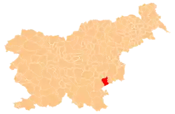
 Gorenje Vrhpolje Location in Slovenia | |
| Coordinates: 45°48′52.94″N 15°19′38.91″E | |
| Country | |
| Traditional region | Lower Carniola |
| Statistical region | Southeast Slovenia |
| Municipality | Šentjernej |
| Area | |
| • Total | 2.25 km2 (0.87 sq mi) |
| Elevation | 262.5 m (861.2 ft) |
| Population (2002) | |
| • Total | 327 |
| [1] | |
Church
The local church, built south of the village, is dedicated to Saint Urban and belongs to the Parish of Šentjernej. It is mentioned in written documents dating to 1439, but owes its current Baroque style to a major rebuilding in the 18th century. Fragments of the medieval wall paintings are still visible on the exterior northern wall of the nave.[4]
References
- Statistical Office of the Republic of Slovenia
- Leksikon občin kraljestev in dežel zastopanih v državnem zboru, vol. 6: Kranjsko. 1906. Vienna: C. Kr. Dvorna in Državna Tiskarna, p. 74.
- Šentjernej municipal site
- Slovenian Ministry of Culture register of national heritage reference number ešd 2441
External links
- Gorenje Vrhpolje on Geopedia
 Media related to Gorenje Vrhpolje at Wikimedia Commons
| Settlements | Administrative centre: Šentjernej
|  |
|---|---|---|
| Landmarks |
| |
This article is issued from Wikipedia. The text is licensed under Creative Commons - Attribution - Sharealike. Additional terms may apply for the media files.
