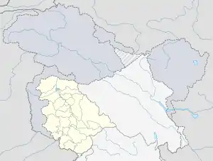
Donadi
Donadi is a village in Kahara tehsil of Doda district in the Indian union territory of Jammu and Kashmir.[1] It is famous for a hydroelectric power project called Lower Kalnie Power Project Donadi.[2]
Donadi | |
|---|---|
Village | |
| (In Urdu دوندی) | |
 Donadi Donadi in Jammu and Kashmir, India | |
| Coordinates: 33.133750°N 75.853266°E | |
| Country | |
| Union territory | Jammu and Kashmir |
| Region | Jammu region |
| District | Doda |
| Demonym(s) | Bhalessi |
| Language | |
| • Spoken | Kashmiri, Gojri |
| • Official | Urdu |
| Time zone | UTC+5:30 (IST) |
Etymology
Donadi name is derived from Gojri language; Do means Two and Nadi means stream or rivulets. The two rivulets unite near Donadi which later forms a rivulet known as Kalnai.[3]
Location
Donadi is located on Thathri-Gandoh highway 9 kilometres (5.6 mi) from National Highway 244 near Thathri town.[4]
References
- "Alternate path near Donadi Thathri provided to locals". Early Times. 3 October 2018. Retrieved 30 July 2020.
- "Employees, contractors of power project hold protest". Daily Excelsior. 23 March 2018. Retrieved 30 July 2020.
- Malik, Sadaket (24 July 2020). "Bhalessa deserves hill district status". The Chenab Times. Retrieved 30 July 2020.
- "Welcome to Kishtwar". www.csridentity.com. Retrieved 31 July 2020.
This article is issued from Wikipedia. The text is licensed under Creative Commons - Attribution - Sharealike. Additional terms may apply for the media files.
