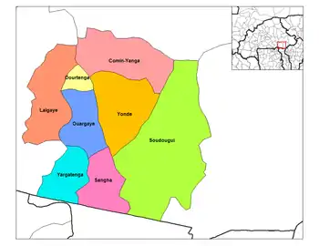
Dourtenga
Dourtenga is a small town in the Dourtenga Department of Balé Province in southern Burkina Faso. It is the capital of the Dourtenga Department and the town has a total population of 3,276.[1]
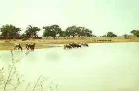
Dourtenga lake
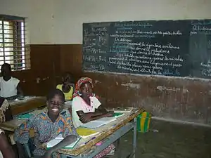
Dourtenga school children
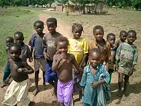
Children of Dourtenga
Dourtenga | |
|---|---|
 | |
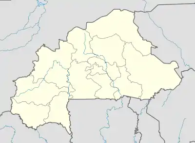 Dourtenga Location in Burkina Faso | |
| Coordinates: 11°43′N 0°0′E | |
| Country | |
| Region | Centre-Est Region |
| Province | Koulpélogo Province |
| Department | Dourtenga Department |
| Population (1996) | |
| • Total | 3,276 |
Climate
Köppen-Geiger climate classification system classifies its climate as hot semi-arid (BSh) and closely borders with tropical wet and dry (Aw).
| Climate data for Dourtenga | |||||||||||||
|---|---|---|---|---|---|---|---|---|---|---|---|---|---|
| Month | Jan | Feb | Mar | Apr | May | Jun | Jul | Aug | Sep | Oct | Nov | Dec | Year |
| Average high °C (°F) | 34.4 (93.9) |
36.3 (97.3) |
38.8 (101.8) |
38.9 (102.0) |
36.4 (97.5) |
33.7 (92.7) |
31.3 (88.3) |
30.3 (86.5) |
31.4 (88.5) |
34.7 (94.5) |
36 (97) |
34.4 (93.9) |
34.7 (94.5) |
| Daily mean °C (°F) | 26.3 (79.3) |
28.5 (83.3) |
31.3 (88.3) |
32.2 (90.0) |
30.5 (86.9) |
28.3 (82.9) |
26.6 (79.9) |
25.9 (78.6) |
26.4 (79.5) |
28.2 (82.8) |
27.7 (81.9) |
26.3 (79.3) |
28.2 (82.7) |
| Average low °C (°F) | 18.3 (64.9) |
20.8 (69.4) |
23.9 (75.0) |
25.5 (77.9) |
24.7 (76.5) |
22.9 (73.2) |
21.9 (71.4) |
21.5 (70.7) |
21.4 (70.5) |
21.7 (71.1) |
19.5 (67.1) |
18.2 (64.8) |
21.7 (71.0) |
| Average precipitation mm (inches) | 0 (0) |
2 (0.1) |
9 (0.4) |
29 (1.1) |
78 (3.1) |
108 (4.3) |
177 (7.0) |
233 (9.2) |
154 (6.1) |
35 (1.4) |
2 (0.1) |
2 (0.1) |
829 (32.9) |
| Average rainy days (≥ 1 mm) | 0 | 0 | 0 | 3 | 6 | 9 | 13 | 16 | 13 | 5 | 0 | 0 | 65 |
| Source 1: Climate-Data.org[2] | |||||||||||||
| Source 2: Storm247 for rainy days[3] | |||||||||||||
References
- Burkinabé government inforoute communale Archived 2008-01-24 at the Wayback Machine
- "Climate: Dourtenga - Climate graph, Temperature graph, Climate table". Climate-Data.org. Retrieved 25 October 2013.
- "Weather for Dourtenga, Burkina Faso - Climate". Storm247. Archived from the original on 29 October 2013. Retrieved 25 October 2013.
External links
| Wikimedia Commons has media related to Dourtenga. |
This article is issued from Wikipedia. The text is licensed under Creative Commons - Attribution - Sharealike. Additional terms may apply for the media files.