Drolet River
The Drolet River (in French: rivière Drolet) is a tributary of the west bank of the Chaudière River which flows northward to empty onto the south bank of the St. Lawrence River.
| Drolet River | |
|---|---|
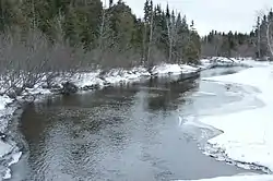 Drolet River downstream from the Rang 5 bridge to the east. | |
 | |
| Native name | Rivière Drolet (French) |
| Location | |
| Country | Canada |
| Province | Quebec |
| Region | Estrie |
| MRC | Le Granit Regional County Municipality |
| Physical characteristics | |
| Source | Drolet Lake |
| • location | Lac-Drolet |
| • coordinates | 45.72857°N 70.858699°W |
| • elevation | 460 metres (1,510 ft) |
| Mouth | Chaudière River |
• location | Lac-Drolet |
• coordinates | 45.69194°N 70.78667°W |
• elevation | 322 metres (1,056 ft) |
| Length | 9.8 kilometres (6.1 mi) |
| Basin features | |
| Progression | Chaudière River, St. Lawrence River |
| River system | St. Lawrence River |
| Tributaries | |
| • left | (upstream) |
| • right | (upstream) |
The "Drolet River" flows in the municipality of Lac-Drolet, in the Le Granit Regional County Municipality (MRC), in the administrative region of Estrie, in Quebec, in Canada.
Geography
The main hydrographic slopes near the "Drolet river" are:
- north side: Ludgine River, Petit Portage River, rivière de la Grande Coudée;
- east side: Chaudière River;
- south side: Chaudière River, Madisson River;
- west side: Drolet Lake, Lac du Rat Musqué, Rivière aux Bluets Sud.
The Drolet river takes its source at the outlet of Drolet Lake (length: 3.2 kilometres (2.0 mi); altitude: 457 metres (1,499 ft)), in the municipality of Lac-Drolet. This lake is located near the Route des Sommets, this lake has a central island connected to the "Pointe à Bénedict". The resort is developed especially on the southwest shore and the northern part. This lake is located northwest of the village of Lac-Drolet.
From the mouth of Drolet Lake, the Drolet river flows over 9.8 kilometres (6.1 mi) divided into the following segments:
- 2.0 kilometres (1.2 mi) towards the south-west, crossing the village of Lac-Drolet, as far as the road to Le Morne, which it intersects at the south-east exit of the village;
- 7.8 kilometres (4.8 mi) towards the south-west, down to the bottom of a small valley following the route of Le Morne, up to its confluence.[1]
The Drolet River empties on the west bank of the Chaudière River in the municipality of Lac-Drolet in the place called "Puits de Jacob". Its confluence is 0.9 kilometres (0.56 mi) west of route 204, upstream of the bridge in the village of Saint-Ludger and downstream of the intermunicipal boundary between Sainte-Cécile-de-Whitton and Lac-Drolet.
Toponymy
The toponym "rivière Drolet" was made official on December 5, 1968 at the Commission de toponymie du Québec.[2]