Dunn Center, North Dakota
Dunn Center is a city in Dunn County, North Dakota, United States. The population was 146 at the 2010 census.[5] Dunn Center was founded in 1914.
Dunn Center, North Dakota | |
|---|---|
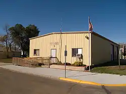 Dunn Center City Hall | |
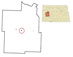 Location of Dunn Center, North Dakota | |
| Coordinates: 47°21′12″N 102°37′22″W | |
| Country | United States |
| State | North Dakota |
| County | Dunn |
| Area | |
| • Total | 0.39 sq mi (1.02 km2) |
| • Land | 0.39 sq mi (1.01 km2) |
| • Water | 0.00 sq mi (0.00 km2) |
| Elevation | 2,188 ft (667 m) |
| Population | |
| • Total | 146 |
| • Estimate (2019)[3] | 191 |
| • Density | 488.49/sq mi (188.65/km2) |
| Time zone | UTC-7 (Mountain (MST)) |
| • Summer (DST) | UTC-6 (MDT) |
| ZIP code | 58626 |
| Area code(s) | 701 |
| FIPS code | 38-20940 |
| GNIS feature ID | 1028746[4] |
| Website | cityofdunncenter.com |
History
Dunn Center was laid out in 1914, when the railroad was extended to that point.[6] The city was so named on account of its central location in Dunn County.[7]
Geography
Dunn Center is located at 47°21′12″N 102°37′22″W (47.353307, -102.622740).[8]
According to the United States Census Bureau, the city has a total area of 0.39 square miles (1.01 km2), all land.[9]
Dunn Center is located on North Dakota Highway 200, east of Lake Ilo.
Demographics
| Historical population | |||
|---|---|---|---|
| Census | Pop. | %± | |
| 1920 | 247 | — | |
| 1930 | 276 | 11.7% | |
| 1940 | 238 | −13.8% | |
| 1950 | 246 | 3.4% | |
| 1960 | 250 | 1.6% | |
| 1970 | 107 | −57.2% | |
| 1980 | 170 | 58.9% | |
| 1990 | 128 | −24.7% | |
| 2000 | 122 | −4.7% | |
| 2010 | 146 | 19.7% | |
| 2019 (est.) | 191 | [3] | 30.8% |
| U.S. Decennial Census[10] 2018 Estimate[11] | |||
2010 census
At the 2010 census there were 146 people in 66 households, including 38 families, in the city. The population density was 374.4 inhabitants per square mile (144.6/km2). There were 80 housing units at an average density of 205.1 per square mile (79.2/km2). The racial makup of the city was 93.8% White, 1.4% Native American, 0.7% from other races, and 4.1% from two or more races. Hispanic or Latino of any race were 1.4%.[2]
Of the 66 households 27.3% had children under the age of 18 living with them, 48.5% were married couples living together, 6.1% had a female householder with no husband present, 3.0% had a male householder with no wife present, and 42.4% were non-families. 33.3% of households were one person and 19.7% were one person aged 65 or older. The average household size was 2.21 and the average family size was 2.82.
The median age was 39.2 years. 21.9% of residents were under the age of 18; 8.2% were between the ages of 18 and 24; 27.4% were from 25 to 44; 23.9% were from 45 to 64; and 18.5% were 65 or older. The gender makeup of the city was 51.4% male and 48.6% female.
2000 census
At the 2000 census, there were 122 people in 58 households, including 33 families, in the city. The population density was 304.5 people per square mile (117.8/km2). There were 81 housing units at an average density of 202.2 per square mile (78.2/km2). The racial makup of the city was 90.98% White, 6.56% Native American, and 2.46% from two or more races.
Of the 58 households 15.5% had children under the age of 18 living with them, 50.0% were married couples living together, 3.4% had a female householder with no husband present, and 43.1% were non-families. 36.2% of households were one person and 20.7% were one person aged 65 or older. The average household size was 2.10 and the average family size was 2.67.
The age distribution was 16.4% under the age of 18, 4.9% from 18 to 24, 23.0% from 25 to 44, 32.8% from 45 to 64, and 23.0% 65 or older. The median age was 49 years. For every 100 females, there were 90.6 males. For every 100 females age 18 and over, there were 92.5 males.
The median household income was $23,500 and the median family income was $27,500. Males had a median income of $18,750 versus $16,071 for females. The per capita income for the city was $13,736. There were 8.3% of families and 9.6% of the population living below the poverty line, including no under eighteens and 3.1% of those over 64.
Climate
This climatic region is typified by large seasonal temperature differences, with warm to hot (and often humid) summers and cold (sometimes severely cold) winters. According to the Köppen Climate Classification system, Dunn Center has a humid continental climate, abbreviated "Dfb" on climate maps.[12]
References
- "2019 U.S. Gazetteer Files". United States Census Bureau. Retrieved July 27, 2020.
- "U.S. Census website". United States Census Bureau. Retrieved June 14, 2012.
- "Population and Housing Unit Estimates". United States Census Bureau. May 24, 2020. Retrieved May 27, 2020.
- "US Board on Geographic Names". United States Geological Survey. October 25, 2007. Retrieved January 31, 2008.
- "2010 Census Redistricting Data (Public Law 94-171) Summary File". American FactFinder. United States Census Bureau. Retrieved May 2, 2011.
- Geneva Roth Olstad (2000). Main Street, North Dakota in Vintage Postcards. Arcadia Publishing. p. 29. ISBN 978-0-7385-0726-2.
- Federal Writers' Project (1938). North Dakota, a Guide to the Northern Prairie State,. WPA. p. 321. ISBN 978-1-62376-033-5.
- "US Gazetteer files: 2010, 2000, and 1990". United States Census Bureau. February 12, 2011. Retrieved April 23, 2011.
- "US Gazetteer files 2010". United States Census Bureau. Archived from the original on July 2, 2012. Retrieved June 14, 2012.
- United States Census Bureau. "Census of Population and Housing". Retrieved July 29, 2013.
- "Population Estimates". United States Census Bureau. Retrieved August 31, 2019.
- Climate Summary for Dunn Center, North Dakota
Municipalities and communities of Dunn County, North Dakota, United States | ||
|---|---|---|
| Cities |  Map of North Dakota highlighting Dunn County | |
| CDP | ||
| Unorganized territories |
| |
| Unincorporated communities |
| |
| Indian reservation | ||
| Footnotes | ‡This populated place also has portions in an adjacent county or counties | |
| ||