Dzukwaram
Dzukwaram is a village in the Peren district of Nagaland, India. It is located in the Jalukie Circle.[1]
Dzukwaram | |
|---|---|
village | |
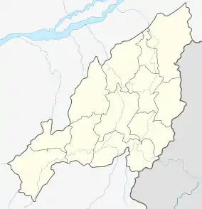 Dzukwaram Location Nagaland, India  Dzukwaram Dzukwaram (India) | |
| Coordinates: 25.631202°N 93.721140°E | |
| Country | India |
| State | Nagaland |
| District | Peren |
| Circle | Jalukie |
| Population (2011) | |
| • Total | 422 |
| Time zone | UTC+5:30 (IST) |
| PIN | 797110 |
| Census code | 268325 |
Demographics
According to the 2011 census of India, Dzukwaram has 82 households. The effective literacy rate (i.e. the literacy rate of population excluding children aged 6 and below) is 49.06%.[2]
| Total | Male | Female | |
|---|---|---|---|
| Population | 422 | 219 | 203 |
| Children aged below 6 years | 51 | 27 | 24 |
| Scheduled caste | 0 | 0 | 0 |
| Scheduled tribe | 378 | 193 | 185 |
| Literates | 182 | 91 | 91 |
| Workers (all) | 350 | 177 | 173 |
| Main workers (total) | 222 | 116 | 106 |
| Main workers: Cultivators | 190 | 99 | 91 |
| Main workers: Agricultural labourers | 30 | 17 | 13 |
| Main workers: Household industry workers | 0 | 0 | 0 |
| Main workers: Other | 2 | 0 | 2 |
| Marginal workers (total) | 128 | 61 | 67 |
| Marginal workers: Cultivators | 125 | 59 | 66 |
| Marginal workers: Agricultural labourers | 3 | 2 | 1 |
| Marginal workers: Household industry workers | 0 | 0 | 0 |
| Marginal workers: Others | 0 | 0 | 0 |
| Non-workers | 72 | 42 | 30 |
References
- "Nagaland revenue village directory" (PDF). Archived from the original (PDF) on 4 March 2016. Retrieved 22 July 2015.
- "District Census Handbook - Peren" (PDF). 2011 Census of India. Directorate of Census Operations, Nagaland. Retrieved 22 July 2015.
This article is issued from Wikipedia. The text is licensed under Creative Commons - Attribution - Sharealike. Additional terms may apply for the media files.