East Hampstead, New Hampshire
East Hampstead is an unincorporated community in the town of Hampstead in Rockingham County, New Hampshire, United States.
East Hampstead, New Hampshire | |
|---|---|
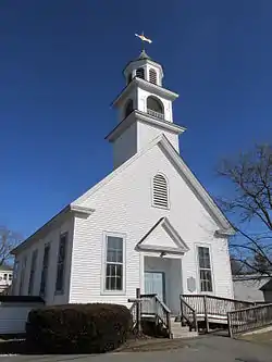 Union Church | |
 East Hampstead  East Hampstead | |
| Coordinates: 42°53′28″N 71°08′35″W | |
| Country | United States |
| State | New Hampshire |
| County | Rockingham |
| Town | Hampstead |
| Elevation | 256 ft (78 m) |
| Time zone | UTC-5 (Eastern (EST)) |
| • Summer (DST) | UTC-4 (EDT) |
| ZIP code | 03826 |
| Area code(s) | 603 |
| GNIS feature ID | 866707[1] |
It is located near the northeast corner of the town of Hampstead, at the intersection of New Hampshire Route 111 and Route 121A. Route 111 connects Salem to the southwest with Kingston to the northeast, while Route 121A is a local road which connects with Sandown to the northwest and Plaistow to the southeast.
East Hampstead has a separate ZIP code (03826) from the rest of the town of Hampstead.
References
Municipalities and communities of Rockingham County, New Hampshire, United States | ||
|---|---|---|
| City | 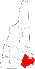 Map of New Hampshire highlighting Rockingham County | |
| Towns |
| |
| CDPs | ||
| Other villages | ||
| ||
This article is issued from Wikipedia. The text is licensed under Creative Commons - Attribution - Sharealike. Additional terms may apply for the media files.