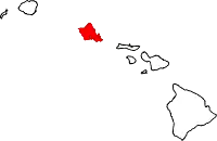
East Honolulu, Hawaii
East Honolulu is a census-designated place (CDP) located in Honolulu County, Hawaii, United States. As of the 2010 Census, the CDP had a population of 49,914, making it the 2nd most populated CDP in Hawaii, behind Honolulu.[2]
East Honolulu | |
|---|---|
 | |
| Coordinates: 21°17′20″N 157°43′2″W | |
| Country | |
| State | |
| Counties | |
| Area | |
| • Total | 3.4 sq mi (8.9 km2) |
| • Land | 2.3 sq mi (6.0 km2) |
| • Water | 1.2 sq mi (3.0 km2) |
| Population (2010) | |
| • Total | 49,914 |
| Time zone | UTC-10 |
| Area code(s) | 808 |
| GNIS feature ID | 2583416[1] |
Geography
East Honolulu is centered on 21°17′20″N 157°43′2″W (21.2891, -157.7173). According to the United States Census Bureau, the CDP has a total area of 3.4 square miles (8.9 km2), of which 2.3 square miles (6.0 km2) is land and 1.2 square miles (3.0 km2), or 33.22%, is water.[3]

East Honolulu consists of the area directly east of the center of Honolulu, beginning at the Wai'alae Country Club and extending east to Makapu'u Point, the easternmost point on the island of Oahu. It consists of mostly upscale neighborhoods.
Areas:
- ʻĀina Haina
- Hawaii Kai
- Niu Valley
Education
Hawaii Department of Education operates area public schools.[4]
Elementary schools:
- Ana Haina Elementary School[5]
- Haha'ione Elementary School[6]
- Kamilo'iki Elementary School[7]
- Koko Head Elementary School[8]
Middle schools:
- Niu Valley Middle School[9]
High schools:
Private schools:
- The Roman Catholic Diocese of Honolulu maintains the Holy Nativity School[12]
- Honolulu Waldorf School
Hawaii State Public Library System maintains the Aina Haina Public Library.[13]
References
- "East Honolulu Census Designated Place". Geographic Names Information System. United States Geological Survey. Retrieved December 29, 2013.
- "Profile of General Population and Housing Characteristics: 2010 Demographic Profile Data (DP-1): East Honolulu CDP, Hawaii". United States Census Bureau. Retrieved May 17, 2012.
- "Geographic Identifiers: 2010 Demographic Profile Data (G001): East Honolulu CDP, Hawaii". United States Census Bureau. Retrieved May 17, 2012.
- "2010 CENSUS - CENSUS BLOCK MAP (INDEX): East Honolulu CDP, HI" (PDF). U.S. Census Bureau. Retrieved 2020-10-10. - Pages 1 and 2 - Compare to school locations
- "Home". Ana Haina Elementary School. Retrieved 2020-10-11.
801 W. HIND DRIVE HONOLULU, HAWAII 96821
- "Home". Haha'ione Elementary School. Retrieved 2020-10-11.
595 PEPEEKEO ST, HONOLULU, HI, USA
- "Home". Kamilo'iki Elementary School. Retrieved 2020-10-11.
7788 Hawaii Kai Drive Honolulu, HI 96825
- "Home". Koko Head Elementary School. Retrieved 2020-10-11.
189 Lunailo Home Road, Honolulu, HI 96825, USA[on top banner]
- "Niu Valley Middle". Hawaii Department of Education. Retrieved 2020-10-11.
310 Halemaumau Street Honolulu, Hawaii 96821
- "Home". Henry J. Kaiser High School.
- "Home". Kalani High School. Retrieved 2020-10-10.
4680 Kalanianaole Highway Honolulu, Hawaii 96821
- "Holy Nativity School". Holy Nativity School. Retrieved 2020-10-11.
5286 Kalanianaole Highway, Honolulu, HI 96821
- "Aina Haina". Hawaii State Public Library System. Retrieved 2020-10-11.
Islands, municipalities, and communities of Honolulu County, Hawaii, United States | ||
|---|---|---|
| CDPs |
|  Map of Hawaii highlighting Honolulu County |
| Other communities |
| |
| ||