East Kildonan, Winnipeg
East Kildonan is a primarily residential community in Winnipeg, Manitoba, Canada, located in the northeast part of the city. Commonly known by its initials "E. K.", the suburb has a population of approximately 35,800 (2016 Census).
East Kildonan | |
|---|---|
Suburb | |
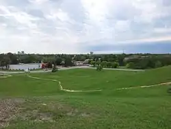 Skyline of Winnipeg from Civic Park | |
| Established | 1914 |
| Incorporated as a City | July 1, 1957 |
| Named for | Kildonan, Arran |
| Area | |
| • Suburb | 12.9 km2 (5.0 sq mi) |
| • Metro | 5,306.79 km2 (2,048.96 sq mi) |
| Elevation | 231 m (758 ft) |
| Population (2016) | |
| • Suburb | 35,800 |
| • Density | 2,800/km2 (7,200/sq mi) |
| • Metro | 778,489 |
| Time zone | Central Standard Time |
| • Summer (DST) | Central Daylight Time |
| Area code(s) | Area codes 204 and 431 |
East Kildonan is bounded by the Red River on the west, the lane between Larsen and Harbison Avenues on the south, Panet Road, 100 metres (330 ft) north of Blantyre Avenue, and the Canadian Pacific Railway Marconi tracks (removed in 2006) on the east, and Oakland Avenue on the north. East Kildonan is made up of the neighbourhoods of Munroe, Morse Place, Rossmere, and Fraser's Grove.
It is mainly a working and middle class community, though there are poorer pockets south of Munroe Avenue and more affluent areas along the Red River and west of Henderson Highway, East Kildonan's major thoroughfare. There is a small industrial area located between Watt Street and the CPR tracks.
History
The name "Kildonan" originates from the Parish of Kildonan which was created in 1817.[1] At the time, parishes formed both a land use system and a system of local government.[2] The Parish of Kildonan formed part of the Red River Colony, and was named for the Strath of Kildonan on the Sutherland estate in Scotland where many of the settlers came from.[1][3]
The Municipality of Kildonan was established in 1876. From 1876 to 1914 the Rural Municipality of Kildonan included a large area on both sides of the Red River, just north of the original City of Winnipeg.[4] The area remained primarily agricultural until the beginning of the 20th century. It was a centre for market gardening to serve the needs of nearby Winnipeg. In 1903 streetcar service was initiated in the area and this began the area's development as a residential suburb of Winnipeg. In 1906 the more heavily developed southern area of the municipality, known as Elmwood, joined with the City of Winnipeg.
In 1914 Kildonan was divided in two: East and West Kildonan, with the Red River as the boundary. Subsequently, in 1925, the areas north of Oakland Avenue separated to form the Municipality of North Kildonan. East Kildonan developed rapidly after World War II, the population grew from 8,439 in 1941 to 30,150[5] in 1971.
It was incorporated as the City of East Kildonan on July 1, 1957.[6] Incorporation made East Kildonan into Manitoba's sixth largest city, with a population of 20,000.[7] In 1959, the opening of the Disraeli Freeway further accelerated the growth of the area.
| Term | Reeve / Mayor |
|---|---|
| 1914-1917 | Donald Munroe (1854-1924) |
| 1918-1923 | Samuel Robert Henderson (1863-1928) |
| 1924-1928 | Nicholas "Nick" Fletcher (1888-1981) |
| 1929-1933 | David Jeffery Allan (1887-1956) |
| 1934-1947 | Walter Peter Larsen (1897-1962) |
| 1948-1955 | John Leslie Bodie (1909-1997) |
| 1956 | Francis William "Frank" Dryden (1903-1963) |
| 1956-1965 | George Nordland Suttie (1901-1968) |
| 1966 | Michael Spack (1922-2011) |
| 1966-1967 | George Nordland Suttie (1901-1968) |
| 1968-1969 | Michael Ruta |
| 1970-1971 | Stanley Dowhan (1927-1993) |
In 1972, East Kildonan, along with the old City of Winnipeg and eleven other municipalities in the Greater Winnipeg Area, amalgamated to form the City of Winnipeg. It was the only suburban municipality to be in favour of the "unicity" scheme.[8][9]
Neighbourhoods
| Pop. | Area
sq. km. | |
|---|---|---|
| Munroe West | 3,010 | 1.3 |
| Rossmere A | 13,330 | 4.0 |
| Rossmere B | 4,185 | 1.2 |
| River East | 7,725 | 3.4 |
| Kildonan Drive | 4,695 | 2.3 |
| Valhalla | 2,855 | 0.7 |
| TOTAL | 35,800 | 12.9 |
References
- "PastForward - Winnipeg Communities & Neighborhoods". PastForward: Winnipeg's Digital Public History. Archived from the original on 2 April 2015. Retrieved 31 March 2015.
- "Planning Manitoba's Capital Region: Next Steps" (PDF). Province of Manitoba. Retrieved 31 March 2015.
- "North & East Kildonan". Tourism Winnipeg. Archived from the original on 28 May 2012. Retrieved 28 November 2012.
- "East Kildonan Police 1914-1974". Pre-Amalgamation Police Department Histories. City of Winnipeg. 8 August 2007. Retrieved 4 February 2013.
- "TABLE 3. Population by Specified Age Groups, for Incorporated Cities, Towns and Villages of 10,000 Population and Over, 1971". Advance Bulletin 1971 Census of Canada. Statistics Canada. p. 7. Retrieved 4 February 2013.
- "Fourth city here; but not 'Kildonan': E.K. gets charter". Winnipeg Free Press. April 3, 1957. p. 3.
- "Manitoba Municipalities: Municipality of East Kildonan". Manitoba Historical Society. Retrieved 21 November 2012.
- "East Kildonan Municipality". City of Winnipeg. Retrieved 31 March 2015.
- Lee, David (December 31, 1971). "Settlers' Woodlot Began Development of East Kildonan". Winnipeg Free Press. p. 21.
External links
- Miles MacDonell Collegiate - East Kildonan History
- Province of Manitoba, Capital Region Planning Framework: A Brief Historical Perspective
- East Kildonan Police 1914-1974 Pre-Amalgamation Police Department Histories (City of Winnipeg)