North Kildonan
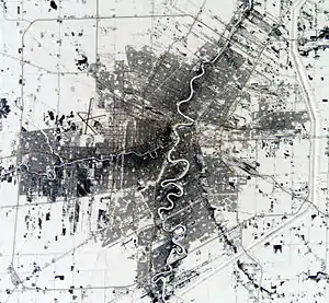
North Kildonan is a ward within the city of Winnipeg, and a former municipality in Manitoba, Canada. Its population in 2016 was 44,664.[1]
North Kildonan | |
|---|---|
Suburb | |
 North Kildonan | |
| Coordinates: 49°56′27″N 97°05′19″W | |
| Area | |
| • Metro | 5,306.79 km2 (2,048.96 sq mi) |
| Population (2011) | |
| • Suburb | 44,664 |
| • Metro | 778,489 |
| Forward Sortation Areas | R2G, R3W |
| Area code(s) | 204, 431 |
History
Originally there was only one large rural municipality (R.M.) known as Kildonan. In 1914, it was divided into the Rural Municipality of West Kildonan and the Rural Municipality of East Kildonan. A petition to the provincial government led to a further division of East Kildonan.
On January 1, 1925, the northern portion became incorporated as the Rural Municipality of North Kildonan. North Kildonan was a farming community and in 1928, the first Mennonites settled there. This was done to fulfil immigration requirements to be farmers and yet be close to city employment opportunities.[2]
Present day
In 1972, North Kildonan and other municipalities were amalgamated with the city of Winnipeg to create the modern city of Winnipeg.[3] North Kildonan is a ward within Winnipeg represented by a member of Winnipeg City Council.
Its approximate boundary-lines are as follows:[4]
- Glenway Ave. (from Raleigh St. to Henderson Hwy.),
- The Red River (from Glenway Ave. to McLeod Ave.),
- McLeod Ave. (from Henderson Hwy. to Gateway Road),
- Gateway Road (from Oakland Ave. to 100 metres north of Blantyre Ave.),
- Line North of Blantyre Ave. (from Gateway Road to Panet Road),
- Panet Road (from line north of Blantyre Ave. to 250 metres south of Almey Ave.),
- Line south of Almey Ave. (from Panet Road to Owen St.),
- Owen St. to Ravelston Ave. West,
- Ravelston Ave. west to Plessis Road,
- Plessis Road to Springfield Road,
- Springfield Road to the line comprising the north boundary of the City of Winnipeg 100 metres west of Wenzel St.,
- and finally a straight line that runs northwest from that location back to the intersection of Raleigh St. and Glenway Ave. (this line runs parallel to, and just north of, Knowles Ave.)
Representation
City Councilor
The current City Councilor is Jeff Browaty, who has represented North Kildonan since 2006.[5]
Member of Legislature Assembly
The current MLA is Andrew Micklefield in the south end and Cathy Cox in the north part.
Parliament
Raquel Dancho of the Conservative Party of Canada has been the Member of Parliament representing the constituency of Kildonan—St. Paul since October 2019.
Recreation
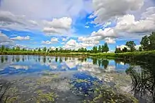
North Kildonan is home to many green spaces, the largest of which is Kilcona Park, located on Springfield Avenue east of Lagimodiere Boulevard. The park offers a wide variety of recreational activities and resources including ponds, open fields, soccer pitches, and baseball diamonds.
Located within the park is Harbour View Golf Course & Recreation Complex, which provides visitors with the opportunity to play tennis, lawn bowling, nine holes of golf, or go on pedal boat rides. Winter activities include tobogganing, skating, and cross-country skiing.
The Bunn's Creek Trail is a scenic walking path and bike trail, meandering its way from McIvor Avenue and Raleigh Street to the Red River. The trail ends on a high bank where a wonderful view of the river awaits anyone who completes the nearly 2.5 km trail.
Gateway Community Club (located at 1717 Gateway Rd.) is home to numerous, year-round sports teams including hockey, baseball, softball, and outdoor and indoor soccer. The fields are open to the public when not in use. Indoor and outdoor hockey rinks are available for rented ice-times in winter, as well as the indoor soccer pitch.
References
- Winnipeg, City of. "The 2017 Winnipeg Wards Boundaries Commission - City Clerk's Department - City of Winnipeg". winnipeg.ca. Retrieved 2020-12-12.
- Underwood, Matt; Kibsey, Mike. "History". Merlin.mb.ca. Archived from the original on August 10, 2007.
- Ingle, Ken (December 31, 1971). "Taxes Made North Kildonan". Winnipeg Free Press. p. 21.
- Winnipeg, City of. "Maps - The 2017 Winnipeg Wards Boundaries Commission - City Clerk's Department - City of Winnipeg". winnipeg.ca. Retrieved 2020-12-12.
- Winnipeg, City of. "Election Archive - Elections - City Clerk's Department - City of Winnipeg". winnipeg.ca. Retrieved 2020-12-12.