East Perth, Western Australia
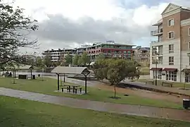
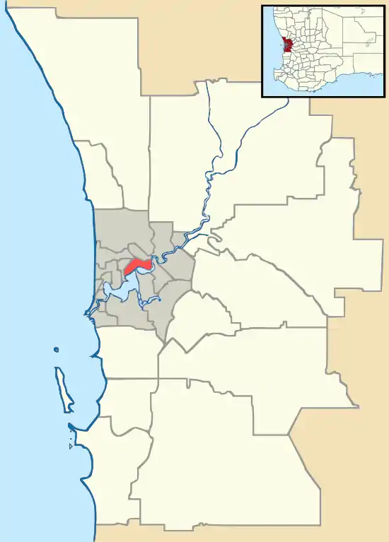
East Perth is an inner suburb of Perth, Western Australia, located next to the Perth central business district. Claise Brook and Claisebrook Cove are within the suburb. Formerly characterised by industrial land uses and urban blight, the design of the new residential neighbourhoods was strongly influenced by the new urbanism movement.[2]
| East Perth Perth, Western Australia | |||||||||||||||
|---|---|---|---|---|---|---|---|---|---|---|---|---|---|---|---|
 East Perth apartments | |||||||||||||||
 East Perth | |||||||||||||||
| Coordinates | 31.954°S 115.876°E | ||||||||||||||
| Population | 10,596 (2016 census)[1] | ||||||||||||||
| • Density | 3,210/km2 (8,320/sq mi) | ||||||||||||||
| Postcode(s) | 6004 | ||||||||||||||
| Area | 3.3 km2 (1.3 sq mi) | ||||||||||||||
| Location | 2 km (1 mi) from Perth | ||||||||||||||
| LGA(s) | |||||||||||||||
| State electorate(s) | Perth | ||||||||||||||
| Federal Division(s) | Perth | ||||||||||||||
| |||||||||||||||
| External video | |
|---|---|
Land use
Primarily an industrial area in the early twentieth century, it was the location of the East Perth Gas Works, East Perth Power Station (which was decommissioned and the building is being renovated for other purposes), the East Perth railway yard, and engine sheds.
From the early 1980s, virtually all of the residential real estate on the western side of Lord Street became home to commercial enterprises; the buildings remain, either single or duplex dwellings previously inhabited mostly by migrant families.
Population
In the 2016 Census, there were 10,596 people in East Perth. 30.3% of people were born in Australia. The most common countries of birth were England 6.7%, China 4.0%, India 3.7%, Malaysia 3.4% and South Korea 2.9%. 47.6% of people only spoke English at home. Other languages spoken at home included Mandarin 6.6%, Korean 2.7%, Cantonese 2.6%, Portuguese 2.0% and Spanish 1.9%. The most common responses for religion were No Religion 33.3% and Catholic 18.4%.[1]
Cemetery
East Perth is the location of Perth's significant early colonial era cemetery, which contains graves of many early colonial families. Its condition is marginal due to the loss of many headstones and lack of adequate record of graves, only 800 of the estimated 10,000 grave sites have been identified.[3][4]
Railway
The former East Perth railway yard and engine sheds were removed in the 1960s and have been redeveloped into the Railway headquarters - consolidating a very scattered system of offices and sections for the railways.
East Perth serves as the main hub for country and interstate rail services and Road Coach services. Departing from the station are services such as the Prospector, AvonLink, tourist trains, and the Indian Pacific.
The original East Perth railway station is now called Claisebrook, and while it has the same number of platforms that it did in the 1960s, the original buildings have given way to modern shelters.
It is also the location of the Goongoongup Bridge on the railway to Bunbury for the South Western Railway.
Redevelopment Authority
East Perth Redevelopment Authority (EPRA) was established in 1991[5] to manage the redevelopment and urbanisation of the suburb.[6] In 2012 EPRA merged with other redevelopment authorities to become the Metropolitan Redevelopment Authority (MRA).[7] In 2019, the MRA became part of DevelopmentWA.[8] Many parts of East Perth that have been fully developed have been “normalised”—meaning returned to the City of Perth for administration.
Sports
Sporting attractions include the WACA Ground and Gloucester Park trotting ground.
Education
Educational facilities include Trinity College, a day school for boys, years 4–12.
See also
Notes
- Australian Bureau of Statistics (27 June 2017). "State Suburbs: East Perth". 2016 Census QuickStats. Retrieved 19 December 2017.

- "Australian New Urbanism – A Guide to Projects (Second Edition)" (PDF). Australian Council of the New Urbanism. November 2006.
- "East Perth Cemeteries". National Trust of Australia (WA). Retrieved 10 August 2012.
- "Place No: 02164 Name: East Perth Cemeteries". Places Database. Heritage Council of Western Australia. Archived from the original on 6 February 2012. Retrieved 10 August 2012.
- http://www.mra.wa.gov.au/Documents/Corporate/EPRA-Annual-Reports/EPRA-Annual-Report-2005.pdf
- http://pandora.nla.gov.au/pan/23604/20020213-0000/www.mediastatements.wa.gov.au/media/archivemedia.nsf/9af6c28061d8b880482569ff002ca12e/7f6588877073a75e48256840003fa9aa02ec.html
- New redevelopment authority to transform Perth Minister for Health, Culture & the Arts 29 December 2011
- "Who is DevelopmentWA". DevelopmentWA. Retrieved 13 April 2020.
References
- Bodycoat, Ronald. (1993) East Perth heritage study : prepared for the East Perth Development Authority East Perth, W.A. The Authority. 2 volumes (Volume 1 only held in Battye Library).