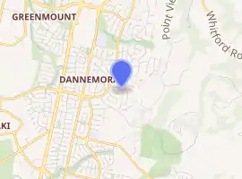
East Tāmaki Heights
East Tāmaki Heights is an eastern residential suburb of the city of Auckland, New Zealand.
East Tāmaki Heights | |
|---|---|
Suburb | |
| |
| Country | New Zealand |
| Local authority | Auckland Council |
| Electoral ward | Howick Ward |
| Local board | Howick Local Board |
| Population (2018)[1] | |
| • Total | 2,751 |
| Dannemora | ||
| East Tamaki |
|
Whitford |
| Flat Bush |
The earliest houses date from the 1880s, but most of the houses were built in the 2000s.[2] Between 1998 and 2009, the major streets were defined.[3][4]
Demographics
| Year | Pop. | ±% p.a. |
|---|---|---|
| 2006 | 2,193 | — |
| 2013 | 2,559 | +2.23% |
| 2018 | 2,751 | +1.46% |
| Source: [1] | ||
East Tāmaki Heights had a population of 2,751 at the 2018 New Zealand census, an increase of 192 people (7.5%) since the 2013 census, and an increase of 558 people (25.4%) since the 2006 census. There were 813 households. There were 1,329 males and 1,422 females, giving a sex ratio of 0.93 males per female. The median age was 40 years, with 486 people (17.7%) aged under 15 years, 597 (21.7%) aged 15 to 29, 1,335 (48.5%) aged 30 to 64, and 333 (12.1%) aged 65 or older.
Ethnicities were 41.4% European/Pākehā, 3.7% Māori, 2.8% Pacific peoples, 53.3% Asian, and 4.9% other ethnicities (totals add to more than 100% since people could identify with multiple ethnicities).
The proportion of people born overseas was 51.6%, compared with 27.1% nationally.
Although some people objected to giving their religion, 44.7% had no religion, 30.5% were Christian, 8.5% were Hindu, 3.7% were Muslim, 3.9% were Buddhist and 4.0% had other religions.
Of those at least 15 years old, 705 (31.1%) people had a bachelor or higher degree, and 276 (12.2%) people had no formal qualifications. The median income was $35,500. The employment status of those at least 15 was that 1,116 (49.3%) people were employed full-time, 366 (16.2%) were part-time, and 60 (2.6%) were unemployed.[1]
References
- "Statistical area 1 dataset for 2018 Census". Statistics New Zealand. March 2020. East Tamaki Heights (156300). 2018 Census place summary: East Tamaki Heights
- "East Tamaki Heights, Manukau City". One Roof. Retrieved 11 September 2020.
- Auckland (Map). 1:50000. NZMS260. LINZ / Lands and Survey. 1998. § R11.
- Auckland (Map). 1:50000. Topo50. LINZ / Lands and Survey. 2009. § BA32.
