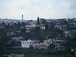
Ebba, Lebanon
Ebba, also known as Aabba and Ubba (Arabic: عبا; Syriac: ܥܒܐ), is a village in the Nabatieh Governorate region of southern Lebanon located between Nabatieh and Tyr, north of the Litani River.
Ebba, Lebanon
عبا | |
|---|---|
village | |
 | |
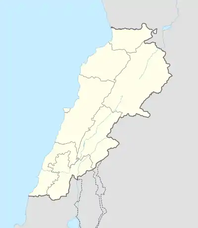 Ebba, Lebanon Location within Lebanon | |
| Coordinates: 33°21′36″N 35°24′00″E | |
| Grid position | 118/158 L |
| Country | |
| Governorate | Nabatieh Governorate |
| District | Nabatieh District |
| Area | |
| • Total | 7.42 km2 (2.86 sq mi) |
| Highest elevation | 300 m (1,000 ft) |
| Lowest elevation | 200 m (700 ft) |
| Population | |
| • Total | 8,000 |
| • Density | 1,100/km2 (2,800/sq mi) |
| Time zone | UTC+2 (EET) |
| • Summer (DST) | UTC+3 (EEST) |
| Dialing code | +961 |
Etymology and meaning
There are many possibilities in determining the origin of the word "ebba; aba or ubba". They are either Syriac word "ܥ ܒ ܐ" may mean forest; or Arabic is derived from the word "ALEBB / العِبّ"; or linked to on behalf of a tribe or family "Abbou /عِبّو". But among the common people of the town that the word back to the original Syriac means the forest.
History
In 1875 Victor Guérin found the village to have 300 Metuali inhabitants.[1]
Area and location
The village is located approximately 12 kilometers from Nabatieh and 84 kilometers from Beirut, and rises approximately 250 –300 meters from the sea level.
The total area of this village is 7.42 km2, about 35% of the area of town occupied by full of buildings and institutions and the rest divided between agricultural land, republic land and WAQF land. The cultivated area is about 55% of the limits of the town, while the estimated length of the road network is about 35 km linear.
Several valleys separate EBBA from the nearest villages: Ansar, Doueir, Jebchit, Harouf, Adchit and Zrarieh.
Demographics
EBBA, is a majority Shia Muslims village with 9000 as a total population.
The name of families living in EBBA:
|
|
Education
There are two schools in the village, one private school and one intermediate public school.
See also
- Mohamed Hassan Tarhini
References
- Guérin, 1880, p. 530
Bibliography
- Guérin, Victor (1880). Description Géographique Historique et Archéologique de la Palestine (in French). 3: Galilee, pt. 2. Paris: L'Imprimerie Nationale.
External links
| Wikimedia Commons has media related to Ebba (Lebanon). |
- Official website (in Arabic)
- Information about Ebba from LOCALIBAN (in Arabic)
- Aabba, Localiban
| Capital | 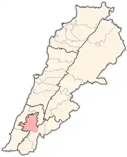 | |
|---|---|---|
| Towns and villages |
| |
| Other | ||