Edenville, Free State
Edenville is a small farming town situated in the northern Free State province of South Africa.
Edenville | |
|---|---|
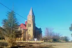 Dutch Reformed Church in Edenville | |
 Edenville  Edenville | |
| Coordinates: 27°33′S 27°40′E | |
| Country | South Africa |
| Province | Free State |
| District | Fezile Dabi |
| Municipality | Ngwathe |
| Area | |
| • Total | 7.3 km2 (2.8 sq mi) |
| Population (2011)[1] | |
| • Total | 6,294 |
| • Density | 860/km2 (2,200/sq mi) |
| Racial makeup (2011) | |
| • Black African | 94.7% |
| • Coloured | 0.9% |
| • Indian/Asian | 0.2% |
| • White | 4.0% |
| • Other | 0.2% |
| First languages (2011) | |
| • Sotho | 88.0% |
| • Afrikaans | 4.7% |
| • Zulu | 3.2% |
| • Sign language | 1.0% |
| • Other | 3.1% |
| Time zone | UTC+2 (SAST) |
| Postal code (street) | 9535 |
| PO box | 9535 |
The town is situated 48 km north-east of Kroonstad and 50 km south-west of Heilbron. It was established on the farms Erfdeel-Noord, Langland and Welgelegen in 1912, and attained municipal status in 1921. The name is assumed to refer to the biblical Garden of Eden, but this is uncertain.[2]
References
- Sum of the Main Places Ngwathe and Edenville from Census 2011.
- "Dictionary of Southern African Place Names (Public Domain)". Human Science Research Council. p. 151.
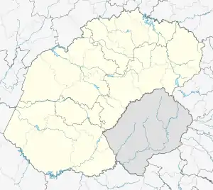
Municipalities and communities of Fezile Dabi District Municipality, Free State | ||
|---|---|---|
District seat: Sasolburg | ||
| Moqhaka | .svg.png.webp) Fezile Dabi District within South Africa | |
| Ngwathe | ||
| Metsimaholo | ||
| Mafube | ||
King: Tshenolo Mokhali Queen: Palesa Maduna
This article is issued from Wikipedia. The text is licensed under Creative Commons - Attribution - Sharealike. Additional terms may apply for the media files.
