Eketāhuna
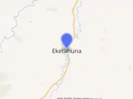
Eketāhuna is a small rural settlement, in the south of the Tararua District and the Manawatū-Whanganui region of New Zealand's North Island.
Eketāhuna | |
|---|---|
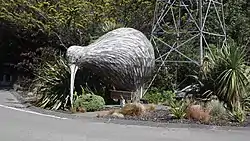 Eketāhuna Kiwi | |
| |
| Coordinates: 40.62465°S 175.56085°E | |
| Country | New Zealand |
| Region | Manawatū-Whanganui |
| Territorial authority | Tararua District |
| Government | |
| • Mayor of Tararua | Tracey Collins |
| • Wairarapa MP | Kieran McAnulty |
| • Ikaroa-Rāwhiti MP | Meka Whaitiri |
| Area | |
| • Total | 892.66 km2 (344.66 sq mi) |
| • Land | 892.66 km2 (344.66 sq mi) |
| • Water | 0 km2 (0 sq mi) |
| Population (June 2020) | |
| • Total | 1,630[1] |
| Time zone | UTC+12 (NZST) |
| • Summer (DST) | UTC+13 (NZDT) |
| Postcode | 4900 |
| Area code(s) | 06 |
The town is located at eastern foot of the Tararua Ranges, 35 kilometres north of Masterton and a similar distance south of Palmerston North. It is situated on State Highway 2, on the eastern bank of the Makakahi River.[2]
Eketāhuna has become synonymous with stereotypes of remote rural New Zealand towns, with New Zealanders colloquially referring to the town in the same way other English speakers refer to Timbuktu.[3]
The New Zealand Ministry for Culture and Heritage gives a translation of "land on the sandbank" for Eketāhuna.[4] The name sounds like a sentence in Afrikaans which translates to "I have a chicken", making it amusing to immigrant Afrikaans-speaking South Africans in New Zealand.[5]
Geography
The corresponding Statistics New Zealand statistical area covers an area of 892.66 km².[6]
The Mount Bruce bird sanctuary is located to the south of the town.[5]
History
Early settlement
Eketāhuna was settled in 1872, under the name Mellemskov.[5] It was renamed soon after its founding.[7]
Modern history
The population of Eketāhuna and the wider area has plummeted in the 21st century, dropping from 1,920 in 1996 to just 630 in 2013.[8]
On 20 January 2014, the town was the epicenter of the 2014 Eketahuna earthquake. Measuring 6.2 on the Richter magnitude scale, the quake caused moderate damage all over the southern North Island.[9]
In July 2020, the name of the town was officially gazetted as Eketāhuna by the New Zealand Geographic Board.[10]
Demography
The area has an estimated population of 1,630, with a population density of 1.83 people per km² in 2019.[11]
As of the 2018 census, the median age was 38.8, the median income was $27,600, 4.0% of people earned over $100,00, 12.3% had a Bachelor's Degree or higher, and 5.0% of the workforce was unemployed.[8]
Ethnically, the population was 89.8% New Zealand European, 22.6% Māori, 1.1% Pacific peoples, 1.7% Asian; 8.8% were born overseas.[8]
Religiously, the population is 57.7% non-religious and 28.0% Christian.[8]
Economy
In 2018, 5.0% of the workforce worked in manufacturing, 6.1% worked in construction, 5.0% worked in hospitality, 1.4% worked in transport, 3.9% worked in education, and 6.4% worked in healthcare.[8]
Transport
As of 2018, among those who commute to work, 46.4% drove a car and 3.2% rode in a car. No one commuted by public transport, walked, ran or cycled.[8]
Education
Eketahuna School is a co-educational state primary school for Year 1 to 8 students,[12][13] with a roll of 121 as of March 2020.[14]
Notable people
- Tania Lineham, born 1966 in Eketahuna. Royal Society of New Zealand, Science and Technology Teacher Fellowship in 1999 and the Prime Minister's Science Teacher Prize in 2015.
- Kieran McAnulty, born 1985 in Eketahuna. Member of Parliament since 2017.
Notes
- "Population estimate tables - NZ.Stat". Statistics New Zealand. Retrieved 22 October 2019.
- "Eketahuna Travel Guide". Jasons Travel Media.
- Davison, Isaac (29 August 2017). "Heartbeat: Eketahuna makes a community-led recovery". New Zealand Media and Entertainment. New Zealand Herald.
- "1000 Māori place names". New Zealand Ministry for Culture and Heritage. 6 August 2019.
- Easther, Elisabeth (20 March 2015). "Kia ora: Eketahuna". New Zealand Media and Entertainment. New Zealand Herald.
- "Statistical Area 2 2018 (generalised) GIS" (Data table). stats.govt.nz. Statistics New Zealand.
- "Horizons Regional Council – Regional Policy Statement". horizons.govt.nz. Horizons Regional Council.
- "Place Summary – Nireaha-Eketahuna". Stats NZ. Statistics New Zealand.
- "6.2-magnitude earthquake hits lower North Island". The New Zealand Herald. 20 January 2014. Retrieved 17 June 2016.
- "Notice of approved official geographic names" (PDF). New Zealand Gazette. 16 July 2020. Retrieved 24 July 2020.
- "Provisional Statistics". stats.govt.nz. Statistics New Zealand.
- "Official School Website". eketahuna.school.nz.
- "Ministry of Education School Profile". educationcounts.govt.nz. Ministry of Education.
- "Education Review Office Report". ero.govt.nz. Education Review Office.
External links
| Wikimedia Commons has media related to Eketahuna. |
- Eketahuna information at the Wayback Machine (archived 24 July 2014)