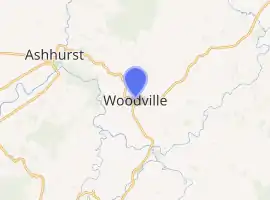
Woodville, New Zealand
Woodville, previously known as The Junction[2] is a small town in the southern North Island of New Zealand, 75 km north of Masterton and 25 km east of Palmerston North. The 2013 census showed that 1401 people reside in Woodville.[3]
Woodville | |
|---|---|
Town | |
| |
| Coordinates: 40.3371°S 175.8667°E | |
| Country | |
| Region | Manawatū-Whanganui |
| Territorial authority | Tararua District |
| Government | |
| • Tararua Mayor | Tracey Collins |
| • Wairarapa MP | Kieran McAnulty |
| • Ikaroa-Rāwhiti MP | Meka Whaitiri |
| Area | |
| • Total | 4.04 km2 (1.56 sq mi) |
| • Land | 4.04 km2 (1.56 sq mi) |
| • Water | 0 km2 (0 sq mi) |
| Population (June 2020) | |
| • Total | 1,620[1] |
| Time zone | UTC+12 (NZST) |
| • Summer (DST) | UTC+13 (NZDT) |
| Postcode | 4920 |
The town is in the Tararua District and the Manawatū-Whanganui region, although it has strong ties with the Hawke's Bay region, of which it was once a part, but is often considered to be the northern boundary of Wairarapa. It is within the catchment area of the Manawatu River.
Geography
Woodville covers a land area of 4.04 km².[4]
Only a few kilometres west of Woodville, the Manawatu River runs from east to west and cuts a deep gorge through the mountains, effectively slicing a mountain range in two. It is unusual geology as the river flows east towards the Pacific coast of the lower North Island, then cuts back west through the gorge and flows out into the Tasman Sea near Foxton.
Known by Māori as Te Apiti, the gorge itself features in Māori mythology as the consequence of a show of strength by Okatia as he made his way to the sea. Hacked into the steep sides of the gorge on each side of the river are a road, now permanently closed, and a little-used railway. Since the indefinite closure of the Manawatu Gorge road, the Saddle Road and the Pahiatua Track now provide the easiest access between the east and west coasts of the southern North Island.[5]
Once a vital route between Manawatu, Hawkes Bay and Wairarapa, geologic instability means the Manawatu Gorge road will never be re-opened. A new 4-lane road project was approved by the NZ Government in September 2019. It will be built between the existing Saddle Road and the Manawatu Gorge, connecting to SH2 west of Woodville.[6]
History
Woodville is at the northern end of the Tararua Range and the southern end of the Ruahines. In Māori history, it appears to have been a traveller's rest spot and a place for hunters to rest after they had walked from one side of the Manawatu Gorge to the other. The local iwi were Rangitane, descended from Whatonga of the Kurahaupo canoe. They maintained strong and positive relations with other tribes for the most part.
One local landmark is Whariti, one of the main peaks in the Ruahine Ranges, a mountain range that runs north east for 110kms from the Manawatu Gorge to the Kawekas, inland from Napier. The name for the 920m/3017 foot high mountain appears to be a corruption of the original name Wharetiti (Whare – house, titi – muttonbird (the Sooty Shearwater)). According to an interview on Radio Woodville in 2009, the peak gained its name when migrating muttonbird nested on top of the ridges of the Ruahine mountain range.
The birds arrived at Wharetiti from Bare Island, Waimarama and continued northwards to Tongariro. Local Māori would construct temporary housing when the titi began to arrive and would harvest the birds from their burrows, preserving them inside pouches made from bull kelp which they carried up from the coast. It is some years since muttonbirds were last seen in this part of the Ruahines.
The estimated population of Woodville reached 1,610 in 1996; it had dropped to 1,340 by 2018.[7]
Demography
Woodville has an estimated population of 1,620, with a population density of 401.05 people per km².[8]
As of the 2018 census, the median age was 49.6 the median income was $22,700, 1.7% of people earned over $100,00, 10.7% had a Bachelor's Degree or higher, and 4.4% of the workforce was unemployed.[7]
Ethnically, the population was 81.8% New Zealand European, 26.0% Māori, 3.1% Pacific peoples and 3.3% Asia; 11.8% were born overseas.[7]
Religiously, the population is 52.3% non-religious and 31.4% Christian.[7]
Economy
In 2018, 14.7% worked in manufacturing, 6.0% worked in construction, 5.5% worked in hospitality, 6.5% worked in transport, 7.8% worked in education, and 11.1% worked in healthcare.[7]
Woodville's place in European migration history was established when it became the third of three sizeable timber milling towns in the 'Seventy Mile Bush' which extended along the eastern side of the Tararua Range and Ruahine Range. The others were Dannevirke and Pahiatua.
As farmland was settled and cleared, a number of small dairy factories were established to process the supply of milk for consumption as milk, cheese or other dairy products. As recently as the mid-1980s the dairy factory at the western end of Woodville, on State Highway 2 heading towards the Manawatu Gorge, operated a cheese processing line and a 'factory shop' selling dairy produce direct to the public. A thriving sheep and beef economy at one stage supported a number of local trucking firms and carriers, among them Gunn Transport and Hawkes Bay Farmers Transport, both of which were based at a site at the corner of State Highway 2/Vogel Street and Tay Street, which is the Wairarapa bypass. The site is now the offices for Horizons Regional Council. These haulage businesses were only economic in the pre-deregulated transport industry that existed prior to the Rogernomics reforms of the Lange Labour Government elected in 1984. With the lifting of distance restrictions (vehicles over a certain weight were at one stage restricted to travelling only 150km from their geographic base) Woodville's role as a transport hub quickly fell away.
In addition, the local community sustained a supermarket (closed for a period in the 1980s, since re-opened as a Four Square) a Feltex fabrication factory, built in the mid-1970s and closed by the mid-1980s - at least four or five service station or garage outlets of which only one remains on the west side of the township (Known as Caltex Woodville), and a significant railway presence.
The advent of the Oringi Meatworks in 1980-81 was a boost to Woodville's economy as a consequence of significant wage inflows from Woodville people working at Oringi. Oringi's plant closed in 2008. Very little light industry has survived into the 21st century, and the local agricultural community is supported from Palmerston North, Pahiatua or Dannevirke. Milk from farms in the Woodville district was, until 2015, transported by rail from the Oringi Milk Transfer Station to Hawera for processing. It is now processed locally at the Fonterra plant in Pahiatua.
There has been a boost to the local economy with the construction and maintenance of the Te Apiti Wind Farm on the ridges above the town. The foothills of the Ruahine and Tararua mountain ranges are to the west of Woodville. The lower ridges are now dotted with wind turbines making up New Zealand's largest wind farm, which was established in the early 2000s. The prevailing westerly winds in the Manawatu-Southern Hawkes Bay region provide a consistent Median Wind Velocity which is the key relevant measure for wind generation as a renewable energy source. Manawatu's flat pastoral lands and in particular the funnel effect created by the Manawatu Gorge, mean the area is well known for being subject to regular high winds.
Following detailed assessment and testing in the early 1990s, the decision was made by newly privatised electricity generation companies to site two large farms on the ridge-lines. The Te Apiti Wind Farm is made up of 55 turbines, generating about 90 megawatts of electricity, enough to power about 30,000 homes.
Transportation
As of 2018, among those who commute to work, 78.3% drove a car, 3.7% rode in a car, 0.9% use a bike, and 0.9% walked or run. No one commuted by public transport.[7]
State Highway 3 through the gorge, on the southern Tararua side of the river, is closed. It will be replaced with a new state highway in the 2020s.
The Palmerston North - Gisborne railway line runs along the northern bank of the river. At Woodville Railway Station, the Palmerston North - Gisborne Line meets the Wairarapa Line and a balloon loop - a rare example of railway engineering where trains reverse direction on a loop track built specifically for the purpose - permits through running via the Wairarapa to Wellington.
Due to low freight levels, the northern portion of the Wairarapa line was reviewed in 2010 as part of KiwiRail's turnaround plan. It remains a low traffic network. In some weeks there is only a single train on the line, running from Wellington to Napier. The use of the railway by Fonterra for bulk milk haulage from Oringi meant the Hawke's Bay line was sufficiently busy. Fonterra's Oringi milk transfer station was decommissioned in 2015-16.
Culture
Te Ahu a Turanga i Mua marae is located in the Woodville area. It is a tribal meeting ground of Rangitāne and its Ngāti Te Koro and Ngāti Te Rangiwhakaewa sub-tribe.[9] It includes Te Ahu a Turanga i Mua meeting house.[10]
One of New Zealand's first international hit songs, Blue Smoke was written by Ruru Karaitiana, who was born on a farm between Woodville and Dannevirke.[11] Karaitiana served with the Māori Battalion in World War II and wrote and recorded the song on his return to New Zealand.[12] It has been covered by other artists including Dean Martin.[13]
Woodville was the original home of the Mountain Rock Music Festival, a celebration of New Zealand music growing to be the largest celebration of New Zealand music during the 1990s.
Artist Gottfried Lindauer is buried in the local Old Gorge Cemetery.
Sport
Woodville has produced a number of well-regarded sporting competitors, particularly in the 1980s. Robert Collings Tennent formed the first rugby club in New Zealand when he lived in Nelson. Born in Rio de Janeiro, he moved with his family to New Zealand in the 1860s and was only 19 at the time he set up Nelson Rugby Club. He later moved north and was instrumental in forming more rugby clubs in Taranaki (Patea) and Manawatu. He also played first-class cricket in Nelson in the 1870s. Tennent later moved to Woodville and is buried in the Old Gorge Cemetery.
Woodville continues to host a successful horse-racing, rearing and training industry, based at the Woodville & Pahiatua Jockey Club's track on the north-east of the town.
Woodville has hosted the New Zealand MotoCross Grand Prix motorcycling races since 1961. Now widely regarded as New Zealand's premier motocross event, the Woodville Grand Prix is held in the height of summer in January each year. Held on the Cleghorn farm near the eastern entrance to the Manawatu Gorge, the honours board to 2011 features several well-known motorsport names, not least of whom is Ken Cleghorn (of the farm owning family) himself. Another notable early racer was Tim Gibbes of Palmerston North, who helped teach Hollywood actor Steve McQueen several stunts for The Great Escape.
Education
Woodville School is a co-educational state primary school for Year 1 to 8 students,[14] with a roll of 81 as of March 2020.[15]
Notable people
- Rob Foreman, Manawatu provincial rugby player
- Dean Kenny, All Black and Otago provincial rugby player
- Atholstan Mahoney, All Black and Bush provincial rugby player
- Robbie McLean, All Black and Wairarapa Bush and Manawatu provincial rugby player
- Joe Schmidt, rugby and basketball player. Head coach of the Ireland rugby team.
- Rob Thompson, All Black and provincial rugby player
References
- "Population estimate tables - NZ.Stat". Statistics New Zealand. Retrieved 22 October 2019.
- https://teara.govt.nz/en/1966/woodville
- "2013 Census QuickStats about a place". Retrieved 2017-10-17.
- "Statistical Area 2 2018 (generalised) GIS" (Data table). stats.govt.nz. Statistics New Zealand.
- Te Apiti - Māori History
- Coughlan, Thomas (24 September 2019). "Manawatū Gorge to get $620 million replacement motorway". stuff.co.nz.
- woodville "Place Summary - Woodville" Check
|url=value (help). Stats NZ. Statistics New Zealand. - "Provisional Statistics". stats.govt.nz. Statistics New Zealand.
- "Te Kāhui Māngai directory". tkm.govt.nz. Te Puni Kōkiri.
- "Māori Maps". maorimaps.com. Te Potiki National Trust.
- 'Blue Smoke'
- Ruru Karaitiana
- Dean Martin
- "Ministry of Education School Profile". educationcounts.govt.nz. Ministry of Education.
- "Education Review Office Report". ero.govt.nz. Education Review Office.