Ela Township, Lake County, Illinois
Ela Township is a township in Lake County, Illinois, USA. As of the 2010 census, its population was 42,654.[2]
Ela Township | |
|---|---|
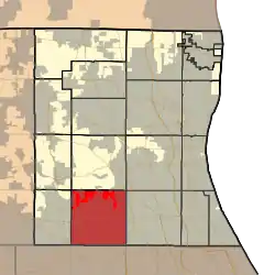
 Location in Lake County | |
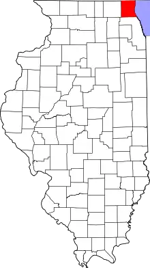
 Lake County's location in Illinois | |
| Coordinates: 42°11′52″N 88°03′49″W | |
| Country | United States |
| State | Illinois |
| County | Lake |
| Established | November 6, 1849 |
| Government | |
| • Supervisor | Lucy A. Prouty |
| Area | |
| • Total | 35.9 sq mi (93.0 km2) |
| • Land | 34.4 sq mi (89.1 km2) |
| • Water | 1.5 sq mi (3.9 km2) |
| Elevation | 830 ft (253 m) |
| Population (2010) | |
| • Estimate (2016)[1] | 44,026 |
| Time zone | UTC-6 (CST) |
| • Summer (DST) | UTC-5 (CDT) |
| FIPS code | 17-097-22853 |
| Website | elatownship |
History
Ela Township bears the name of George Ela, an Illinois legislator.[3]
Geography
Ela Township covers an area of 35.9 square miles (93.0 km2); of this, 1.5 square miles (3.9 km2) or 4.24 percent is water. Lakes in this township include Ashley Lake, Bresen Lake, Echo Lake, Forest Lake, Lake Germaine, Lake Louise, Lake Zurich and Leo Lake.
Cities and towns
- Barrington (northeast edge)
- Deer Park (vast majority)
- Forest Lake
- Hawthorn Woods (vast majority)
- Kildeer
- Lake Zurich
- Long Grove (west half)
- North Barrington (east quarter)
The United States Census data from the year 2000 shows Arlington Heights, primarily in Cook County, extending slightly into the southeast corner of Ela Township (covering 0.00 sq mi), as well as the southwest corner of Vernon Township (covering 0.01 sq mi) directly to the east of Ela.[4] However, the Lake County GIS shows an even smaller extension into Vernon Township and none into Ela.[5]
Adjacent townships
- Fremont Township (north)
- Libertyville Township (northeast)
- Vernon Township (east)
- Wheeling Township, Cook County (southeast)
- Palatine Township, Cook County (south)
- Barrington Township, Cook County (southwest)
- Cuba Township (west)
- Wauconda Township (northwest)
Cemeteries
The township contains three cemeteries: Fairfield, Lake Zurich and Saint Matthew Lutheran.
Major highways
- U.S. Route 12
- Illinois State Route 22
- Illinois State Route 53
Airports and landing strips
- Honey Lake Heliport
- Rotor Swing Heliport
Railroad lines
References
- "Population and Housing Unit Estimates". Retrieved June 9, 2017.
- "Geographic Identifiers: 2010 Demographic Profile Data (G001): Ela township, Lake County, Illinois". U.S. Census Bureau, American Factfinder. Archived from the original on February 12, 2020. Retrieved December 18, 2012.
- Callary, Edward (29 September 2008). Place Names of Illinois. University of Illinois Press. p. 106. ISBN 978-0-252-09070-7.
- Census map of Lake County
- Lake County Illinois Maps Online Archived 2008-06-08 at the Wayback Machine
- "Census of Population and Housing". Census.gov. Retrieved June 4, 2016.