Eldon, Missouri
Eldon is a city in Miller County, Missouri, United States, located thirty miles southwest of Jefferson City. The population was 4,567 at the 2010 census.
Eldon, Missouri | |
|---|---|
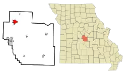 Location of Eldon, Missouri | |
| Coordinates: 38°20′54″N 92°34′54″W | |
| Country | United States |
| State | Missouri |
| County | Miller |
| Founded | 1882 |
| Incorporated | 1904 |
| Government | |
| • Mayor | Trevor Vernon |
| Area | |
| • Total | 3.56 sq mi (9.21 km2) |
| • Land | 3.56 sq mi (9.21 km2) |
| • Water | 0.00 sq mi (0.00 km2) |
| Elevation | 925 ft (282 m) |
| Population | |
| • Total | 4,567 |
| • Estimate (2019)[4] | 4,706 |
| • Density | 1,323.77/sq mi (511.12/km2) |
| Time zone | UTC-6 (Central (CST)) |
| • Summer (DST) | UTC-5 (CDT) |
| ZIP code | 65026 |
| Area code(s) | 573 |
| FIPS code | 29-21484[5] |
| GNIS feature ID | 0729476[2] |
History
Eldon was platted in 1881, and according to tradition, named after a railroad official.[6] A post office called Eldon has been in operation since 1881.[7]
2019 tornado
On the night of May 22, 2019, a tornado touched down west of Eldon. It came through Eldon damaging many homes and businesses. That same tornado struck Jefferson City.[8]
Geography
Eldon is located near the head of Saline Creek. The city is served by U.S. Route 54 and Missouri Route 52. Jefferson City is 30 miles to the northeast. Bagnell Dam and the Lake of the Ozarks is approximately 10 miles south.[9]
According to the United States Census Bureau, the city has a total area of 3.56 square miles (9.22 km2), all land.[10]
Demographics
| Historical population | |||
|---|---|---|---|
| Census | Pop. | %± | |
| 1900 | 379 | — | |
| 1910 | 1,999 | 427.4% | |
| 1920 | 2,636 | 31.9% | |
| 1930 | 3,171 | 20.3% | |
| 1940 | 2,590 | −18.3% | |
| 1950 | 2,766 | 6.8% | |
| 1960 | 3,158 | 14.2% | |
| 1970 | 3,520 | 11.5% | |
| 1980 | 4,342 | 23.4% | |
| 1990 | 4,419 | 1.8% | |
| 2000 | 4,895 | 10.8% | |
| 2010 | 4,567 | −6.7% | |
| 2019 (est.) | 4,706 | [4] | 3.0% |
| U.S. Decennial Census[11] | |||
2010 census
As of the census[3] of 2010, there were 4,567 people, 1,984 households, and 1,158 families living in the city. The population density was 1,282.9 inhabitants per square mile (495.3/km2). There were 2,242 housing units at an average density of 629.8 per square mile (243.2/km2). The racial makeup of the city was 95.9% White, 0.5% African American, 0.5% Native American, 0.4% Asian, 0.3% Pacific Islander, 0.4% from other races, and 1.9% from two or more races. Hispanic or Latino of any race were 1.4% of the population.
There were 1,984 households, of which 31.0% had children under the age of 18 living with them, 38.4% were married couples living together, 14.6% had a female householder with no husband present, 5.4% had a male householder with no wife present, and 41.6% were non-families. 36.8% of all households were made up of individuals, and 17.4% had someone living alone who was 65 years of age or older. The average household size was 2.27 and the average family size was 2.94.
The median age in the city was 38.7 years. 24.7% of residents were under the age of 18; 7.7% were between the ages of 18 and 24; 24.4% were from 25 to 44; 24.1% were from 45 to 64; and 19.1% were 65 years of age or older. The gender makeup of the city was 47.0% male and 53.0% female.
2000 census
As of the census[5] of 2000, there were 4,895 people, 2,194 households, and 1,270 families living in the city. The population density was 1,450.2 people per square mile (559.2/km2). There were 2,396 housing units at an average density of 709.8 per square mile (273.7/km2). The racial makeup of the city was 98.14% White, 0.33% African American, 0.31% Native American, 0.16% Asian, 0.31% from other races, and 0.76% from two or more races. Hispanic or Latino of any race were 1.16% of the population.
There were 2,194 households, out of which 26.5% had children under the age of 18 living with them, 41.8% were married couples living together, 12.5% had a female householder with no husband present, and 42.1% were non-families. 38.1% of all households were made up of individuals, and 20.6% had someone living alone who was 65 years of age or older. The average household size was 2.18 and the average family size was 2.88.
In the city, the population was spread out, with 23.2% under the age of 18, 8.7% from 18 to 24, 24.5% from 25 to 44, 20.8% from 45 to 64, and 22.7% who were 65 years of age or older. The median age was 40 years. For every 100 females, there were 83.1 males. For every 100 females age 18 and over, there were 75.6 males.
The median income for a household in the city was $27,103, and the median income for a family was $34,621. Males had a median income of $27,818 versus $17,690 for females. The per capita income for the city was $15,015. 15.8% of the population and 12.0% of families were below the poverty line. Out of the total population, 22.5% of those under the age of 18 and 16.4% of those 65 and older were living below the poverty line.
Education
Education in the city of Eldon is provided by two elementary schools, one middle school and one high school. It also includes the Eldon Career Center, which provides quality training in many technical fields.
| Eldon South Elementary | Eldon Upper Elementary | Eldon Middle School | Eldon High School | |
|---|---|---|---|---|
| Built: | 1962, Addition added in 1980 | 1998 | 1880 | 1920 |
| Grade Level: | Preschool-Third Grade | Fourth-Sixth Grade | Seventh-Eighth Grade | Ninth-Twelfth Grade |
| Principal: | Steven Rhine | Michele Herbert | Shaun Fischer | Kris Harwood |
| Student Population: | 650 | 430 | 274 | 549 |
Eldon has a public library, a branch of the Heartland Regional Library System.[12]
Popular culture
- The television show Petticoat Junction, which aired from 1963 to 1970, was based on the Burris Hotel that existed in this small railroad town in the midwest. Paul Henning, the producer and creator of the show, was married to the granddaughter of the owner of the hotel and often visited.[13]
Notable people
- Christian Cantwell, 2008 Olympic shot-put silver medalist
- William Mueller, professional wrestler known under the names "Trevor Murdoch" and "Jethro Holiday"
- Harley Race, professional wrestler
- Lloyd Dane, early NASCAR champion
References
- "2019 U.S. Gazetteer Files". United States Census Bureau. Retrieved July 26, 2020.
- U.S. Geological Survey Geographic Names Information System: Eldon, Missouri
- "U.S. Census website". United States Census Bureau. Retrieved 2012-07-08.
- "Population and Housing Unit Estimates". United States Census Bureau. May 24, 2020. Retrieved May 27, 2020.
- "U.S. Census website". United States Census Bureau. Retrieved 2008-01-31.
- "Miller County Place Names, 1928–1945". The State Historical Society of Missouri. Archived from the original on June 24, 2016. Retrieved November 6, 2016.
- "Post Offices". Jim Forte Postal History. Retrieved 6 November 2016.
- Dabbs, Janet. "'A War Zone': Widespread Damage In Eldon, As Missouri Town Hit By Tornado [PHOTOS]". LakeExpo.com. Retrieved 2020-10-01.
- Eldon, MO, 7.5 Minute Topographic Quadrangle, USGS, 1959 (1981 rev.)
- "US Gazetteer files 2010". United States Census Bureau. Archived from the original on 2012-01-25. Retrieved 2012-07-08.
- "Census of Population and Housing". Census.gov. Retrieved June 4, 2015.
- "Eldon Branch". Heartland Regional Library System. Retrieved 17 March 2018.
- David Stein (1998). "Petticoat Junction Black & White Episodes". Official Petticoat Junction Web Site. Archived from the original on 2002-10-19. Retrieved 2009-10-16.
External links
- Historic maps of Eldon in the Sanborn Maps of Missouri Collection at the University of Missouri
Municipalities and communities of Miller County, Missouri, United States | ||
|---|---|---|
| Cities | 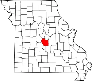 Map of Missouri highlighting Miller County | |
| Villages | ||
| Townships | ||
| Unincorporated communities | ||
| Footnotes | ‡This populated place also has portions in an adjacent county or counties | |
| ||
| Authority control |
|---|