Missouri Route 52
Route 52 is an east/west highway running from its eastern terminus at Route 133 7 miles (11 km) east of St. Elizabeth to the Kansas state line where it continues as K-52 (this road continues for 23 additional miles). Highway 52 comprises 173 miles (278 km) of primarily two-lane roadway in Missouri.
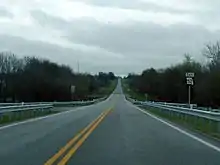
Missouri Route 52 eastbound shortly after ending a concurrency with I-49/US 71.
| ||||
|---|---|---|---|---|
| Route information | ||||
| Maintained by MoDOT | ||||
| Length | 176.603 mi (284.215 km) | |||
| Existed | 1926–present | |||
| Major junctions | ||||
| West end | ||||
| East end | ||||
| Highway system | ||||
| ||||

Route 52 was formerly Route 24 between Eldon and the Kansas state line. The numbering change was to avoid duplication with the new U.S. Route 24 which came through Missouri in 1926.
Major intersections
| County | Location | mi[1] | km | Destinations | Notes | |||
|---|---|---|---|---|---|---|---|---|
| Bates | | 0.000 | 0.000 | Continuation into Kansas | ||||
| | 15.141 | 24.367 | I-49 exit 131 | |||||
| Butler | 15.954 | 25.675 | Western end of I-49 Bus. overlap | |||||
| | 17.223 | 27.718 | Westbound exit and eastbound entrance; eastern end of I-49 Bus. overlap; western end of I-49 / US 71 overlap; Route 52 west follows exit 130 | |||||
| | 18.653 | 30.019 | Eastern end of I-49 / US 71 overlap; Route 52 east follows exit 129 | |||||
| St. Clair |
No major junctions | |||||||
| Henry | Deepwater | 55.090 | 88.659 | |||||
| | 56.027 | 90.167 | Interchange; western end of Route 13 overlap | |||||
| | 57.087 | 91.873 | ||||||
| Clinton | 64.159 | 103.254 | Western end of Route 7 overlap | |||||
| 65.636 | 105.631 | Interchange; eastern end of Route 7 / Route 13 overlap | ||||||
| Windsor | 82.076 | 132.089 | ||||||
| Pettis | | 87.568 | 140.927 | |||||
| Benton–Pettis county line | Windsor Junction | 95.795 | 154.167 | Western end of US 65 overlap | ||||
| Benton | Cole Camp Junction | 100.936 | 162.441 | Interchange; eastern end of US 65 overlap | ||||
| Morgan | | 115.794 | 186.352 | Western end of Route 135 overlap | ||||
| Stover | 117.491 | 189.083 | Eastern end of Route 135 overlap | |||||
| Versailles | 125.278 | 201.615 | Western end of Route 5 overlap | |||||
| | 127.982 | 205.967 | Eastern end of Route 5 overlap | |||||
| Miller | Eldon | 143.235 | 230.514 | Western end of US 54 Bus. overlap | ||||
| | 146.244 | 235.357 | Interchange; eastern end of US 54 Bus. overlap | |||||
| Tuscumbia | 155.896 | 250.890 | Western end of Route 17 overlap | |||||
| | 156.772 | 252.300 | Eastern end of Route 17 overlap | |||||
| | 176.603 | 284.215 | ||||||
1.000 mi = 1.609 km; 1.000 km = 0.621 mi
| ||||||||
References
- Missouri Department of Transportation (December 27, 2020). MoDOT HPMAPS (Map). Missouri Department of Transportation. Retrieved December 27, 2020.
This article is issued from Wikipedia. The text is licensed under Creative Commons - Attribution - Sharealike. Additional terms may apply for the media files.