Electoral district of Bicton
Bicton is an electoral district of the Legislative Assembly of Western Australia. It is located in Perth's southern suburbs, and named after the riverside suburb of Bicton.
| Bicton Western Australia—Legislative Assembly | |
|---|---|
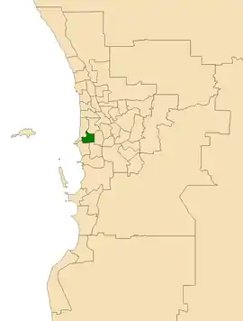 Location of Bicton (dark green) in the Perth metropolitan area | |
| State | Western Australia |
| Dates current | 2017–present |
| MP | Lisa O'Malley |
| Party | Labor Party |
| Namesake | Bicton |
| Electors | 26,959 (2019) |
| Area | 20 km2 (7.7 sq mi) |
| Demographic | South Metropolitan Region |
Bicton was created by the Western Australian Electoral Commission in a 2015 redistribution, and elected its first member at the 2017 state election. It incorporates areas that previously fell into the seats of Alfred Cove, Bateman, Fremantle, and Willagee.
Geography
At the 2017 state election, Bicton includes the suburbs of Attadale, Bicton, and Melville in their entireties, most of East Fremantle and Palmyra, and smaller portions of Alfred Cove, Fremantle, and Myaree. It is bounded by Stirling Highway to the west, High Street and Leach Highway to the south, North Lake Road to the east, and the Swan River to the north.[1]
Members for Bicton
| Member | Party | Term | |
|---|---|---|---|
| Lisa O'Malley | Labor | 2017–present | |
Election results
| Party | Candidate | Votes | % | ±% | |
|---|---|---|---|---|---|
| Liberal | Matt Taylor | 9,734 | 43.0 | −9.9 | |
| Labor | Lisa O'Malley | 8,955 | 39.6 | +11.8 | |
| Greens | Louise Dickmann | 2,406 | 10.6 | −1.1 | |
| Independent | Steve Kepert | 734 | 3.2 | +3.2 | |
| Animal Justice | Colleen Saporita | 325 | 1.4 | +1.4 | |
| Christians | Stephen Wardell-Johnson | 237 | 1.0 | +1.0 | |
| Micro Business | Richard Korfanty | 226 | 1.0 | +1.0 | |
| Total formal votes | 22,617 | 97.0 | +2.1 | ||
| Informal votes | 695 | 3.0 | −2.1 | ||
| Turnout | 23,312 | 89.6 | +3.8 | ||
| Two-party-preferred result | |||||
| Labor | Lisa O'Malley | 11,968 | 52.9 | +13.0 | |
| Liberal | Matt Taylor | 10,641 | 47.1 | −13.0 | |
| Labor gain from Liberal | Swing | +13.0 | |||
References
- 2015 Final Boundaries by Region and District, Western Australian Electoral Commission. Retrieved 2 February 2017.
- Bicton District Profile and Results, 2017 State General Election, WAEC.